Manson, Indiana
| Manson | |
|---|---|
| Unincorporated community | |
 Manson | |
| Coordinates: 40°14′24″N 86°35′25″W / 40.24000°N 86.59028°WCoordinates: 40°14′24″N 86°35′25″W / 40.24000°N 86.59028°W | |
| Country | United States |
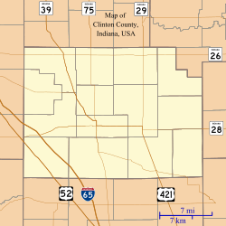
| State | Indiana |
| County | Clinton |
| Township | Perry |
| Founded | 1874 |
| Named for | Mahlon Manson |
| Elevation | 860 ft (260 m) |
| ZIP code | 46041 |
| FIPS code | 18-46494[1] |
| GNIS feature ID | 438535[2] |
Manson is an unincorporated community in Perry Township, Clinton County, Indiana. The town is named for Mahlon Dickerson Manson, a general in the American Civil War and Lieutenant Governor of Indiana.[3]
History
Manson was laid out June 30, 1874, by Lucinda Clark, David Clark and Rebecca Clark. The New Lights had a small church in Manson in the early 20th century.[4]
Geography
Manson is located at 40°14′24″N 86°35′25″W / 40.24000°N 86.59028°W.
References
- ↑ "American FactFinder". United States Census Bureau. Retrieved 2008-01-31.
- ↑ "Manson, Indiana". Geographic Names Information System. United States Geological Survey. Retrieved 2009-10-17.
- ↑ Claybaugh, Joseph (1913). History of Clinton County, Indianap. Indianapolis: A. W. Bowen & Company. p. 32.
- ↑ Claybaugh, Joseph (1913). "Perry Township". History of Clinton County, Indiana. Indianapolis: A. W. Bowen & Company.
Municipalities and communities of Clinton County, Indiana, United States | ||
|---|---|---|
| City | ||
| Towns | ||
| Townships | ||
| Unincorporated communities |
| |
This article is issued from Wikipedia - version of the 4/13/2016. The text is available under the Creative Commons Attribution/Share Alike but additional terms may apply for the media files.