Danapur
| Danapur दानापुर | |
|---|---|
| City | |
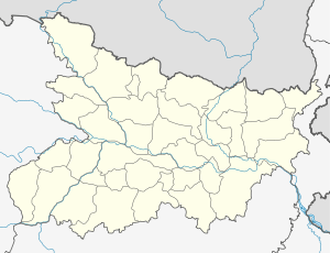 Danapur Location in Bihar, India | |
| Coordinates: 25°38′N 85°3′E / 25.633°N 85.050°ECoordinates: 25°38′N 85°3′E / 25.633°N 85.050°E | |
| Country |
|
| State | Bihar |
| Division | Patna |
| District | Patna |
| UA | Patna |
| Ward | 40 wards |
| Established | 1887 |
| Government | |
| • Body | Danapur Nagar Parishad |
| • Mayor | Reshma Devi |
| Population (2011) | |
| • Total | 182,241 |
| Languages | |
| • Spoken | Magadhi, Hindi |
| Time zone | IST (UTC+5:30) |
| PIN |
801101/03/05/08/09/13/12 801501/03/06 800111 |
| Telephone code | 06115 |
| Vehicle registration | BR-01 |
| Planning agency | Patna Regional Development Authority |
| Civic agency | Danapur Nagar Parishad |
| Website |
danapur |
Danapur (also known as Dinapur) is a satellite town of Patna in Bihar state of India.[1] The population was 182,241 at the 2011 India Census. It is part of the Patna Metropolitan Region.[2] It was constituted as a municipality in 1887.[3] Danapur is also a shelter and hatchery for the migrating Siberian cranes, locally called Janhgil. They visit every year during the monsoon season for breeding and leave this place before the start of the winter season. The Sub-Area Headquarters of Bihar and Jharkhand is situated in the army cantonment here.[4][5]
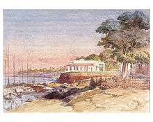
Flagstaff ghat on the Ganges at Dinapur, Patna, 1859 is one of the oldest ghats.[6] Gurdwara Handi Sahib, a gurdwara of Guru Tegh Bahadur, is a pilgrimage place for Sikhs. Naulakha temple and various historical buildings of British rule are places of interest.
Geography
It is located on the bank of the River Sone which merges with River Ganges at Digha a few kilometers from Danapur.
According to the City development plan for Danapur, the city has a total area of 11.63 km2 and is divided into 40 wards.[1] The Danapur Nagar Parishad was established in 1889.
Demographics
| Historical population | ||
|---|---|---|
| Year | Pop. | ±% |
| 1991 | 84,616 | — |
| 2001 | 131,176 | +55.0% |
| 2011 | 182,241 | +38.9% |
| Source: [1] | ||
As of the census of 2011, there were 182,241 with 97,129 men and 85,112 women residing in the city. Out of which 25,092 (13.77%) had children under the age of 6. There were 13,398 boys while 11,694 are girls. The population density as per 2001 data is about 113 persons/ha.[1] The overall literacy rate is 78.4%, with the male literacy rate being 84.54% and the female literacy rate being 71.39%. The sex ratio of 882 per 1000 males was lower than the national average of 944. And child sex ratio of girls is 873 per 1000 boys.[2]
Transport

Danapur is well connected by rail and road. It is connected to most of the major cities in India by the railway network. Danapur Station (Station Code DNR) is the main railway station of the area. It is also the divisional headquarter of the Danapur Division of the East Central Railway. The town is located in the Mughalsarai – Howrah main line. National Highway no. 30 links the town to other cities of Bihar. Patna Airport is the nearest airport.
Education
Notable educational institutions of Danapur include:
- Army Public School, Danapur Cantt
- Children's Academy Patna, Danapur Patna Bihar
- Delhi Public School Patna
- Kendriya Vidyalaya, Danapur Cantt
- Baldeva Inter School
- Gyan Niketan Senior Secondary School
See also
References
- 1 2 3 4 City Development Plan for Danapur 2014-03-05
- 1 2 "Dinapur Nizamat City Population Census 2011 | Bihar". Census2011.co.in. Retrieved 2014-03-05.
- ↑ Students' Britannica India — Google Books. Books.google.co.in. Retrieved 2014-03-05.
- ↑ Ramashankar (2010-12-08). "The Telegraph — Calcutta (Kolkata) | Bihar | Police force to hire 9000 ex-armymen". Telegraphindia.com. Retrieved 2014-03-05.
- ↑ "New commander of Danapur Army HQ — The Times of India". Timesofindia.indiatimes.com. 2009-05-03. Retrieved 2014-03-05.
- ↑ The story of the Lall Bazar Baptist Church Calcutta: being the history of Carey's church from 24th April 1800 to the present day. Edinburgh Press. 1908. Retrieved 17 March 2011.