Patna district
| Patna district पटना जिला | |
|---|---|
| District of Bihar | |
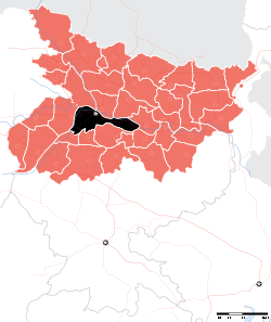 Location of Patna district in Bihar | |
| Country | India |
| State | Bihar |
| Administrative division | Patna division |
| Headquarters | Patna |
| Government | |
| • Lok Sabha constituencies | 1. Patna Sahib, 2. Pataliputra, 3. Munger (shared with Munger district) |
| • Assembly seats | 14 |
| Area | |
| • Total | 3,202 km2 (1,236 sq mi) |
| Population (2011) | |
| • Total | 5,838,465 |
| • Density | 1,800/km2 (4,700/sq mi) |
| • Urban | 2,514,590 (43.7 per cent) (2,011) |
| Demographics | |
| • Literacy | 70.68 per cent[1] |
| • Sex ratio | 897 |
| Major highways | NH 30, NH 83 |
| Website | Official website |
Patna district is one of the thirty-eight districts of Bihar state in eastern India. Patna, the capital of Bihar state is the district headquarters. Patna district is a part of Patna division.
As of 2011 it is the most populous district of Bihar (out of 39).[2]
History
In 1976, Nalanda district was split from Patna.[3]
Today, it is one of the fastest growing district of India.
Geography
Patna district occupies an area of 3,202 square kilometres (1,236 sq mi),[4] comparatively equivalent to the Solomon Islands' Makira Island.[5]
Blocks: Patna Sadar, Phulwari sharif, Sampatchak, Paliganj, Fatuha, Khusrupur, Daniyawaan, Bakhtiyarpur, Barh, Belchi, Athmalgola, Mokama, Pandarak, Ghoswari, Bihta, Maner, Danapur, Naubatpur, Masaurhi, Dhanarua, Punpun.
Sub-divisions
Patna district comprises 6 Sub-divisions:
Assembly constituencies
14 assembly segments fall under Patna district.[6]
Demographics
According to the 2011 census Patna district has a population of 5,838,465,[2] roughly equal to the nation of Nicaragua[7] or the US state of Maryland.[8] This gives it a ranking of 15th in India (out of a total of 640).[2] The district has a population density of 1,823 inhabitants per square kilometre (4,720/sq mi) .[2] Its population growth rate over the decade 2001-2011 was 22.34%.[2] Patna has a sex ratio of 897 females for every 1000 males,[2] and a literacy rate of 72.47%.[2]
Climate
| Climate data for Patna | |||||||||||||
|---|---|---|---|---|---|---|---|---|---|---|---|---|---|
| Month | Jan | Feb | Mar | Apr | May | Jun | Jul | Aug | Sep | Oct | Nov | Dec | Year |
| Average high °C (°F) | 23.3 (73.9) |
26.5 (79.7) |
32.6 (90.7) |
37.7 (99.9) |
38.9 (102) |
36.7 (98.1) |
33.0 (91.4) |
32.4 (90.3) |
32.3 (90.1) |
31.5 (88.7) |
28.8 (83.8) |
24.7 (76.5) |
31.53 (88.75) |
| Average low °C (°F) | 9.2 (48.6) |
11.6 (52.9) |
16.4 (61.5) |
22.3 (72.1) |
25.2 (77.4) |
26.7 (80.1) |
26.2 (79.2) |
26.1 (79) |
25.7 (78.3) |
21.8 (71.2) |
14.7 (58.5) |
9.9 (49.8) |
19.65 (67.37) |
| Average precipitation mm (inches) | 19 (0.75) |
11 (0.43) |
11 (0.43) |
8 (0.31) |
33 (1.3) |
134 (5.28) |
306 (12.05) |
274 (10.79) |
227 (8.94) |
94 (3.7) |
9 (0.35) |
4 (0.16) |
1,130 (44.49) |
| Source: worldweather.org[9] | |||||||||||||
Economy
In 2006 the Ministry of Panchayati Raj named Patna one of the country's 250 most backward districts (out of a total of 640).[10] It is one of the 38[11] districts in Bihar currently receiving funds from the Backward Regions Grant Fund Programme (BRGF).[10]
Agricultural products include: Paddy, Maize, Pulses and Wheat. Also oil seeds. Roughly one third of the area sown is under rice (paddy). Cash crops such as vegetables and water-melons are also grown in Diara belt. Major industries include leather, handicrafts, and agro processing.
References
- ↑ "District-specific Literates and Literacy Rates, 2001". Registrar General, India, Ministry of Home Affairs. Retrieved 2010-10-05.
- 1 2 3 4 5 6 7 "District Census 2011". Census2011.co.in. 2011. Retrieved 2011-09-30.
- ↑ Law, Gwillim (2011-09-25). "Districts of India". Statoids. Retrieved 2011-10-11.
- ↑ Srivastava, Dayawanti et al. (ed.) (2010). "States and Union Territories: Bihar: Government". India 2010: A Reference Annual (54th ed.). New Delhi, India: Additional Director General, Publications Division, Ministry of Information and Broadcasting (India), Government of India. pp. 1118–1119. ISBN 978-81-230-1617-7.
- ↑ "Island Directory Tables: Islands by Land Area". United Nations Environment Program. 1998-02-18. Retrieved 2011-10-11.
Makira 3,190km2
- ↑ "14 segments in Patna dist this time".
- ↑ US Directorate of Intelligence. "Country Comparison:Population". Retrieved 2011-10-01.
Nicaragua 5,666,301 July 2011 est.
- ↑ "2010 Resident Population Data". U. S. Census Bureau. Archived from the original on October 19, 2013. Retrieved 2011-09-30.
Maryland 5,773,552
- ↑ "Climatological Information for Patna". World Weather. Retrieved 2011-02-25.
- 1 2 Ministry of Panchayati Raj (September 8, 2009). "A Note on the Backward Regions Grant Fund Programme" (PDF). National Institute of Rural Development. Retrieved September 27, 2011.
- ↑ By: Manav Saurav : Government of Bihar website :gov.bih.nic.in/Profile/Districts.htm
External links
| Wikimedia Commons has media related to Patna district. |
 |
Saran district | Vaishali district | Samastipur district | |
| Bhojpur district | |
Begusarai district | ||
| ||||
| | ||||
| Arwal district | Jehanabad district | Nalanda district |
Coordinates: 25°25′N 85°10′E / 25.417°N 85.167°E