Danby, New York
| Danby, New York | |
|---|---|
| Town | |
 Danby, New York Location within the state of New York | |
| Coordinates: 42°20′15″N 76°28′22″W / 42.33750°N 76.47278°W | |
| Country | United States |
| State | New York |
| County | Tompkins |
| Area | |
| • Total | 53.7 sq mi (139.2 km2) |
| • Land | 53.6 sq mi (138.7 km2) |
| • Water | 0.2 sq mi (0.5 km2) |
| Elevation | 1,532 ft (467 m) |
| Population (2010) | |
| • Total | 3,329 |
| Time zone | Eastern (EST) (UTC-5) |
| • Summer (DST) | EDT (UTC-4) |
| FIPS code | 36-19620 |
| GNIS feature ID | 0978882 |
Danby is a town in Tompkins County, New York, USA. The population was 3,329 at the 2010 census.
The Town of Danby is located in the south part of the county and is south of the City of Ithaca.
History
Danby was first settled around 1797.
Danby was formed in 1811 from the Town of Spencer (now in Tioga County). In 1839, a part of the Town of Caroline was added to Danby, and part of Danby was lost to the Town of Dryden in 1856.
Among Danby's most famous natives was Martin L. Smith, a Confederate general in the American Civil War.
Geography
According to the United States Census Bureau, the town has a total area of 53.8 square miles (139 km2), of which, 53.6 square miles (139 km2) of it is land and 0.2 square miles (0.52 km2) of it (0.33%) is water.
The south town line is the border of Tioga County.
New York State Route 96B (Danby Road) is a north-south highway in the town.
Cayuga Inlet flows northward on the west side of Danby to Cayuga Lake, and Danby Creek flows eastward alongside NY-96B.
Demographics
| Historical population | |||
|---|---|---|---|
| Census | Pop. | %± | |
| 1820 | 2,001 | — | |
| 1830 | 2,481 | 24.0% | |
| 1840 | 2,570 | 3.6% | |
| 1850 | 2,411 | −6.2% | |
| 1860 | 2,261 | −6.2% | |
| 1870 | 2,126 | −6.0% | |
| 1880 | 2,035 | −4.3% | |
| 1890 | 1,707 | −16.1% | |
| 1900 | 1,449 | −15.1% | |
| 1910 | 1,235 | −14.8% | |
| 1920 | 1,143 | −7.4% | |
| 1930 | 1,407 | 23.1% | |
| 1940 | 1,253 | −10.9% | |
| 1950 | 1,555 | 24.1% | |
| 1960 | 2,059 | 32.4% | |
| 1970 | 2,141 | 4.0% | |
| 1980 | 2,449 | 14.4% | |
| 1990 | 2,858 | 16.7% | |
| 2000 | 3,007 | 5.2% | |
| 2010 | 3,329 | 10.7% | |
| Est. 2015 | 3,534 | [1] | 6.2% |
As of the census[3] of 2010, there were 3,007 people, 1,187 households, and 830 families residing in the town. There were 1,264 housing units at an average density of 23.6 per square mile (9.1/km²). The racial makeup of the town as 93.65% White, 2.69% African American, 0.17% Native American, 1.06% Asian, 0.43% from other races, and 2.00% from two or more races. Hispanic or Latino of any race were 1.70% of the population.
There were 1,187 households out of which 33.8% had children under the age of 18 living with them, 56.6% were married couples living together, 8.7% had a female householder with no husband present, and 30.0% were non-families. 21.2% of all households were made up of individuals and 5.0% had someone living alone who was 65 years of age or older. The average household size was 2.53 and the average family size was 2.94.
In the town the population was spread out with 24.5% under the age of 18, 6.7% from 18 to 24, 30.0% from 25 to 44, 28.9% from 45 to 64, and 9.9% who were 65 years of age or older. The median age was 40 years. For every 100 females there were 103.5 males. For every 100 females age 18 and over, there were 98.2 males.
The median income for a household in the town was $50,348, and the median income for a family was $52,303. Males had a median income of $34,181 versus $30,136 for females. The per capita income for the town was $23,078. About 3.9% of families and 5.1% of the population were below the poverty line, including 5.0% of those under age 18 and 2.8% of those age 65 or over.
Communities and locations in Danby
- Buttermilk Falls State Park – A part of the state park is located in the town, southwest of Danby village.
- Caroline Depot – A hamlet at the east town line.
- Danby (formerly "Beers Settlement") – The hamlet of Danby is located on NY-96B.
- Point O' Rocks – A location by the south town line.
- South Danby – A hamlet in the southeast part of the town.
- West Danby – A hamlet in the southwest part of the town by the Cayuga Inlet. It was first settled around 1814.
- White Hawk – An ecovillage that is to the south of Ithaca, NY.
References
- ↑ "Annual Estimates of the Resident Population for Incorporated Places: April 1, 2010 to July 1, 2014". Retrieved June 4, 2015.
- ↑ "Census of Population and Housing". Census.gov. Retrieved June 4, 2015.
- ↑ "American FactFinder". United States Census Bureau. Retrieved 2008-01-31.
External links
Municipalities and communities of Tompkins County, New York, United States | ||
|---|---|---|
| City | 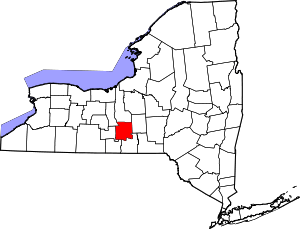 | |
| Towns | ||
| Villages | ||
| CDPs | ||
| Other hamlets | ||
Coordinates: 42°21′08″N 76°28′51″W / 42.35222°N 76.48083°W