Freeville, New York
| Freeville, New York | |
|---|---|
| Village | |
 Freeville, New York Location within the state of New York | |
| Coordinates: 42°30′45″N 76°20′45″W / 42.51250°N 76.34583°WCoordinates: 42°30′45″N 76°20′45″W / 42.51250°N 76.34583°W | |
| Country | United States |
| State | New York |
| County | Tompkins |
| Settled | 1787 |
| Incorporated | July 2, 1887 |
| Named for | Uncertain, possibly suggested by first settler as an alternative to the name "White's Mill," which referred to him and his property[1] |
| Area | |
| • Total | 1.1 sq mi (2.8 km2) |
| • Land | 1.1 sq mi (2.8 km2) |
| • Water | 0.0 sq mi (0.0 km2) |
| Elevation | 1,043 ft (318 m) |
| Population (2010) | |
| • Total | 520 |
| Time zone | Eastern (EST) (UTC-5) |
| • Summer (DST) | EDT (UTC-4) |
| ZIP code | 13068 |
| Area code(s) | 607 |
| FIPS code | 36-27529 |
| GNIS feature ID | 0950679 |
| Website |
freevilleny |
Freeville is a village in Tompkins County, New York, United States. The population was 520 at the 2010 census.
The Village of Freeville is in the Town of Dryden and is east of Ithaca.
History
Dryden was in the former Central New York Military Tract.
The Village of Dryden was incorporated in 1887.
George Junior Republic, a youth center was established in 1895.
Geography
Freeville is located at 42°30′45″N 76°20′45″W / 42.51250°N 76.34583°W (42.513, -76.346).[2]
According to the United States Census Bureau, the village has a total area of 1.1 square miles (2.8 km2), all of it land.
New York State Route 38 intersects New York State Route 366 in Freeville.
Demographics
| Historical population | |||
|---|---|---|---|
| Census | Pop. | %± | |
| 1890 | 312 | — | |
| 1900 | 440 | 41.0% | |
| 1910 | 318 | −27.7% | |
| 1920 | 303 | −4.7% | |
| 1930 | 374 | 23.4% | |
| 1940 | 379 | 1.3% | |
| 1950 | 373 | −1.6% | |
| 1960 | 471 | 26.3% | |
| 1970 | 664 | 41.0% | |
| 1980 | 449 | −32.4% | |
| 1990 | 437 | −2.7% | |
| 2000 | 505 | 15.6% | |
| 2010 | 520 | 3.0% | |
| Est. 2015 | 520 | [3] | 0.0% |
As of the census[5] of 2000, there were 505 people, 210 households, and 118 families residing in the village. The population density was 467.7 people per square mile (180.5/km²). There were 224 housing units at an average density of 207.4 per square mile (80.1/km²). The racial makeup of the village was 97.03% White, 0.59% African American, 0.20% Native American, 0.40% Asian, and 1.78% from two or more races. Hispanic or Latino of any race were 1.39% of the population.
There were 210 households out of which 28.1% had children under the age of 18 living with them, 44.8% were married couples living together, 7.6% had a female householder with no husband present, and 43.8% were non-families. 31.0% of all households were made up of individuals and 13.8% had someone living alone who was 65 years of age or older. The average household size was 2.33 and the average family size was 3.03.
In the village the population was spread out with 26.5% under the age of 18, 9.9% from 18 to 24, 27.1% from 25 to 44, 23.4% from 45 to 64, and 13.1% who were 65 years of age or older. The median age was 37 years. For every 100 females there were 99.6 males. For every 100 females age 18 and over, there were 91.2 males.
The median income for a household in the village was $39,643, and the median income for a family was $44,688. Males had a median income of $31,500 versus $27,500 for females. The per capita income for the village was $17,910. About 7.3% of families and 9.3% of the population were below the poverty line, including 9.6% of those under age 18 and 8.0% of those age 65 or over.
Notable natives
- Amy Dickinson, author of the syndicated advice column Ask Amy (succeeding Ann Landers at the Chicago Tribune), grew up on a dairy farm in Freeville.
- Woody Erdman, sportscaster, television producer, businessman, and white collar criminal.
References
- ↑ Genung, Albert Benjamin (1942), Historical Sketch of the Village of Freeville, New York (PDF), Dryden, New York: Dryden Historical Society, p. 28, OCLC 35163750, retrieved 2013-08-03,
Most of the folks were in favor of letting it go on as "White's Mill" but Elder White himself vowed that in this new country the place names ought not merely to perpetuate some man's name because he got there first. He proposed that they call their settlement "Freeville"
- ↑ "US Gazetteer files: 2010, 2000, and 1990". United States Census Bureau. 2011-02-12. Retrieved 2011-04-23.
- ↑ "Annual Estimates of the Resident Population for Incorporated Places: April 1, 2010 to July 1, 2015". Retrieved July 2, 2016.
- ↑ "Census of Population and Housing". Census.gov. Retrieved June 4, 2015.
- ↑ "American FactFinder". United States Census Bureau. Retrieved 2008-01-31.
External links
| Wikimedia Commons has media related to Freeville, New York. |
Municipalities and communities of Tompkins County, New York, United States | ||
|---|---|---|
| City | 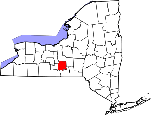 | |
| Towns | ||
| Villages | ||
| CDPs | ||
| Other hamlets | ||