Darby, Montana
| Darby, Montana | |
|---|---|
| Town | |
|
Discovery nature trail (East side towards river) | |
 Location of Darby, Montana | |
| Coordinates: 46°1′19″N 114°10′47″W / 46.02194°N 114.17972°WCoordinates: 46°1′19″N 114°10′47″W / 46.02194°N 114.17972°W | |
| Country | United States |
| State | Montana |
| County | Ravalli |
| Government | |
| • Mayor | JC McDowel [1] |
| Area[2] | |
| • Total | 0.58 sq mi (1.50 km2) |
| • Land | 0.58 sq mi (1.50 km2) |
| • Water | 0 sq mi (0 km2) |
| Elevation | 3,885 ft (1,184 m) |
| Population (2010)[3] | |
| • Total | 720 |
| • Estimate (2015)[4] | 747 |
| • Density | 1,241.4/sq mi (479.3/km2) |
| Time zone | Mountain (MST) (UTC-7) |
| • Summer (DST) | MDT (UTC-6) |
| ZIP code | 59829 |
| Area code(s) | 406 |
| FIPS code | 30-19300 |
| GNIS feature ID | 0782081 |
| Website | http://www.darbymt.net/ |
Darby (Salish: snk̓ʷɫxʷexʷem̓i, "Place Where They Would Lift Something"[5][6]) is a town in Ravalli County, Montana, United States. The population was 720 at the 2010 census. Darby is located near the southwestern border of Montana and Idaho, along the Continental Divide.
Geography
Darby is located at 46°1′19″N 114°10′47″W / 46.02194°N 114.17972°W (46.022030, -114.179603).[7]
According to the United States Census Bureau, the town has a total area of 0.58 square miles (1.50 km2), all of it land.[2]
The area south of Darby is called nɫpapʔá in Salish.[5]
Climate
This climatic region is typified by large seasonal temperature differences, with warm to hot (and often humid) summers and cold (sometimes severely cold) winters. According to the Köppen Climate Classification system, Darby has a humid continental climate, abbreviated "Dfb" on climate maps.[8]
Visitors to Darby may wish to seek shelter during thunderstorms. In July 2012, "A cowboy and two spectators were taken by ambulance to a Hamilton hospital ... after lightning hit a power pole at the Elite Bull Connection, sending an electric shock through the grandstands, rodeo chutes and bull pens."[9] On July 14, 2014, 45 cattle on a ranch near Darby were killed in a single lightning strike.[10]
Demographics
| Historical population | |||
|---|---|---|---|
| Census | Pop. | %± | |
| 1920 | 325 | — | |
| 1930 | 285 | −12.3% | |
| 1940 | 481 | 68.8% | |
| 1950 | 415 | −13.7% | |
| 1960 | 398 | −4.1% | |
| 1970 | 538 | 35.2% | |
| 1980 | 581 | 8.0% | |
| 1990 | 625 | 7.6% | |
| 2000 | 710 | 13.6% | |
| 2010 | 720 | 1.4% | |
| Est. 2015 | 747 | [11] | 3.8% |
| U.S. Decennial Census[12][13] 2015 Estimate[4] | |||
2010 census
As of the census[3] of 2010, there were 720 people, 303 households, and 179 families residing in the town. The population density was 1,241.4 inhabitants per square mile (479.3/km2). There were 360 housing units at an average density of 620.7 per square mile (239.7/km2). The racial makeup of the town was 91.3% White, 0.1% African American, 4.2% Native American, 0.8% Asian, and 3.6% from two or more races. Hispanic or Latino of any race were 2.2% of the population.
There were 303 households of which 28.1% had children under the age of 18 living with them, 39.6% were married couples living together, 14.5% had a female householder with no husband present, 5.0% had a male householder with no wife present, and 40.9% were non-families. 33.3% of all households were made up of individuals and 12.9% had someone living alone who was 65 years of age or older. The average household size was 2.36 and the average family size was 2.94.
The median age in the town was 40.8 years. 24% of residents were under the age of 18; 8.2% were between the ages of 18 and 24; 23.1% were from 25 to 44; 29.6% were from 45 to 64; and 15% were 65 years of age or older. The gender makeup of the town was 49.9% male and 50.1% female.
2000 census
As of the census[14] of 2000, there were 710 people, 279 households, and 176 families residing in the town. The population density was 1,336.5 people per square mile (517.2/km²). There were 316 housing units at an average density of 230.2/km² or 594.8/sq mi. The racial makeup of the town was 90.56% White, 0.14% African American, 3.24% Native American, 2.39% from other races, and 3.66% from two or more races. Hispanic or Latino of any race were 3.52% of the population.
There were 279 households out of which 36.9% had children under the age of 18 living with them, 41.9% were married couples living together, 14.0% had a female householder with no husband present, and 36.9% were non-families. 30.5% of all households were made up of individuals and 10.8% had someone living alone who was 65 years of age or older. The average household size was 2.54 and the average family size was 3.20.
In the town the population was spread out with 32.3% under the age of 18, 9.0% from 18 to 24, 26.9% from 25 to 44, 22.5% from 45 to 64, and 9.3% who were 65 years of age or older. The median age was 33 years. For every 100 females there were 99.4 males. For every 100 females age 18 and over, there were 91.6 males.
The median income for a household in the town was $25,221, and the median income for a family was $27,500. Males had a median income of $21,071 versus $20,781 for females. The per capita income for the town was $11,658. About 19.5% of families and 24.0% of the population were below the poverty line, including 30.6% of those under age 18 and 9.3% of those age 65 or over.
City Council
The Darby Town Council has two wards and an at-large position.
Ward 1
- Scott Ralston
Ward 2
- Shane Starkey
At-large [15]
Scenic Community Gallery
-
Fishing north of Darby (Lost Horse)
-
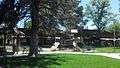
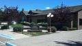
Main street park
-
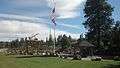
Veterans Memorial at Loggers Day field
-
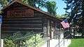
Pioneer Memorial Museum
-
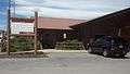
District Library
-
Community clubhouse
-
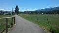
Discovery nature trail (West side near Rodeo grounds)
-
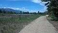
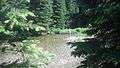
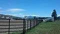
Discovery nature trail (East side towards river)
-
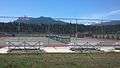
Richard Cromwell Memorial Rodeo Grounds
-
Tennis courts next to school
-

Town Hall (Tanner Ave and Hwy 93)
Movies filmed in Darby
In 1989 the movie Disorganized Crime was filmed in Darby, Hamilton, and Missoula.
See also
References
- ↑ "Office of the Mayor". Town of Darby. Town of Darby. Retrieved 9 August 2015.
- 1 2 "US Gazetteer files 2010". United States Census Bureau. Retrieved 2012-12-18.
- 1 2 "American FactFinder". United States Census Bureau. Retrieved 2012-12-18.
- 1 2 "Population Estimates". United States Census Bureau. Retrieved July 22, 2016.
- 1 2 Tachini, Pete; Louie Adams, Sophie Mays, Mary Lucy Parker, Johnny Arlee, Frances Vanderburg, Lucy Vanderburg, Diana Christopher-Cote (1998). nyoʻnuntn q̓éymin, Flathead Nation Salish dictionary. Pablo, MT: Bilingual Education Department, Salish Kootenai College. p. 36.
- ↑ "Salish Audio Files". Salish-Pend d'Oreille Culture Committee. 2014. Retrieved June 28, 2014.
- ↑ "US Gazetteer files: 2010, 2000, and 1990". United States Census Bureau. 2011-02-12. Retrieved 2011-04-23.
- ↑ Climate Summary for Darby, Montana
- ↑ Devlin, Sherry (2012-07-15). "3 injured when lightning hits Darby rodeo grounds". Missoulian. Retrieved 2014-07-24.
- ↑ Backus, Perry (2014-07-22). "45 cows killed by single lightning strike near Darby". Missoulian. Retrieved 2014-07-24.
- ↑ "Annual Estimates of the Resident Population for Incorporated Places: April 1, 2010 to July 1, 2015". Retrieved July 2, 2016.
- ↑ "Census of Population and Housing". Census.gov. Retrieved June 4, 2015.
- ↑ "Census & Economic Information Center". Retrieved July 3, 2015.
- ↑ "American FactFinder". United States Census Bureau. Retrieved 2008-01-31.
- ↑ "Town Council". Town of Darby. Town of Darby. Retrieved 9 August 2015.
External links
Municipalities and communities of Ravalli County, Montana, United States | ||
|---|---|---|
| City | 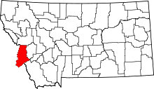 | |
| Towns | ||
| CDPs | ||
| Other communities | ||