Darke County Airport
| Darke County Airport | |||||||||||
|---|---|---|---|---|---|---|---|---|---|---|---|
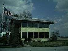 Airport building, used as a waiting area | |||||||||||
| IATA: none – ICAO: KVES – FAA LID: VES | |||||||||||
| Summary | |||||||||||
| Airport type | Public | ||||||||||
| Owner | Darke County Commissioners | ||||||||||
| Serves | Versailles, Ohio | ||||||||||
| Elevation AMSL | 1,007 ft / 307 m | ||||||||||
| Coordinates | 40°12′16″N 084°31′55″W / 40.20444°N 84.53194°WCoordinates: 40°12′16″N 084°31′55″W / 40.20444°N 84.53194°W | ||||||||||
| Map | |||||||||||
 VES  VES Location of airport in Ohio/United States | |||||||||||
| Runways | |||||||||||
| |||||||||||
| Statistics (2012) | |||||||||||
| |||||||||||
Darke County Airport (ICAO: KVES, FAA LID: VES) is a county owned, public use airport in Darke County, Ohio, United States.[1] It is located two nautical miles (4 km) southwest of the central business district of Versailles.[1] It is along State Route 121 just south of Versailles. Midmark operates a private jet from this airport. The airport is included in the National Plan of Integrated Airport Systems for 2011–2015, which categorized it as a general aviation facility.[2]
Although most U.S. airports use the same three-letter location identifier for the FAA and IATA, this airport is assigned VES by the FAA,[1] but has no designation from the IATA.[3][4]
Facilities and aircraft
Darke County Airport covers an area of 42 acres (17 ha) at an elevation of 1,007 feet (307 m) above mean sea level. It has one runway designated 9/27 with an asphalt surface measuring 4,512 by 75 feet (1,375 x 23 m).[1]
For the 12-month period ending July 17, 2012, the airport had 9,238 aircraft operations, an average of 25 per day: 99% general aviation, 1% air taxi, and <1% military. At that time there were 23 aircraft based at this airport: 91% single-engine, 4% multi-engine, and 4% jet.[1]
References
- 1 2 3 4 5 6 FAA Airport Master Record for VES (Form 5010 PDF). Federal Aviation Administration. Effective November 15, 2012.
- ↑ "2011–2015 NPIAS Report, Appendix A" (PDF, 2.03 MB). National Plan of Integrated Airport Systems. Federal Aviation Administration. October 4, 2010. External link in
|work=(help) - ↑ "Darke County Airport (FAA: VES, ICAO: KVES, IATA: none)". Great Circle Mapper. Retrieved December 17, 2012.
- ↑ "IATA Airport Code Search". International Air Transport Association. Retrieved December 16, 2012.
External links
- Aerial image as of April 1994 from USGS The National Map
- FAA Terminal Procedures for VES, effective November 10, 2016
- Resources for this airport:
- FAA airport information for VES
- AirNav airport information for KVES
- FlightAware airport information and live flight tracker
- NOAA/NWS latest weather observations
- SkyVector aeronautical chart, Terminal Procedures