Davenport, Oklahoma
| Davenport, Oklahoma | |
|---|---|
| Town | |
 Location of Davenport, Oklahoma | |
| Coordinates: 35°42′27″N 96°45′52″W / 35.70750°N 96.76444°WCoordinates: 35°42′27″N 96°45′52″W / 35.70750°N 96.76444°W | |
| Country | United States |
| State | Oklahoma |
| County | Lincoln |
| Area | |
| • Total | 0.8 sq mi (2.1 km2) |
| • Land | 0.8 sq mi (2.1 km2) |
| • Water | 0.0 sq mi (0.0 km2) |
| Elevation | 843 ft (257 m) |
| Population (2000) | |
| • Total | 881 |
| • Density | 1,082.2/sq mi (417.9/km2) |
| Time zone | Central (CST) (UTC-6) |
| • Summer (DST) | CDT (UTC-5) |
| ZIP code | 74026 |
| Area code(s) | 539/918 |
| FIPS code | 40-19350[1] |
| GNIS feature ID | 1091940[2] |
Davenport is a town in Lincoln County, Oklahoma, United States. The population was 881 at the 2000 census.
Geography
Davenport is located at 35°42′27″N 96°45′52″W / 35.70750°N 96.76444°W (35.707463, -96.764583).[3]
According to the United States Census Bureau, the town has a total area of 0.8 square miles (2.1 km2), all of it land.
Demographics
| Historical population | |||
|---|---|---|---|
| Census | Pop. | %± | |
| 1910 | 394 | — | |
| 1920 | 440 | 11.7% | |
| 1930 | 1,072 | 143.6% | |
| 1940 | 975 | −9.0% | |
| 1950 | 841 | −13.7% | |
| 1960 | 813 | −3.3% | |
| 1970 | 831 | 2.2% | |
| 1980 | 974 | 17.2% | |
| 1990 | 979 | 0.5% | |
| 2000 | 881 | −10.0% | |
| 2010 | 814 | −7.6% | |
| Est. 2015 | 821 | [4] | 0.9% |
As of the census[1] of 2000, there were 881 people, 353 households, and 261 families residing in the town. The population density was 1,082.2 people per square mile (419.9/km²). There were 401 housing units at an average density of 492.6 per square mile (191.1/km²). The racial makeup of the town was 85.24% White, 3.41% African American, 6.81% Native American, 0.11% Pacific Islander, 0.57% from other races, and 3.86% from two or more races. Hispanic or Latino of any race were 1.36% of the population.
There were 353 households out of which 33.4% had children under the age of 18 living with them, 58.4% were married couples living together, 10.2% had a female householder with no husband present, and 25.8% were non-families. 22.7% of all households were made up of individuals and 10.8% had someone living alone who was 65 years of age or older. The average household size was 2.50 and the average family size was 2.91.
In the town the population was spread out with 27.7% under the age of 18, 9.3% from 18 to 24, 27.9% from 25 to 44, 18.4% from 45 to 64, and 16.7% who were 65 years of age or older. The median age was 34 years. For every 100 females there were 89.9 males. For every 100 females age 18 and over, there were 85.2 males.
The median income for a household in the town was $24,205, and the median income for a family was $30,329. Males had a median income of $25,972 versus $19,091 for females. The per capita income for the town was $12,438. About 19.5% of families and 23.9% of the population were below the poverty line, including 34.6% of those under age 18 and 13.5% of those age 65 or over.
References
- 1 2 "American FactFinder". United States Census Bureau. Retrieved 2008-01-31.
- ↑ "US Board on Geographic Names". United States Geological Survey. 2007-10-25. Retrieved 2008-01-31.
- ↑ "US Gazetteer files: 2010, 2000, and 1990". United States Census Bureau. 2011-02-12. Retrieved 2011-04-23.
- ↑ "Annual Estimates of the Resident Population for Incorporated Places: April 1, 2010 to July 1, 2015". Retrieved July 2, 2016.
- ↑ "Census of Population and Housing". Census.gov. Archived from the original on May 11, 2015. Retrieved June 4, 2015.
External links
- City website
- Encyclopedia of Oklahoma History and Culture - Davenport
- Oklahoma Digital Maps: Digital Collections of Oklahoma and Indian Territory
Municipalities and communities of Lincoln County, Oklahoma, United States | ||
|---|---|---|
| Cities | 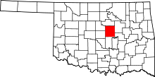 | |
| Towns | ||
| Unincorporated communities |
| |
| Ghost towns | ||
| Footnotes | ‡This populated place also has portions in an adjacent county or counties | |