Deaver, Wyoming
| Deaver, Wyoming | |
|---|---|
| Town | |
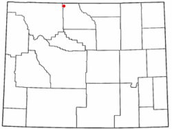 Location of Deaver, Wyoming | |
 Deaver, Wyoming Location in the United States | |
| Coordinates: 44°53′26″N 108°35′49″W / 44.89056°N 108.59694°WCoordinates: 44°53′26″N 108°35′49″W / 44.89056°N 108.59694°W | |
| Country | United States |
| State | Wyoming |
| County | Big Horn |
| Area[1] | |
| • Total | 1.01 sq mi (2.62 km2) |
| • Land | 1.01 sq mi (2.62 km2) |
| • Water | 0 sq mi (0 km2) |
| Elevation | 4,108 ft (1,252 m) |
| Population (2010)[2] | |
| • Total | 178 |
| • Estimate (2012[3]) | 182 |
| • Density | 176.2/sq mi (68.0/km2) |
| Time zone | Mountain (MST) (UTC-7) |
| • Summer (DST) | MDT (UTC-6) |
| ZIP code | 82421 |
| Area code(s) | 307 |
| FIPS code | 56-19530[4] |
| GNIS feature ID | 1587452[5] |
Deaver is a town in Big Horn County, Wyoming, United States. The population was 178 at the 2010 census.
Geography
Deaver is located at 44°53′26″N 108°35′49″W / 44.89056°N 108.59694°W (44.890439, −108.596860).[6]
According to the United States Census Bureau, the town has a total area of 1.01 square miles (2.62 km2), all of it land.[1]
Deaver is located in a sheltered valley to the west of the Big Horn Mountains and has a cold desert climate (Köppen BWk), a very rare type of climate so far north in North America and due to its very shielded location from moisture-bearing winds. Winters are almost snowless despite being very cold, with a median snowfall of only 1.4 inches (3.6 cm), though as much as 12.1 inches (30.73 cm) fell in April 1973. In the summer, days can be hot but humidity is low and nights are pleasantly cool. The shielded location means that the very limited rainfall of around 5.5 inches (140 mm) is confined to late spring and early summer thunderstorms.
| Climate data for Deaver, Wyoming (1971 to 2000) | |||||||||||||
|---|---|---|---|---|---|---|---|---|---|---|---|---|---|
| Month | Jan | Feb | Mar | Apr | May | Jun | Jul | Aug | Sep | Oct | Nov | Dec | Year |
| Record high °F (°C) | 63 (17) |
74 (23) |
82 (28) |
87 (31) |
98 (37) |
102 (39) |
105 (41) |
104 (40) |
102 (39) |
89 (32) |
73 (23) |
63 (17) |
105 (41) |
| Average high °F (°C) | 28.9 (−1.7) |
37.7 (3.2) |
49.9 (9.9) |
60.4 (15.8) |
70.2 (21.2) |
80.4 (26.9) |
87.5 (30.8) |
86.1 (30.1) |
74.4 (23.6) |
61.7 (16.5) |
43.0 (6.1) |
31.7 (−0.2) |
59.33 (15.18) |
| Average low °F (°C) | 2.8 (−16.2) |
9.6 (−12.4) |
20.4 (−6.4) |
29.0 (−1.7) |
39.4 (4.1) |
47.8 (8.8) |
53.1 (11.7) |
50.8 (10.4) |
40.0 (4.4) |
29.4 (−1.4) |
16.0 (−8.9) |
5.6 (−14.7) |
28.66 (−1.86) |
| Record low °F (°C) | −37 (−38) |
−36 (−38) |
−18 (−28) |
6 (−14) |
14 (−10) |
27 (−3) |
35 (2) |
25 (−4) |
17 (−8) |
−6 (−21) |
−23 (−31) |
−38 (−39) |
−38 (−39) |
| Average precipitation inches (mm) | 0.17 (4.3) |
0.10 (2.5) |
0.24 (6.1) |
0.35 (8.9) |
1.10 (27.9) |
0.99 (25.1) |
0.75 (19) |
0.59 (15) |
0.56 (14.2) |
0.38 (9.7) |
0.16 (4.1) |
0.13 (3.3) |
5.52 (140.1) |
| Average snowfall inches (cm) | 2.9 (7.4) |
1.2 (3) |
1.3 (3.3) |
1.0 (2.5) |
0.2 (0.5) |
0 (0) |
0 (0) |
0 (0) |
0.5 (1.3) |
0.4 (1) |
1.5 (3.8) |
1.5 (3.8) |
10.5 (26.6) |
| Average precipitation days (≥ 0.01 inch) | 2.4 | 2.1 | 1.7 | 3.1 | 5.7 | 5.4 | 4.1 | 3.9 | 3.4 | 2.5 | 1.6 | 1.5 | 37.4 |
| Average snowy days (≥ 0.1 inch) | 1.7 | 0.8 | 0.9 | 0.4 | 0 | 0 | 0 | 0 | 0.1 | 0.2 | 0.9 | 0.9 | 5.9 |
| Source: National Oceanic and Atmospheric Administration[7] | |||||||||||||
Demographics
| Historical population | |||
|---|---|---|---|
| Census | Pop. | %± | |
| 1920 | 142 | — | |
| 1930 | 85 | −40.1% | |
| 1940 | 111 | 30.6% | |
| 1950 | 118 | 6.3% | |
| 1960 | 121 | 2.5% | |
| 1970 | 112 | −7.4% | |
| 1980 | 178 | 58.9% | |
| 1990 | 199 | 11.8% | |
| 2000 | 177 | −11.1% | |
| 2010 | 178 | 0.6% | |
| Est. 2015 | 186 | [8] | 4.5% |
2010 census
As of the census[2] of 2010, there were 178 people, 66 households, and 48 families residing in the town. The population density was 176.2 inhabitants per square mile (68.0/km2). There were 84 housing units at an average density of 83.2 per square mile (32.1/km2). The racial makeup of the town was 96.6% White, 2.8% from other races, and 0.6% from two or more races. Hispanic or Latino of any race were 6.7% of the population.
There were 66 households of which 37.9% had children under the age of 18 living with them, 62.1% were married couples living together, 4.5% had a female householder with no husband present, 6.1% had a male householder with no wife present, and 27.3% were non-families. 18.2% of all households were made up of individuals and 3% had someone living alone who was 65 years of age or older. The average household size was 2.70 and the average family size was 3.08.
The median age in the town was 39 years. 26.4% of residents were under the age of 18; 10.7% were between the ages of 18 and 24; 19.6% were from 25 to 44; 33.8% were from 45 to 64; and 9.6% were 65 years of age or older. The gender makeup of the town was 53.4% male and 46.6% female.
2000 census
As of the census[4] of 2000, there were 177 people, 65 households, and 44 families residing in the town. The population density was 174.0 people per square mile (67.0/km²). There were 80 housing units at an average density of 78.7 per square mile (30.3/km²). The racial makeup of the town was 94.92% White, 1.13% Native American, 2.82% from other races, and 1.13% from two or more races. Hispanic or Latino of any race were 8.47% of the population.
There were 65 households out of which 46.2% had children under the age of 18 living with them, 60.0% were married couples living together, 4.6% had a female householder with no husband present, and 32.3% were non-families. 26.2% of all households were made up of individuals and 9.2% had someone living alone who was 65 years of age or older. The average household size was 2.72 and the average family size was 3.34.
In the town the population was spread out with 35.0% under the age of 18, 6.8% from 18 to 24, 32.2% from 25 to 44, 17.5% from 45 to 64, and 8.5% who were 65 years of age or older. The median age was 30 years. For every 100 females there were 110.7 males. For every 100 females age 18 and over, there were 101.8 males.
The median income for a household in the town was $31,071, and the median income for a family was $34,063. Males had a median income of $31,563 versus $15,938 for females. The per capita income for the town was $14,134. About 14.0% of families and 10.4% of the population were below the poverty line, including 6.3% of those under the age of eighteen and none of those sixty five or over.
Education
Public education in Deaver is provided by Big Horn County School District Number 1. High school and middle school students attend Rocky Mountain Middle/High School in Cowley, and elementary students attend Rocky Mountain Elementary School in Cowley. In 2009 the school district closed the Deaver school campus and slated the building for demolition. In early 2011, Wyoming engineer Dennis Danzik learned of the planned demolition and stepped in to stop the campus from being destroyed. Danzik, along with his Absaroka Capital and DEJA II Fund, reached an agreement with the State of Wyoming to allow Danzik and Ridgeline Energy Services of Calgary to take over the property and develop manufacturing and laboratory facilities.
References
- 1 2 "US Gazetteer files 2010". United States Census Bureau. Retrieved 2012-12-14.
- 1 2 "American FactFinder". United States Census Bureau. Retrieved 2012-12-14.
- ↑ "Population Estimates". United States Census Bureau. Retrieved 2013-06-01.
- 1 2 "American FactFinder". United States Census Bureau. Retrieved 2008-01-31.
- ↑ "US Board on Geographic Names". United States Geological Survey. 2007-10-25. Retrieved 2008-01-31.
- ↑ "US Gazetteer files: 2010, 2000, and 1990". United States Census Bureau. 2011-02-12. Retrieved 2011-04-23.
- ↑ "Climatic Averages for the United States 1971–2000: DEAVER, WY" (PDF). National Oceanic and Atmospheric Administration. Retrieved 2013-04-04.
- ↑ "Annual Estimates of the Resident Population for Incorporated Places: April 1, 2010 to July 1, 2015". Retrieved July 2, 2016.
- ↑ "Census of Population and Housing". Census.gov. Retrieved June 4, 2015.
Municipalities and communities of Big Horn County, Wyoming, United States | ||
|---|---|---|
| Towns | 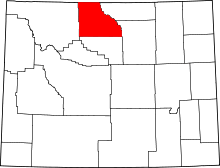 | |
| CDPs | ||
| Unincorporated communities | ||
| Footnotes | ‡This populated place also has portions in an adjacent county or counties | |