Debagarh
| Deogarh ଦେବଗଡ଼ Bamanda-Bamra | |
|---|---|
| city | |
| Nickname(s): City of waterfalls | |
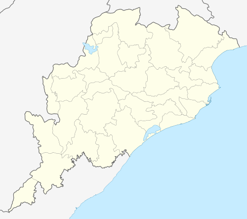 Deogarh  Deogarh Location in Odisha, India | |
| Coordinates: 21°32′N 84°44′E / 21.53°N 84.73°ECoordinates: 21°32′N 84°44′E / 21.53°N 84.73°E | |
| Country |
|
| State | Odisha |
| District | Deogarh |
| Government | |
| • Body | Deogarh Municipality |
| Elevation | 192 m (630 ft) |
| Population (2011) | |
| • Total | 22,390 |
| Demonym(s) | ଦେବଗଡିଆ |
| Languages | |
| • Official | Odia |
| Time zone | IST (UTC+5:30) |
| PIN | 768108 |
| Vehicle registration | OD-28 |
| UN/LOCODE | IN DEB |
| Nearest city(s) | Sambalpur, Rourkela, Bhubaneswar |
| Website | http://deogarh.nic.in[1] |
Debagarh, also known as Deogarh, is a city in Odisha state of eastern India. It is the headquarters of Debagarh District.
Deogarh
Deogarh is one of the 30 administrative districts of Odisha situated in the Western region of the state having its Headquarters at Deogarh town.
| Facts & Figures
Date of formation 01-Jan-1994 Area 2781.66 km2 Forest Land 1560.22 km2 Latitude 21° 31' 53" N Longitude 84° 43' 2" E Population (2001) 2, 74,095 Males 1, 38,913 Females 1, 35,182 Population density 93 per km2 Sex Ratio 980 females per 1000 males Literacy Rate 60.78% No. of Sub-Division 1 No. of Tehsil 1 No. of Blocks 3 No. of Villages 774 Average rainfall 1014.2 mm Postal Code 768108 STD Code 06641 |
Introduction
Deogarh District was newly created on 1.1.1994 being bifurcated from Sambalpur District. It is a relatively Backward District domicile by both tribal and non-tribal people in almost equal proportion. As it is an industry less district the people solely depends upon agriculture.Though a large section of its population is educated and it is adequately filled with land and forest resources, the obvious lack of sufficient social and physical infrastructure makes it a backward district with 79%% of its rural population below poverty line (BPL)and 29% under very poor (with annual income < Rs.4000) category.
Geography
Debagarh is located at 21°32′N 84°44′E / 21.53°N 84.73°E.[2] It has an average elevation of 192 m (630 ft).
District of Deogarh is situated in the Western region of the state having its Headquarters at Deogarh. Deogarh is located between 21o 31' 53" N Latitude and 84o 43' 2" E Longitude. Deogarh Town is 90 km to the east of Sambalpur Town on N.H.-6. National Highway No.6 passes through the district acts as the main artery of inter-regional trade and other links.Among various biodiversity rich and ecologically balanced locations,"Pradhanpat" and "Kurudkut" waterfalls are with historical importance and with a salubrious atmosphere around them.Kurudkut is one of the earliest locations where hydroelectricity was generated in Asia though it is really hard to find the traces of such historical importance of those locations,thanks to the continuous negligence and lack of administrative effort being extended towards the restoration and development of those magnificent and least explored natural beauties.
Approach
1. Air: – The nearest airports for visiting places of interest in Deogarh District are at Bhubaneswar (265 km) & Raipur (376 km). A new airport is being constructed at Jharsuguda (98 km) .
2. Rail: - The nearest rail heads for Deogarh are at Sambalpur (90 km), Bamra on the Tatanagar-Bilaspur section of Howrah-Nagpur-Mumbai line (103 km), Jharsuguda (98 km) and Rourkela (115 km)
3. Road: - Deogarh is connected with NH6 (Part of AH46) (Mumbai-Kolkata) & NH200 (Raipur-Chandikhole).The city is 90 km from Sambalpur, 115 km from Rourkela & 265 km from Bhubaneswar.
Physiography
This District is entirely of hilly tract. The Hill system of Deogarh has been categorized mainly under four ranges such as
1. The Khajuria Range on the north running from West-East in Badbar-Pragana of Deogarh Police Station having a maximum height of 745 Metres.
2. The Pradhanpat & Kaidanta Ranges having maximum height of 743 Metres and 816 Metres on the North.
3. The Pawri Range on the eastern side of the River Brahmani which is 678 Metres in height.
4. The Ushakothi Range in Kansar & Reamal Police Stations. The hill ranges have elevation ranging from 610 Metres to 762 Metres from the mean Sea Levels.
Soil
The soil group of this district are mainly
1. Sandy loan 2. Red Soil
History
Debagarh is the former capital of Bamanda or Bamra princely state of British India. The king of this princely state belongs to Ganga vamsi dynasty and one of the extended royal family of Gajapati emperor of Odisha.
Raja Shri Basudeb Sudhal Deb (1869–1903) was an enlightened ruler, he did much to further conditions in princely state and for the cause of Oriya nationalism. His contribution was more towards Literature, Education and Art. He established an educational institution, which is currently well known as Raja Basu Dev High School.His son had equally contributed to the social,cultural and scientific development of Debagarh. Bamanda was the first princely state to introduce postal,telegraph and electricity in India. Currently Jagannath sahitya sansad is actively inspiring and promoting local talent in the field of art and literature in Oriya language. The sansad was a combined effort of some real patriotic and creative people like Sh. Jagamohan Mishra, Sh. Yogesh Dalbehera, Sh. Prafulla giri, Sh. Madhusudan Guru,Sh. durga Prasad Dwivedy, Sh. Prafulla Mahapatra.......etc. A beautiful waterfall PRADHANPAT decorates the town and supply the clean drinking water to the citizen. Pradhanpat ustav is celebrated annually near tha fall.
Bamanda–the citadel of creative artists dates back to 5th century A.D. when Mathara Royal Family was at the helm of the Administration. After this dynasty, Ganga Rulers came into power and established their capital at Deogarh. Deogarh attained all-round prosperity during the reign of Raja Basudev Sudhal Dev, the most enlightened rulers of this clan. A new horizon was innovated in the field of communication by the foundation of Jagannath Ballav press in 1886 and publication of a weekly magazine the “Sambalpur Hitaishini” in 1889. It was during his rule that the jail, police station, post offices, Dispensaries were established and irrigation system was introduced. He had a telephone line of 78 Miles connecting Bamara and Barkote in 1900 was the longest in India during that period. Bamanda’s own postal system was very developed. It got affiliated to the British Postal system in 1895. Sir Sudhal Dev, the then King of Bamanda had coined and issued postage stamps in his own Kingdom. He had promulgated paper currency also in his state.
After him, his illustrious son Raja Sachidananda Tribhuban Dev undertook the improvement activities of the earstwhile estate. The most outstanding developmental activities was the introduction of the hydro-electric system in Kodarkot water fall by which the Palace, cloth loom, Sugar factory established in 1908 at Rambhei got power supply. During the reign of Bhanuganga Tribhuban Dev, the estate of Bamra was merged with Odisha i,e. on 1 January 1948 and it became a part of the District of Sambalpur.
Demographics
As of 2011 India census,[3] Debagarh had a population of 22,390. Males constitute 52% of the population and females 48%. Debagarh has an average literacy rate of 67%, higher than the national average of 59.5%: male literacy is 74% and, female literacy is 59%. In Debagarh, 12% of the population is under 6 years of age.
Politics
Current MLA from Deogarh Sh.Nitish chandra Gangadev of Bharatiya Janata Party who won the seat in State elections of 2014. Previous MLAs from this seat include,Sh. Sanjib Pradhan of Biju Janata Dal in 2009, Sh.Nitish chandra ganga dev of congress who won this seat in 2004,Sh.Shubash ch. Panigrahi of BJP in 2000 and a byelection prior to it Pradipta Ganaga Deb of JD in 1995 and in 1990, Raj Kishore Pradhan of INC in 1985, Ashwini Kumar Behera of INC(I) in 1980, and Bhanu Ganga Tribhuban Deb of JNP in 1977.[4]
Deogarh is part of Deogarh (Lok Sabha constituency).[5]
References
- ↑ "Deogarh district".
- ↑ Falling Rain Genomics, Inc - Debagarh
- ↑ http://www.censusindia.gov.in/pca/SearchDetails.aspx?Id=400549
- ↑ "State Elections 2004 - Partywise Comparison for 134-Deogarh Constituency of Odisha". Election Commission of India. Retrieved 2008-09-27.
- ↑ "Assembly Constituencies - Corresponding Districts and Parliamentary Constituencies of Odisha" (PDF). Election Commission of India. Retrieved 2008-09-27.