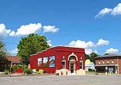
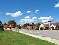
Decatur, Tennessee
| Decatur, Tennessee | |
|---|---|
| Town | |
 | |
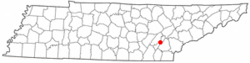 Location of Decatur, Tennessee | |
| Coordinates: 35°31′8″N 84°47′36″W / 35.51889°N 84.79333°WCoordinates: 35°31′8″N 84°47′36″W / 35.51889°N 84.79333°W | |
| Country | United States |
| State | Tennessee |
| County | Meigs |
| Founded | 1836 |
| Incorporated | 1838[1] |
| Named for | Stephen Decatur |
| Area | |
| • Total | 2.6 sq mi (6.6 km2) |
| • Land | 2.6 sq mi (6.6 km2) |
| • Water | 0.0 sq mi (0.0 km2) |
| Elevation | 778 ft (237 m) |
| Population (2010)[2] | |
| • Total | 1,598 |
| • Density | 545.1/sq mi (210.5/km2) |
| Time zone | Eastern (EST) (UTC-5) |
| • Summer (DST) | EDT (UTC-4) |
| ZIP code | 37322 |
| Area code(s) | 423 |
| FIPS code | 47-19880[3] |
| GNIS feature ID | 1306311[4] |
| Website |
www |
Decatur (/dəˈkeɪtər/ duh-KAY-ter) is a town in Meigs County, Tennessee, United States. The population was 1,598 at the 2010 census. It is the county seat of Meigs County.[5]
History
Decatur was founded in May 1836 as a county seat for Meigs County, which had been formed that same year. The initial 50 acres (0.20 km2) for the town were donated by James Lillard and Leonard Brooks. Decatur is named after Commodore Stephen Decatur, Jr., an early 19th-century American naval officer renowned for his exploits in the First Barbary War and the Second Barbary War and the War of 1812.[6]
Geography
Decatur is located at 35°31′8″N 84°47′36″W / 35.51889°N 84.79333°W (35.518871, -84.793201).[7] The town is situated at the western base of No Pone Ridge, an elongate ridge characteristic of the Appalachian Ridge-and-Valley Province. Just west of Decatur, the Tennessee River flows around a blunt peninsula known as Armstrong Bend. This section of the river is part of Chickamauga Lake.
Decatur is situated around the junction of Tennessee State Route 30, which connects the town to Athens to the east and Dayton to the west, and Tennessee State Route 58, which connects Decatur to Kingston to the north and Chattanooga to the south. Interstate 75 passes approximately 15 miles (24 km) east of Decatur.
According to the United States Census Bureau, the town has a total area of 2.6 square miles (6.7 km2), all of it land.
Demographics
| Historical population | |||
|---|---|---|---|
| Census | Pop. | %± | |
| 1870 | 99 | — | |
| 1880 | 175 | 76.8% | |
| 1890 | 313 | 78.9% | |
| 1910 | 165 | — | |
| 1920 | 142 | −13.9% | |
| 1930 | 158 | 11.3% | |
| 1940 | 205 | 29.7% | |
| 1950 | 235 | 14.6% | |
| 1960 | 681 | 189.8% | |
| 1970 | 698 | 2.5% | |
| 1980 | 1,069 | 53.2% | |
| 1990 | 1,361 | 27.3% | |
| 2000 | 1,395 | 2.5% | |
| 2010 | 1,598 | 14.6% | |
| Est. 2015 | 1,575 | [8] | −1.4% |
| Sources:[9][10] | |||
As of the census[3] of 2000, there were 1,395 people, 560 households, and 366 families residing in the town. The population density was 545.1 people per square mile (210.4/km²). There were 598 housing units at an average density of 233.7 per square mile (90.2/km²). The racial makeup of the town was 98.14% White, 0.93% African American, 0.14% Native American, 0.29% Asian, 0.07% from other races, and 0.43% from two or more races. Hispanic or Latino of any race were 0.29% of the population.
There were 560 households out of which 28.8% had children under the age of 18 living with them, 49.1% were married couples living together, 12.5% had a female householder with no husband present, and 34.5% were non-families. 30.9% of all households were made up of individuals and 13.8% had someone living alone who was 65 years of age or older. The average household size was 2.29 and the average family size was 2.83.
In the town the population was spread out with 21.5% under the age of 18, 7.9% from 18 to 24, 29.2% from 25 to 44, 23.8% from 45 to 64, and 17.6% who were 65 years of age or older. The median age was 39 years. For every 100 females there were 92.1 males. For every 100 females age 18 and over, there were 88.5 males.
The median income for a household in the town was $29,402, and the median income for a family was $38,375. Males had a median income of $29,327 versus $22,647 for females. The per capita income for the town was $18,784. About 12.9% of families and 15.1% of the population were below the poverty line, including 16.8% of those under age 18 and 12.5% of those age 65 or over.
References
- ↑ Tennessee Blue Book, 2005-2006, pp. 618-625.
- ↑ Tennessee Department of Economic and Community Development, Certified Population of Tennessee Incorporated Municipalities and Counties, State of Tennessee website, 1 July 2011.
- 1 2 "American FactFinder". United States Census Bureau. Retrieved 2008-01-31.
- ↑ "US Board on Geographic Names". United States Geological Survey. 2007-10-25. Retrieved 2008-01-31.
- ↑ "Find a County". National Association of Counties. Retrieved 2011-06-07.
- ↑ Ann Toplovich, "Meigs County." The Tennessee Encyclopedia of History and Culture, 2002. Retrieved: 1 April 2008.
- ↑ "US Gazetteer files: 2010, 2000, and 1990". United States Census Bureau. 2011-02-12. Retrieved 2011-04-23.
- ↑ "Annual Estimates of the Resident Population for Incorporated Places: April 1, 2010 to July 1, 2015". Retrieved July 2, 2016.
- ↑ "Census of Population and Housing: Decennial Censuses". United States Census Bureau. Retrieved 2012-03-04.
- ↑ "Incorporated Places and Minor Civil Divisions Datasets: Subcounty Resident Population Estimates: April 1, 2010 to July 1, 2012". Population Estimates. U.S. Census Bureau. Retrieved 11 December 2013.
External links
| Wikimedia Commons has media related to Decatur, Tennessee. |
- Official site
- Municipal Technical Advisory Service entry for Decatur — information on local government, elections, and link to charter
- Meigs County Historical Museum
Municipalities and communities of Meigs County, Tennessee, United States | ||
|---|---|---|
| Town | ||
| Unincorporated communities | ||
| Footnotes | ‡This populated place also has portions in an adjacent county or counties | |