Dehcho Region
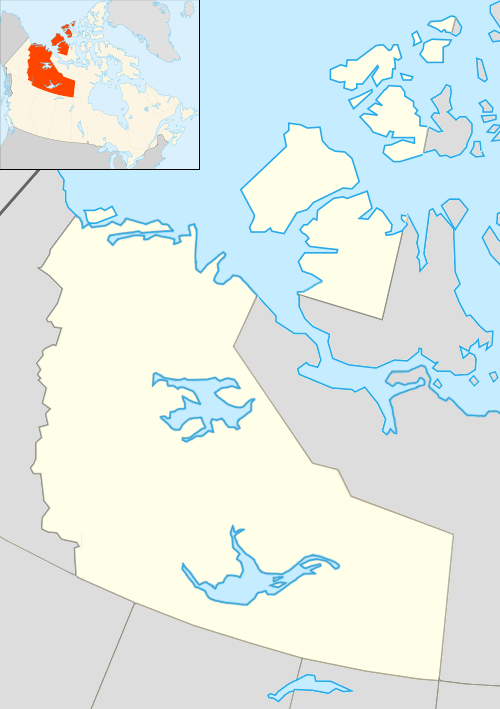
Dehcho Region communities in the Northwest Territories
The Dehcho Region is one of five administrative regions in the Northwest Territories of Canada. The region consists of six communities with the regional office situated in Fort Simpson. All communities in the Dehcho are predominantly Dehcho First Nations.
Communities
The Dehcho Region includes the following communities:
| Community name[1] | Translation[1] | Governance[2] | Population 2011[3] |
% change from 2006 |
Location |
| Fort Liard[4] | Echaot'l Koe; people from the land of the giants | Hamlet | 536 | -8.1% | 60°14′27″N 123°28′11″W / 60.24083°N 123.46972°W |
| Fort Simpson[5] | Liidlii Kue; place where rivers come together | Village | 1,238 | 1.8% | 61°51′47″N 121°21′18″W / 61.86306°N 121.35500°W |
| Jean Marie River[6] | Tthedzehk'edeli; water flowing over clay | First Nation - Designated Authority (TthedzehK'edeli First Nation) | 64 | -21.0% | 61°31′33″N 120°37′38″W / 61.52583°N 120.62722°W |
| Nahanni Butte[7] | Tthenáágó; strong rock | Dene Band - Designated Authority (Nahanni Butte Dene Band) | 102 | -11.3% | 61°02′02″N 123°22′50″W / 61.03389°N 123.38056°W |
| Trout Lake[8] | Sambaa K'e | Dene Band - Designated Authority (Sambaa K'e Dene Band) | 92 | 7.0% | 60°26′33″N 121°14′43″W / 60.44250°N 121.24528°W |
| Wrigley[9] | Pedzéh Kñ; clay place | First Nation - Designated Authority (Pehdzeh Ki First Nation) | 133 | 9.0% | 63°13′41″N 123°28′12″W / 63.22806°N 123.47000°W |
| Fort Providence[10] | Zhahti Koe; mission house | Hamlet | 734 | 1.0% | 61°21′17″N 117°39′36″W / 61.35472°N 117.66000°W |
| Kakisa[11] | K’agee; between the willows | First Nation - Designated Authority (Ka'a'gee Tu First Nation) | 45 | -13.5% | 60°56′24″N 117°24′51″W / 60.94000°N 117.41417°W |
See also
References
- 1 2 "Northwest Territories Official Community Names and Pronunciation Guide". Prince of Wales Northern Heritage Centre. Yellowknife: Education, Culture and Employment, Government of the Northwest Territories. Archived from the original on 2016-01-13. Retrieved 2016-01-13.
- ↑ Differences in Community Government Structures
- ↑ Canada Census 2011
- ↑ "NWT Communities - Fort Liard". Government of the Northwest Territories: Department of Municipal and Community Affairs. Retrieved 2014-01-29.
- ↑ "NWT Communities - Fort Simpson". Government of the Northwest Territories: Department of Municipal and Community Affairs. Retrieved 2014-01-29.
- ↑ "NWT Communities - Jean Marie River". Government of the Northwest Territories: Department of Municipal and Community Affairs. Retrieved 2014-01-29.
- ↑ "NWT Communities - Nahanni Butte". Government of the Northwest Territories: Department of Municipal and Community Affairs. Retrieved 2014-01-29.
- ↑ "NWT Communities - Trout Lake". Government of the Northwest Territories: Department of Municipal and Community Affairs. Retrieved 2014-01-29.
- ↑ "NWT Communities - Wrigley". Government of the Northwest Territories: Department of Municipal and Community Affairs. Retrieved 2014-01-29.
- ↑ "NWT Communities - Fort Providence". Government of the Northwest Territories: Department of Municipal and Community Affairs. Retrieved 2014-01-29.
- ↑ "NWT Communities - Kakisa". Government of the Northwest Territories: Department of Municipal and Community Affairs. Retrieved 2014-01-29.
| Census divisions | |||||||||||
|---|---|---|---|---|---|---|---|---|---|---|---|
| Former census divisions | |||||||||||
| Dehcho Region |
| ||||||||||
| Inuvik Region |
| ||||||||||
| North Slave Region |
| ||||||||||
| Sahtu Region |
| ||||||||||
| South Slave Region |
| ||||||||||
| Weather stations (outside of communities) | |||||||||||
| Mine sites |
| ||||||||||
| DEW line and NWS sites |
| ||||||||||
| Hudson's Bay Company trading posts | |||||||||||
| Former districts |
| ||||||||||
| |||||||||||
Coordinates: 61°51′47″N 121°21′18″W / 61.86306°N 121.35500°W
This article is issued from Wikipedia - version of the 9/4/2016. The text is available under the Creative Commons Attribution/Share Alike but additional terms may apply for the media files.