Sachs Harbour
| Sachs Harbour Ikahuak | |
|---|---|
| Hamlet | |
 | |
 Sachs Harbour 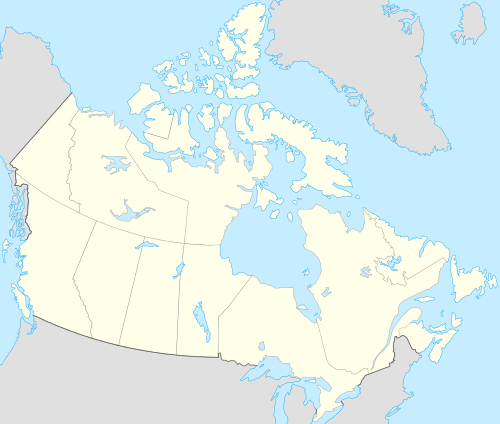 Sachs Harbour | |
| Coordinates: 71°59′08″N 125°14′53″W / 71.98556°N 125.24806°WCoordinates: 71°59′08″N 125°14′53″W / 71.98556°N 125.24806°W | |
| Country | Canada |
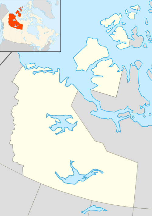
| Territory | Northwest Territories |
| Region | Inuvik Region |
| Constituency | Nunakput |
| Census division | Region 1 |
| First permanent settlement | 1929 |
| Incorporated (hamlet) | 1 April 1986 |
| Government | |
| • Mayor | Lloyd Acheson |
| • Senior Administrative Officer | Steve Wylie |
| • MLA | Herbert Nakimayak |
| Area[1] | |
| • Land | 290.94 km2 (112.33 sq mi) |
| Elevation | 86 m (282 ft) |
| Population (2011)[1] | |
| • Total | 112 |
| • Density | 0.4/km2 (1/sq mi) |
| Time zone | Mountain (MST) (UTC-7) |
| • Summer (DST) | MDT (UTC-6) |
| Canadian Postal code | X0E 0Z0 |
| Area code(s) | 867 |
| Telephone exchange | 690 |
| - Living cost | 177.5A |
| - Food price index | 177.5B |
|
Sources: Department of Municipal and Community Affairs,[2] Prince of Wales Northern Heritage Centre,[3] Canada Flight Supplement[4] ^A 2009 figure based on Edmonton = 100[5] ^B 2010 figure based on Yellowknife = 100[5] | |
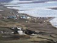
Sachs Harbour is a hamlet located in the Inuvik Region of the Northwest Territories, Canada. Situated on the southwestern coast of Banks Island in the Inuvialuit Settlement Region, the population according to the 2011 census count was 112 people.[1] The two principal languages in the town are Inuvialuktun and English. The traditional name for the area is "Ikahuak", meaning "where you go across to". Bulk supplies of food and other items are brought by barge in the summer months and flights from Inuvik, some 325 mi (523 km) to the southwest, operate all year, via the Sachs Harbour Airport. Sachs Harbour is the only permanent settlement on Banks Island.
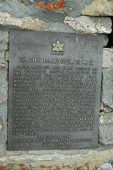
The town was named after the ship Mary Sachs, which was part of the Canadian Arctic Expedition of 1913.
Community life
The community's economy is based largely on hunting and trapping, but tourism also plays a small role. Most of the town lies within 250 yd (230 m) of the shoreline. Residents also engage in ice fishing, harvesting fish from the Amundsen Gulf and the Beaufort Sea. There is a goose hunt every spring - Banks Island being the home to the largest goose colony in North America. The community is also home to the largest commercial muskox harvests in Canada. Three quarters of the world's population of muskoxen roam the island. Barren-ground caribou and polar bear are also seen on the island. On April 26, 2006 the world's first documented wild-born grizzly–polar bear hybrid was shot near the town.
Aulavik National Park
Sachs Harbour is the headquarters of Aulavik National Park. The Aulavik National Park Visitor Reception Centre is situated in Sachs Harbour. Aulavik National Park is located on the north end of Banks Island, and is co-operatively managed by Parks Canada with the residents of Sachs Harbour and the broader Inuvialuit community. The Visitor Reception Centre presents the park and Inuvialuit culture to visitors to Banks Island, as well as serves as a centre for community activities. On the north shore of Banks Island within Aulavik National Park is a narrow bay, Mercy Bay, penetrating some distance into the park. It is of historical significance for one of a number of ships sent out to the Arctic by the British Admiralty to find the lost expedition of James Franklin became trapped in the ice in the bay for some three years and had to be abandoned by its crew. That ship was the Investigator and its captain, Commander Robert McClure. The Investigator sailed from England all around North and South America so that it passed through the Bering Strait in an attempt to find the North West passage from the west while looking for the Franklin Expedition. There was a relatively high hill on Banks Island to the east of Mercy Bay with a clear and unobstructed view of the waters and lands to the east. McClure had been in the Arctic approaching from the east on an earlier voyage. From the top of the hill he was able to identify land features to the east and the water passage to these lands from Banks Island. He had found the fabled North West Passage - a waterway across the top of North America theoretically allowing ships from Europe to pass through and enter Asian waters in the west. This had been a goal for mariners since the overland route, the Silk Road from Asia to Europe, had been closed in 1453 when its western hub, Constantinople, now Istanbul, fell to the Ottoman Turks. Mariners learned fairly quickly thereafter that China could be reached by ship taking a long voyage around the south end of Africa at the Cape of Good Hope, or the south end of South America at Cape Horn. If only there was a North West Passage over the top of North America - a much shorter voyage to China. In the Investigator's log there is this brief entry: "October 31st, [sic 1850], the Captain returned at 8.30. A.M., and at 11.30. A.M., the remainder of the parting, having, upon the 26th instant, ascertained that the waters we are now in communicate with those of Barrow Strait, the north-eastern limit being in latitude 73°31′, N. longitude 114°39′, W. thus establishing the existence of a NORTH-WEST PASSAGE between the Atlantic and Pacific Oceans." Aulavik National Park was where the momentous discovery of the North West Passage was made. Some fifty or so years later, vessels did sail through the North West Passage from east to west and west to east. In recent years, an oil tanker and several freighters with the help of icebreakers have made it through the passage. There may come a day when such passages are common. After abandoning the Investigator in the ice of Mercy Bay, the crew, pulling their four sledges loaded with supplies, left Banks Island and journeyed east over the ice to meet up with the ships that rescued them and took them back to England by way of the Atlantic Ocean. [6]
Exploration
Oil and gas exploration has provided jobs over the years for some Sachs Harbour residents—estimates of commercially recoverable oil in the Beaufort Sea range from 4 to 12 billion barrels (1.9×10⁹ m3), and there is believed to be between 13 and 63 trillion cubic feet (1,800 km3) of natural gas.
Services
Services include a two-member Royal Canadian Mounted Police detachment and a health centre with one nurse.[7] Phone services are provided by Northwestel with Internet access. The local hunters and trappers association provides outfitting for big-game hunts like musk-ox and polar bears.
Demographics
| Historical population | |||||||||||||||||||||||||||||||||||||||||||||||||||||||
|---|---|---|---|---|---|---|---|---|---|---|---|---|---|---|---|---|---|---|---|---|---|---|---|---|---|---|---|---|---|---|---|---|---|---|---|---|---|---|---|---|---|---|---|---|---|---|---|---|---|---|---|---|---|---|---|
|
| ||||||||||||||||||||||||||||||||||||||||||||||||||||||
| Sources: NWT Bureau of Statistics[5] | |||||||||||||||||||||||||||||||||||||||||||||||||||||||
 Located on the southern shores of Banks Island
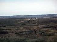 This site was closed and abandoned years ago
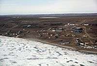 Sachs Harbour's population has been declining and now have approximately 90 residents
Climate
Sachs Harbour is in the Arctic tundra climatic zone, characterized by long, extremely cold winters. Since the activities of many residents of the community revolve around fishing, hunting, and travel, many residents have considerable knowledge of weather conditions, permafrost, and even erosion patterns. Because of climate changes in recent years, local residents fear their knowledge of weather patterns may not be of much use, as the weather has become harder to predict. Since the climate has been changing, sea ice has been breaking up earlier than normal, taking seals farther south in the summer. Seals are one of the main sources of food for the town. Salmon appeared for the first time in nearby waters between 1999 and 2001. New species of birds are migrating to the island, including robins and barn swallows, and more flies and mosquitos have been appearing.[8][9][10]
| Climate data for Sachs Harbour (David Nasogaluak Jr. Saaryuaq) Airport | |||||||||||||
|---|---|---|---|---|---|---|---|---|---|---|---|---|---|
| Month | Jan | Feb | Mar | Apr | May | Jun | Jul | Aug | Sep | Oct | Nov | Dec | Year |
| Record high humidex | −4.4 | −6.1 | −5.6 | 3.0 | 9.4 | 23.5 | 26.0 | 23.7 | 16.3 | 3.9 | 1.1 | −4.3 | 26.0 |
| Record high °C (°F) | −4.4 (24.1) |
−4.5 (23.9) |
−4.0 (24.8) |
2.2 (36) |
10.0 (50) |
20.5 (68.9) |
24.2 (75.6) |
21.5 (70.7) |
15.6 (60.1) |
4.4 (39.9) |
1.7 (35.1) |
−4.0 (24.8) |
24.2 (75.6) |
| Average high °C (°F) | −24.4 (−11.9) |
−24.5 (−12.1) |
−23.1 (−9.6) |
−14.6 (5.7) |
−4.6 (23.7) |
6.1 (43) |
10.0 (50) |
6.5 (43.7) |
1.2 (34.2) |
−7.7 (18.1) |
−17.1 (1.2) |
−21.5 (−6.7) |
−9.5 (14.9) |
| Daily mean °C (°F) | −28.0 (−18.4) |
−28.3 (−18.9) |
−26.7 (−16.1) |
−18.3 (−0.9) |
−7.6 (18.3) |
3.1 (37.6) |
6.6 (43.9) |
3.7 (38.7) |
−1.2 (29.8) |
−10.7 (12.7) |
−20.5 (−4.9) |
−25.1 (−13.2) |
−12.8 (9) |
| Average low °C (°F) | −31.7 (−25.1) |
−32.1 (−25.8) |
−30.3 (−22.5) |
−22.0 (−7.6) |
−10.5 (13.1) |
0.1 (32.2) |
3.1 (37.6) |
0.9 (33.6) |
−3.4 (25.9) |
−13.7 (7.3) |
−23.9 (−11) |
−28.5 (−19.3) |
−16.0 (3.2) |
| Record low °C (°F) | −52.2 (−62) |
−50.2 (−58.4) |
−48.4 (−55.1) |
−43.0 (−45.4) |
−26.7 (−16.1) |
−16.5 (2.3) |
−5.0 (23) |
−11.0 (12.2) |
−22.8 (−9) |
−35.5 (−31.9) |
−42.8 (−45) |
−45.0 (−49) |
−52.2 (−62) |
| Record low wind chill | −71.6 | −68.1 | −64.8 | −58.4 | −40.3 | −21.1 | −10.3 | −20.4 | −31.2 | −44.9 | −56.4 | −64.1 | −71.6 |
| Average precipitation mm (inches) | 4.9 (0.193) |
6.6 (0.26) |
7.1 (0.28) |
12.1 (0.476) |
9.1 (0.358) |
7.5 (0.295) |
17.6 (0.693) |
28.9 (1.138) |
22.0 (0.866) |
20.0 (0.787) |
9.0 (0.354) |
7.0 (0.276) |
151.5 (5.965) |
| Average rainfall mm (inches) | 0.0 (0) |
0.0 (0) |
0.0 (0) |
0.0 (0) |
0.1 (0.004) |
5.1 (0.201) |
16.7 (0.657) |
24.7 (0.972) |
11.2 (0.441) |
0.5 (0.02) |
0.0 (0) |
0.0 (0) |
58.3 (2.295) |
| Average snowfall cm (inches) | 5.2 (2.05) |
7.0 (2.76) |
7.7 (3.03) |
12.4 (4.88) |
9.3 (3.66) |
2.4 (0.94) |
0.9 (0.35) |
4.1 (1.61) |
10.9 (4.29) |
20.2 (7.95) |
9.4 (3.7) |
8.3 (3.27) |
97.7 (38.46) |
| Average precipitation days (≥ 0.2 mm) | 6.5 | 6.3 | 6.7 | 5.6 | 7.4 | 4.7 | 8.1 | 14.5 | 12.0 | 13.7 | 8.2 | 6.2 | 99.9 |
| Average rainy days (≥ 0.2 mm) | 0.0 | 0.0 | 0.0 | 0.0 | 0.2 | 2.9 | 7.8 | 11.7 | 5.4 | 0.6 | 0.0 | 0.0 | 28.7 |
| Average snowy days (≥ 0.2 cm) | 6.6 | 6.4 | 6.7 | 5.6 | 7.3 | 1.8 | 0.6 | 3.4 | 7.4 | 13.3 | 8.3 | 6.3 | 73.5 |
| Average relative humidity (%) | — | 81.6 | 76.9 | 81.7 | 88.9 | 86.7 | 87.8 | 93.9 | 91.9 | 88.2 | 86.0 | 86.3 | 86.4 |
| Mean monthly sunshine hours | — | 27.5 | 168.6 | 276.0 | 252.0 | 397.3 | 254.2 | 152.8 | 76.9 | 36.6 | — | — | 1,641.9 |
| Percent possible sunshine | — | 15.6 | 47.1 | 54.9 | 34.9 | 55.2 | 34.2 | 25.0 | 18.8 | 13.7 | — | — | 33.3 |
| Source: Environment Canada Canadian Climate Normals 1981–2010[11] | |||||||||||||
See also
References
- 1 2 3 Sachs Harbour, HAM Northwest Territories (Census subdivision)
- ↑ "NWT Communities - Sachs Harbour". Government of the Northwest Territories: Department of Municipal and Community Affairs. Retrieved 2014-01-16.
- ↑ "Northwest Territories Official Community Names and Pronunciation Guide". Prince of Wales Northern Heritage Centre. Yellowknife: Education, Culture and Employment, Government of the Northwest Territories. Archived from the original on 2016-01-13. Retrieved 2016-01-13.
- ↑ Canada Flight Supplement. Effective 0901Z 15 September 2016 to 0901Z 10 November 2016
- 1 2 3 Sachs Harbour - Statistical Profile at the GNWT
- ↑ McClure Arctic Expedition
- ↑ Infrastructure
- ↑ First Records of Sockeye (Oncorhynchus nerka) and Pink Salmon (O. gorbuscha) from Banks Island and Other Records of Pacific Salmon in Northwest Territories, Canada
- ↑ Observed Climate Change Impacts in Sachs Harbour, Canada
- ↑ Climate change impacts on Canadian Western Arctic: the Inuvialuit of Sachs Harbour
- ↑ "Sachs Harbour A" (CSV (3069 KB)). Canadian Climate Normals 1981–2010. Environment Canada. Climate ID: 2503650. Retrieved 2014-01-09.
External links
| Wikimedia Commons has media related to Sachs Harbour. |
- The White Fox Fur Trade NWT Historical Timeline, Prince of Wales Northern Heritage Centre
| Census divisions | |||||||||||
|---|---|---|---|---|---|---|---|---|---|---|---|
| Former census divisions | |||||||||||
| Dehcho Region |
| ||||||||||
| Inuvik Region |
| ||||||||||
| North Slave Region |
| ||||||||||
| Sahtu Region |
| ||||||||||
| South Slave Region |
| ||||||||||
| Weather stations (outside of communities) | |||||||||||
| Mine sites |
| ||||||||||
| DEW line and NWS sites |
| ||||||||||
| Hudson's Bay Company trading posts | |||||||||||
| Former districts |
| ||||||||||
| |||||||||||