Diamondhead, Mississippi
| Diamondhead, Mississippi | |
|---|---|
| City | |
 Location of Diamondhead, Mississippi | |
 Diamondhead, Mississippi Location in the United States | |
| Coordinates: 30°23′0″N 89°22′22″W / 30.38333°N 89.37278°WCoordinates: 30°23′0″N 89°22′22″W / 30.38333°N 89.37278°W | |
| Country | United States |
| State | Mississippi |
| County | Hancock |
| Incorporated | February 6, 2012 |
| Government | |
| • Type | Council/Manager |
| • Mayor | Thomas E. Schafer, IV |
| • Councilors | Thomas A. Sislow, Ron Rech, Joseph G. Lopez, Ernie Knobloch, Blaine G. LaFontaine |
| Area | |
| • Total | 11.7 sq mi (30.3 km2) |
| • Land | 11.3 sq mi (29.4 km2) |
| • Water | 0.4 sq mi (1.0 km2) |
| Elevation | 66 ft (20 m) |
| Population (2010) | |
| • Total | 8,425 |
| • Density | 745.6/sq mi (286.6/km2) |
| Time zone | Central (CST) (UTC-6) |
| • Summer (DST) | CDT (UTC-5) |
| ZIP code | 39525 |
| Area code(s) | 228 |
| FIPS code | 28-19100 |
| GNIS feature ID | 0689399 |
Diamondhead is a city in southeastern Hancock County, Mississippi. It is part of the Gulfport−Biloxi, Mississippi Metropolitan Statistical Area. The population was 8,425 as of the 2010 census. In February 2012, Diamondhead was officially incorporated as a city; previously, Diamondhead was a census-designated place (CDP).
History
Incorporation
In 2009, a petition supported by the Property Owners Association (POA) to hold an incorporation election was filed with the Hancock Chancery Court and an election approved the incorporation. Opponents contended that the petition lacked a sufficient number of signatures and that incorporation requirements were not complied with. In 2010, the Hancock Chancery court ruled against the opponents who then appealed to the Mississippi Supreme Court. Further, the appeal claimed irregularities during the hearing on the original objection. On October 29, 2011, the Mississippi Supreme Court upheld the Hancock Chancery court and ruled against the irregularity claims.[1] In January 2012, a motion for extension to appeal the decision was denied by the Supreme Court and a final edict mandating the incorporation was issued. The City of Diamondhead was presented its charter as the 111th city in Mississippi by Secretary of State Delbert Hoseman on February 6, 2012.[2]
Name and Hawaiian influence
The town of Diamondhead was named after Diamond Head, Hawaii. This Hawaiian influence is applied throughout Diamondhead. Most of the roads are named with Hawaiian names, the various community centers and private homes have a Hawaiian look, including prominent Kona/Tahitian roof lines. Originally Diamondhead was designed by the developers in the 1970s to appeal to an older demographic looking for a place to retire near from New Orleans, Gulfport and Biloxi. Over time it has slowly changed from a retirement community to a variety of age groups. Its residents now mostly consist of young families.
Hurricane Katrina
Diamondhead was one of the landfall communities of Hurricane Katrina, which inflicted severe damage. It was hit by the most dangerous north east/eastern eye wall of Hurricane Katrina and probably experienced the highest winds seen in Mississippi. Greatly contributing to the extensive damage was a record storm surge of 25–28 feet (8.5m). Nearly all of the 200 homes and townhomes facing the water on the south side of Diamondhead were obliterated. The north side fared better, and many of the people whose homes had been destroyed in neighboring cities, as well as in Diamondhead, moved into the houses which remained on the north side. Overnight, the population swelled from 6500 to 9000.
The commercial center, including stores and restaurants, was mostly destroyed and has since been rebuilt.
Geography
Unlike most of the Mississippi Gulf Coast, which is relatively level, the Diamondhead area has more rolling topography.
According to the United States Census Bureau, the CDP has a total area of 11.7 square miles (30 km2), of which 11.3 square miles (29 km2) are land and 0.4-square-mile (1.0 km2) (3.16%) is water.
Climate
| Climate data for Diamondhead, Mississippi | |||||||||||||
|---|---|---|---|---|---|---|---|---|---|---|---|---|---|
| Month | Jan | Feb | Mar | Apr | May | Jun | Jul | Aug | Sep | Oct | Nov | Dec | Year |
| Record high °F (°C) | 79 (26) |
88 (31) |
85 (29) |
94 (34) |
95 (35) |
99 (37) |
103 (39) |
104 (40) |
95 (35) |
92 (33) |
85 (29) |
81 (27) |
104 (40) |
| Average high °F (°C) | 59 (15) |
63 (17) |
69 (21) |
75 (24) |
83 (28) |
88 (31) |
90 (32) |
90 (32) |
86 (30) |
78 (26) |
69 (21) |
62 (17) |
76 (24.5) |
| Average low °F (°C) | 40 (4) |
43 (6) |
50 (10) |
56 (13) |
65 (18) |
70 (21) |
73 (23) |
73 (23) |
68 (20) |
57 (14) |
49 (9) |
42 (6) |
57.2 (13.9) |
| Record low °F (°C) | 6 (−14) |
15 (−9) |
22 (−6) |
28 (−2) |
42 (6) |
44 (7) |
61 (16) |
60 (16) |
43 (6) |
33 (1) |
26 (−3) |
8 (−13) |
6 (−14) |
| Average precipitation inches (mm) | 6.77 (172) |
4.84 (122.9) |
6.67 (169.4) |
5.76 (146.3) |
5.40 (137.2) |
5.21 (132.3) |
6.57 (166.9) |
5.68 (144.3) |
6.42 (163.1) |
2.76 (70.1) |
5.14 (130.6) |
4.30 (109.2) |
65.52 (1,664.2) |
| Source: [3] | |||||||||||||
Demographics
| Historical population | |||
|---|---|---|---|
| Census | Pop. | %± | |
| Est. 2015 | 8,132 | [4] | |
As of the 2010 census, there were 8,425 people, 3,586 households, and 2,507 families residing in the CDP. The population density was 745.6 people per square mile (286.6/km2). There were 4,308 housing units at an average density of 381.2/sq mi (146.5/km2). The racial makeup of the CDP was 93.9% White, 2.9% African American, 0.4% Native American, 1.1% Asian, 0.1% Pacific Islander, 0.3% from other races, and 1.2% from two or more races. Hispanic or Latino of any race were 3.3% of the population.
There were 3,586 households out of which 23.8% had children under the age of 18 living with them, 59.3% were married couples living together, 7.4% had a female householder with no husband present, and 30.1% were non-families. 25.9% of all households were made up of individuals and 12.2% had someone living alone who was 65 years of age or older. The average household size was 2.31 and the average family size was 2.77.
In the CDP the population was spread out with 21.1% under the age of 18, 3.6% from 18 to 24, 20.7% from 25 to 44, 28.9% from 45 to 64, and 25.7% who were 65 years of age or older. The median age was 48 years. For every 100 females there were 93.9 males. Females made up 52% of the population.
The median income for a household in the CDP was $51,361, and the median income for a family was $58,533. Males had a median income of $41,725 versus $29,595 for females. The per capita income for the CDP was $26,631. About 4.3% of families and 7.2% of the population were below the poverty line, including 10.7% of those under age 18 and 2.7% of those age 65 or over.
Economy
Casinos
The casino deal with Donald Trump and Diamondhead Casino Corporation at the front of Diamondhead had fallen through as of March 1, 2007. DHCC still wishes to proceed and establish a casino. The Isle of Capri construction plans at the Kiln-DeLisle exit of Interstate 10 had been canceled as of November 8, 2007.
As of late 2008, casinos had applied for zoning in the south side of Diamondhead that was obliterated by Hurricane Katrina. The Silver Slipper Casino from nearby Lakeshore built a seafood restaurant, the Pier House now named Hula Club, at the former site of the yacht club over the water. The eighty-eight acres north of there is also planned to be a major resort casino. It would be the only casino in Mississippi with virtually direct interstate access (I-10). As of June 27, 2014 the Mississippi Gaming Commission denied the site application as not being on the Bay of Saint Louis.
Parks and recreation

Since most of Diamondhead was a planned community it has many facilities designed to attract home buyers. Some of these facilities include:
- Marina, Yacht Club, Tennis World, and Country Club with multiple dining facilities
- The Pines and Cardinal 18-Hole Professional Golf Courses (36 Holes)
- Community Pools throughout the area
- Community Center and Separate Adult Learning Center
- Community Grocery and Hardware Stores
- Multiple Ponds and Lakes
- Several Homes have direct access to the Gulf of Mexico, as well as the Marina and Yacht Club
- Several Restaurants, Bowling, Hotels, Automotive Stations
- Private airstrip including direct access between the airstrip and private homes allowing planes to be housed at a home owners house.
- Military Order of the Purple Heart, Chapter 771
Education
Diamondhead is served by the Hancock County School District.
Local schools of interest include St. Stanislaus Catholic School (boys) and Our Lady Academy (girls).
References
- ↑ The Sea Coast Echo, October 29, 2011, http://12.68.233.230/40/article_5447.shtml
- ↑ The Sun Herald, February 6, 2012, http://www.sunherald.com/2012/02/06/3734646/diamondhead-receives-charter-as.html
- ↑ "Average Weather for Diamondhead, MS - Temperature and Precipitation". Weather.com. Retrieved July 4, 2009.
- ↑ "Annual Estimates of the Resident Population for Incorporated Places: April 1, 2010 to July 1, 2015". Retrieved July 2, 2016.
- ↑ "Census of Population and Housing". Census.gov. Retrieved June 4, 2015.
External links
Municipalities and communities of Hancock County, Mississippi, United States | ||
|---|---|---|
| Cities | 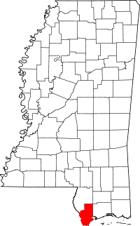 | |
| CDPs | ||
| Unincorporated communities | ||