Dinuba, California
| Dinuba, California | |
|---|---|
| City | |
| Nickname(s): Raisin City, Raisinland U. S. A., Dina | |
| Motto: Together, A Better Community | |
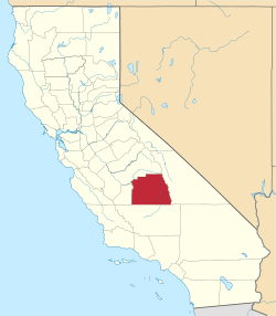
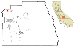 Location in Tulare County and the state of California | |
 Dinuba, California Location in the United States | |
| Coordinates: 36°32′42″N 119°23′21″W / 36.54500°N 119.38917°WCoordinates: 36°32′42″N 119°23′21″W / 36.54500°N 119.38917°W | |
| Country |
|
| State |
|
| County | Tulare |
| Incorporated | January 6, 1906[1] |
| Government | |
| • Mayor | Emilio Morales[2] |
| Area[3] | |
| • Total | 6.470 sq mi (16.758 km2) |
| • Land | 6.470 sq mi (16.758 km2) |
| • Water | 0 sq mi (0 km2) 0% |
| Elevation[4] | 335 ft (102 m) |
| Population (April 1, 2010)[5] | |
| • Total | 21,453 |
| • Estimate (2013)[5] | 23,347 |
| • Density | 3,300/sq mi (1,300/km2) |
| Time zone | Pacific (UTC-8) |
| • Summer (DST) | PDT (UTC-7) |
| ZIP code | 93618 |
| Area code | 559 |
| FIPS code | 06-19318 |
| GNIS feature IDs | 1658422, 2410342 |
| Website |
www |
Dinuba is a city in Tulare County, California, United States. The population was 21,453 at the 2010 census. It is part of the Visalia Metropolitan Statistical Area. The Alta District Museum is located in Dinuba in a restored railroad station; the museum has a collection of materials to illustrate local history.[6]
Geography
Dinuba is located at 36°32′42″N 119°23′21″W / 36.54500°N 119.38917°W (36.544898, -119.389260).[7]
According to the United States Census Bureau, the city has a total area of 6.5 square miles (17 km2), all of it land. The general topography is quite level ground, at an elevation of approximately 345 feet (105 m) above mean sea datum.[8] The gradient is approximately ten feet per mile, from east-northeast to west-southwest. Groundwater generally also flows with the surface of the terrain, that is, from the northeast to the southwest.[9] There are small hills to the northeast side of Dinuba with some elevations achieving heights of 526 feet (160 m).
Demographics
| Historical population | |||
|---|---|---|---|
| Census | Pop. | %± | |
| 1910 | 970 | — | |
| 1920 | 3,400 | 250.5% | |
| 1930 | 2,968 | −12.7% | |
| 1940 | 3,790 | 27.7% | |
| 1950 | 4,971 | 31.2% | |
| 1960 | 6,103 | 22.8% | |
| 1970 | 7,917 | 29.7% | |
| 1980 | 9,907 | 25.1% | |
| 1990 | 12,743 | 28.6% | |
| 2000 | 16,844 | 32.2% | |
| 2010 | 21,453 | 27.4% | |
| Est. 2015 | 23,702 | [10] | 10.5% |
2010
The 2010 United States Census[12] reported that Dinuba had a population of 21,453. The population density was 3,315.7 people per square mile (1,280.2/km²). The racial makeup of Dinuba was 11,166 (52.0%) White, 141 (0.7%) African American, 193 (0.9%) Native American, 454 (2.1%) Asian, 17 (0.1%) Pacific Islander, 8,630 (40.2%) from other races, and 852 (4.0%) from two or more races. Hispanic or Latino of any race were 18,114 persons (84.4%).
The Census reported that 21,291 people (99.2% of the population) lived in households, 77 (0.4%) lived in non-institutionalized group quarters, and 85 (0.4%) were institutionalized.
There were 5,593 households, out of which 3,275 (58.6%) had children under the age of 18 living in them, 3,162 (56.5%) were opposite-sex married couples living together, 1,077 (19.3%) had a female householder with no husband present, 481 (8.6%) had a male householder with no wife present. There were 544 (9.7%) unmarried opposite-sex partnerships, and 37 (0.7%) same-sex married couples or partnerships. 672 households (12.0%) were made up of individuals and 324 (5.8%) had someone living alone who was 65 years of age or older. The average household size was 3.81. There were 4,720 families (84.4% of all households); the average family size was 4.04.
The population was spread out with 7,495 people (34.9%) under the age of 18, 2,476 people (11.5%) aged 18 to 24, 5,881 people (27.4%) aged 25 to 44, 3,920 people (18.3%) aged 45 to 64, and 1,681 people (7.8%) who were 65 years of age or older. The median age was 27.2 years. For every 100 females there were 103.3 males. For every 100 females age 18 and over, there were 101.4 males.
There were 5,868 housing units at an average density of 906.9 per square mile (350.2/km²), of which 3,176 (56.8%) were owner-occupied, and 2,417 (43.2%) were occupied by renters. The homeowner vacancy rate was 2.3%; the rental vacancy rate was 4.2%. 11,975 people (55.8% of the population) lived in owner-occupied housing units and 9,316 people (43.4%) lived in rental housing units.
2000
As of the census[13] of 2000, there were 16,504 people, 4,493 households, and 3,724 families residing in the city. The population density was 4,923.8 people per square mile (1,901.6/km²). There were 4,670 housing units at an average density of 1,365.1 per square mile (527.2/km²). The racial makeup of the city was 49.34% White, 0.34% African American, 1.28% Native American, 2.42% Asian, 0.14% Pacific Islander, 37.98% from other races, and 5.28% from two or more races. Hispanic or Latino of any race were 79.08% of the population.
There were 4,493 households out of which 52.3% had children under the age of 18 living with them, 59.8% were married couples living together, 16.6% had a female householder with no husband present, and 17.1% were non-families. 14.4% of all households were made up of individuals and 8.4% had someone living alone who was 65 years of age or older. The average household size was 3.72 and the average family size was 4.02.
In the city the age distribution of the population shows 35.8% under the age of 18, 12.7% from 18 to 24, 27.5% from 25 to 44, 15.0% from 45 to 64, and 9.1% who were 65 years of age or older. The median age was 26 years. For every 100 females there were 103.2 males. For every 100 females age 18 and over, there were 101.1 males.
The median income for a household in the city was $33,345, and the median income for a family was $33,769. Males had a median income of $23,663 versus $25,364 for females. The per capita income for the city was $11,566. About 31.1% of families and 26.2% of the population were below the poverty line, including 37.1% of those under age 18 and 12.3% of those age 65 or over.
Politics
In the California State Legislature, Dinuba is in the 14th Senate District, represented by Republican Andy Vidak,[14] and in the 26th Assembly District, represented by Republican Devon Mathis.[15]
In the United States House of Representatives, Dinuba is in California's 22nd congressional district, represented by Republican Devin Nunes[16]
President George W. Bush made a visit to this small community in October 2003 to commemorate Ruiz Foods' 40th anniversary.
Economy
Top employers
According to Dinuba's 2011 Comprehensive Annual Financial Report,[17] the top employers in the city are:
| # | Employer | # of Employees |
|---|---|---|
| 1 | Ruiz Foods | 1,571 |
| 2 | Dinuba Unified School District | 768 |
| 3 | Family Tree Farms | 578 |
| 4 | Walmart | 400 |
| 5 | Best Buy | 330 |
| 6 | Odwalla | 200 |
| 7 | Giannini Packing | 180 |
| 8 | City of Dinuba | 159 |
| 9 | Apio Produce | 150 |
| 10 | Surabian & Sons Packing | 125 |
| 11 | Sadoian Bros. | 95 |
| 12 | Patterson Companies | 94 |
Notable people
- Miguel Contreras, Farmworker, Organizer with the United Farm Workers Union and Labor Leader
- Stephen H. Burum, cinematographer
- Cruz Bustamante, 45th Lieutenant Governor of California
- Bryce Seligman DeWitt, Theoretical physicist, author of seminal work in quantum gravity
- Ester Hernandez, an artist of the Chicano Movement
- Earl Kim, Korean-American composer
- Russ Letlow, NFL player for the Green Bay Packers
- Doris Matsui, member of the United States House of Representatives
- William Michaelian, novelist, short story writer, poet
- Manuel Muñoz, short story writer
- Oswald Hope Robertson, founder of the world's first blood bank
- Burt Rutan, founder of Scaled Composites, designer of both the Voyager aircraft, and SpaceShipOne the world's first non-governmental spacecraft
- Claramae Turner, opera singer, film actress
- Rose Ann Vuich, California's First Woman State Senator and local park's namesake
- John Brown Burnham,[18][19] Direct Decendent of of the Burnham family, among America's earliest european settlers arriving in 1635, Civil War veteran and prisoner of war at Libby Prison
Economy
Dinuba is home to the food company Ruiz Foods and the production facility of popular juice company Odwalla. There is also a Best Buy distribution center which sits on the western edge of the town. Many new businesses have been made around the Wal-Mart shopping center such as Burger King, Panda Express, IHOP, Starbucks, and Baskin-Robbins.
Sister cities
References
- ↑ "California Cities by Incorporation Date" (Word). California Association of Local Agency Formation Commissions. Retrieved August 25, 2014.
- ↑ "City Council". City of Dinuba. Retrieved January 13, 2015.
- ↑ "2010 Census U.S. Gazetteer Files – Places – California". United States Census Bureau.
- ↑ "Dinuba". Geographic Names Information System. United States Geological Survey. Retrieved January 13, 2015.
- 1 2 "Dinuba (city) QuickFacts". United States Census Bureau. Retrieved April 9, 2015.
- ↑ Alta District Museum
- ↑ "US Gazetteer files: 2010, 2000, and 1990". United States Census Bureau. 2011-02-12. Retrieved 2011-04-23.
- ↑ U.S. Geological Survey, Orange Grove South Quadrangle, 1947, photorevised 1974
- ↑ Environmental Site Assessment, Dinuba shopping Center, 9037 Avenue 416 (East El Monte Way), Dinuba, Tulare County, California, Earth Metrics Incorporated, Report 10106, September 29, 1989
- ↑ "Annual Estimates of the Resident Population for Incorporated Places: April 1, 2010 to July 1, 2015". Retrieved July 2, 2016.
- ↑ "Census of Population and Housing". Census.gov. Retrieved June 4, 2015.
- ↑ "2010 Census Interactive Population Search: CA - Dinuba city". U.S. Census Bureau. Retrieved July 12, 2014.
- ↑ "American FactFinder". United States Census Bureau. Retrieved 2008-01-31.
- ↑ http://district14.cssrc.us/
- ↑ "Statewide Database". UC Regents. Retrieved January 13, 2015.
- ↑ "California's 22nd Congressional District - Representatives & District Map". Civic Impulse, LLC. Retrieved October 5, 2014.
- ↑ City of Dinuba CAFR
- ↑ "Buzz-O-Burnham - User Trees - Genealogy.com". www.genealogy.com. Retrieved 2016-09-23.
- ↑ http://www.findagrave.com/cgi-bin/fg.cgi?page=gr&GRid=141744697. Missing or empty
|title=(help)