Drumkeeran
| Drumkeeran Droim Caorthainn | |
|---|---|
| Town | |
 Drumkeeran Location in Ireland | |
| Coordinates: 54°10′13″N 8°08′33″W / 54.1704°N 8.1426°WCoordinates: 54°10′13″N 8°08′33″W / 54.1704°N 8.1426°W | |
| Country | Ireland |
| Province | Connacht |
| County | County Leitrim |
| Elevation | 92 m (302 ft) |
| Population (2006) | |
| • Urban | 242 |
| Time zone | WET (UTC+0) |
| • Summer (DST) | IST (WEST) (UTC-1) |
| Irish Grid Reference | G902241 |
Drumkeeran (Irish: Droim Caorthainn) is a village in County Leitrim, Ireland located at the junction of the R280 and R200 regional roads. It lies at the foot of Corry Mountain just north of Lough Allen. Drumkeerin is situated in drumlin hills northwest of Lough Allen, a lake on the Shannon.
The Drumkeerin Development Association was formed in the early 1970s. In 1986, Drumkeerin Community Council was established to address the economic development of the village. In 1992, the Drumkeerin Tourist and Development Company was incorporated in order to effect plans of the Community Council. The main thrust of the plan was the establishment of a number of community enterprise workshop units.
Drumkeerin Gaa Club (CLG Droim Caorthainn) was founded in 1933 and plays an important sporting and social focus in the community.
Demographics
- Drumkeeran had a population of 242 in 2006 while the population went up to 298 by 2011.
Transport
Bus Éireann route 462 serves the village on Fridays providing links to Sligo and Manorhamilton.[1] Route 469 serves the village on Saturdays providing a link to Drumshanbo, Carrick on Shannon and Longford.[2]
See also
Religions
- St Brigid Roman Catholic church (built 1869)
- St Joseph Church of Ireland church (built 1833)
- St Patricia Presbyterian Church (built 1844)
References
External links
Places in County Leitrim | ||
|---|---|---|
| Towns | 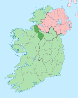 | |
| Villages |
| |
| Islands |
| |
| Townlands | ||
| Loughs | ||
| Parishes | ||
| ||