Eaton Rapids, Michigan
| Eaton Rapids, Michigan | |
|---|---|
| City | |
 Location of Eaton Rapids, Michigan | |
| Coordinates: 42°30′24″N 84°39′20″W / 42.50667°N 84.65556°W | |
| Country | United States |
| State | Michigan |
| County | Eaton |
| Area[1] | |
| • Total | 3.51 sq mi (9.09 km2) |
| • Land | 3.39 sq mi (8.78 km2) |
| • Water | 0.12 sq mi (0.31 km2) |
| Elevation | 869 ft (265 m) |
| Population (2010)[2] | |
| • Total | 5,214 |
| • Estimate (2014[3]) | 5,220 |
| • Density | 1,538.1/sq mi (593.9/km2) |
| Time zone | Eastern (EST) (UTC-5) |
| • Summer (DST) | EDT (UTC-4) |
| ZIP code | 48827 |
| Area code(s) | 517 |
| FIPS code | 26-24540[4] |
| GNIS feature ID | 0625314[5] |
Eaton Rapids is a city in Eaton County in the U.S. state of Michigan. The population was 5,214 at the 2010 census.[6]
The city is located in the south of Eaton Rapids Township, on the boundary with Hamlin Township, though it is politically independent of both townships. Its nickname is the Island City since downtown is an island, with a public park, in the Grand River.[7]
History
The area constituting Eaton Rapids was first settled by pioneers around the year 1835, mainly for the timber and water power in the area. The following year, a sawmill was constructed near Spring Brook in Spicerville that would provide the lumber used to start Eaton Rapids. In 1837, the Old Red Mill was constructed by the mill company and used the power from the stream to grind corn. The mill company later used wood from Spicerville to construct their own sawmill along the Grand River, as well as a wool carding mill.[8]
In 1852, mineral water was first discovered by E.B. Frost, earning Eaton Rapids world-wide fame and the nickname The Saratoga of the West.[8] This water was in huge demand and led to a large influx of people seeking mineral water baths as well as cures from all types of ailment. Fourteen wells were drilled in total, only three of which still remain to this day.
In 1921, John B. Davidson, Sr. came to Eaton Rapids from Philadelphia. He started the only mill in Michigan spinning its own yarn. The Davidson Mill supplied 95% of the wool yarn for the major league baseball, as well as high grade yarns for other applications.[9] After 48 years in business the mill burned in 1969. John B. Davidson served as mayor of Eaton Rapids as well as in both the State House and Senate.[8]
In 1927, Oldsmobile President Irving Jacob Reuter and his wife Janet built Meadowvue, an English Tudor mansion, at which they lived for nine years. Mr. Reuter was also a financier and inventor. The Reuters donated substantial sums to charity.
The property was sold to the Roman Catholic Diocese of Lansing, and became the home of its first Bishop, the Most Reverend Joseph H. Albers as his private residence.[10] The home was later sold to CJ and Mille Sumner who furnished the home with antiques and opened the home as an unusually ornate Adult Foster Care Home which they named "Ivy Manor". The home was sold again in 1990 and made into a Bed and Breakfast. In 1991 it was listed in the state List of Registered Historic Places in Michigan.[11] The original 10,000-square-foot (930 m2) building, complete with many of the original antique furnishings, and is 15 acres (61,000 m2) of garden and pastoral countryside located on the river, are open to the public as a restaurant and bed and breakfast and are a tourist destination. See Irving Jacob Reuter.
Geography
Eaton Rapids is on the northward course of the Grand River as it flows from Jackson to Lansing, where it turns westward, at its confluence with the Spring Brook.
According to the United States Census Bureau, the city has a total area of 3.51 square miles (9.09 km2), of which 3.39 square miles (8.78 km2) is land and 0.12 square miles (0.31 km2) is water.[1]
Geographic features
Transportation
 M-99 connects with I-94, 19 miles (31 km) to the south near Albion; and with I-96, 12 miles (19 km) north, just south of Lansing.
 M-50 connects with I-69, nine miles (14 km) west in Charlotte; and with US 127 and I-94, 21 miles (34 km) to the southeast just north of Jackson.
 M-188 provides access from Eaton Rapids to the Veterans of Foreign Wars (VFW) National Home near Onondaga.
Demographics
| Historical population | |||
|---|---|---|---|
| Census | Pop. | %± | |
| 1860 | 581 | — | |
| 1870 | 1,221 | 110.2% | |
| 1880 | 1,785 | 46.2% | |
| 1890 | 1,970 | 10.4% | |
| 1900 | 2,103 | 6.8% | |
| 1910 | 2,094 | −0.4% | |
| 1920 | 2,379 | 13.6% | |
| 1930 | 2,822 | 18.6% | |
| 1940 | 3,060 | 8.4% | |
| 1950 | 3,509 | 14.7% | |
| 1960 | 4,052 | 15.5% | |
| 1970 | 4,494 | 10.9% | |
| 1980 | 4,510 | 0.4% | |
| 1990 | 4,695 | 4.1% | |
| 2000 | 5,330 | 13.5% | |
| 2010 | 5,214 | −2.2% | |
| Est. 2015 | 5,225 | [12] | 0.2% |
| U.S. Decennial Census | |||
2010 census
As of the census[2] of 2010, there were 5,214 people, 2,092 households, and 1,345 families residing in the city. The population density was 1,538.1 inhabitants per square mile (593.9/km2). There were 2,387 housing units at an average density of 704.1 per square mile (271.9/km2). The racial makeup of the city was 95.1% White, 0.7% African American, 0.4% Native American, 0.5% Asian, 0.8% from other races, and 2.6% from two or more races. Hispanic or Latino of any race were 4.4% of the population.
There were 2,092 households of which 36.9% had children under the age of 18 living with them, 42.1% were married couples living together, 15.3% had a female householder with no husband present, 6.8% had a male householder with no wife present, and 35.7% were non-families. 30.0% of all households were made up of individuals and 11% had someone living alone who was 65 years of age or older. The average household size was 2.49 and the average family size was 3.09.
The median age in the city was 34.8 years. 27.7% of residents were under the age of 18; 9.3% were between the ages of 18 and 24; 26.7% were from 25 to 44; 25.2% were from 45 to 64; and 11.1% were 65 years of age or older. The gender makeup of the city was 48.3% male and 51.7% female.
2000 census
As of the census[4] of 2000, there were 5,330 people, 2,067 households, and 1,399 families residing in the city. The population density was 1,576.9 per square mile (608.9/km²). There were 2,168 housing units at an average density of 641.4 per square mile (247.7/km²). The racial makeup of the city was 96.12% White, 0.38% African American, 0.45% Native American, 0.54% Asian, 1.01% from other races, and 1.50% from two or more races. Hispanic or Latino of any race were 2.93% of the population.
There were 2,067 households out of which 39.7% had children under the age of 18 living with them, 47.8% were married couples living together, 13.9% had a female householder with no husband present, and 32.3% were non-families. 27.4% of all households were made up of individuals and 12.2% had someone living alone who was 65 years of age or older. The average household size was 2.57 and the average family size was 3.11.
In the city the population was spread out with 31.0% under the age of 18, 8.9% from 18 to 24, 30.7% from 25 to 44, 18.2% from 45 to 64, and 11.2% who were 65 years of age or older. The median age was 32 years. For every 100 females there were 92.6 males. For every 100 females age 18 and over, there were 87.9 males.
The median income for a household in the city was $39,769, and the median income for a family was $48,239. Males had a median income of $37,582 versus $29,440 for females. The per capita income for the city was $18,446. About 3.2% of families and 5.9% of the population were below the poverty line, including 6.3% of those under age 18 and 2.1% of those age 65 or over.
Climate
This climatic region is typified by large seasonal temperature differences, with warm to hot (and often humid) summers and cold (sometimes severely cold) winters. According to the Köppen Climate Classification system, Eaton Rapids has a humid continental climate, abbreviated "Dfb" on climate maps.[13]
References
- 1 2 "US Gazetteer files 2010". United States Census Bureau. Retrieved 2012-11-25.
- 1 2 "American FactFinder". United States Census Bureau. Retrieved 2012-11-25.
- ↑ "Population Estimates". United States Census Bureau. Retrieved 2015-05-21.
- 1 2 "American FactFinder". United States Census Bureau. Retrieved 2008-01-31.
- ↑ U.S. Geological Survey Geographic Names Information System: Eaton Rapids, Michigan
- ↑ "Data: 2010 Census, Michigan city populations". Lansing State Journal. March 22, 2011. Retrieved July 27, 2011.
- ↑ http://www.ci.eaton-rapids.mi.us/park_isparkhis.htm
- 1 2 3 A Brief History of Eaton Rapids
- ↑
- ↑ Archdiocese of Lansing home page and history
- ↑ English Inn history page
- ↑ "Annual Estimates of the Resident Population for Incorporated Places: April 1, 2010 to July 1, 2015". Retrieved July 2, 2016.
- ↑ Climate Summary for Eaton Rapids, Michigan
External links
Municipalities and communities of Eaton County, Michigan, United States | ||
|---|---|---|
| Cities | 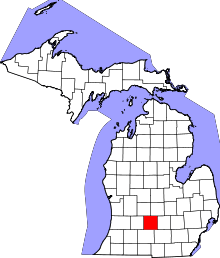 | |
| Villages | ||
| Charter townships | ||
| General law townships | ||
| CDP | ||
| Footnotes | ‡This populated place also has portions in an adjacent county or counties | |
Coordinates: 42°30′33″N 84°39′21″W / 42.50917°N 84.65583°W