Ehrhardt, South Carolina
| Ehrhardt, South Carolina | |
|---|---|
| Town | |
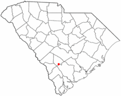 Location of Ehrhardt, South Carolina | |
| Coordinates: 33°5′45″N 81°0′48″W / 33.09583°N 81.01333°WCoordinates: 33°5′45″N 81°0′48″W / 33.09583°N 81.01333°W | |
| Country | United States |
| State | South Carolina |
| County | Bamberg |
| Area | |
| • Total | 3.1 sq mi (8.1 km2) |
| • Land | 3.1 sq mi (8.1 km2) |
| • Water | 0.0 sq mi (0.0 km2) |
| Elevation | 144 ft (44 m) |
| Population (2010) | |
| • Total | 545 |
| • Density | 175/sq mi (67.6/km2) |
| Time zone | Eastern (EST) (UTC-5) |
| • Summer (DST) | EDT (UTC-4) |
| ZIP code | 29081 |
| Area code(s) | 803 |
| FIPS code | 45-23200[1] |
| GNIS feature ID | 1222249[2] |
| Website |
ehrhardtsc |
Ehrhardt is a town in Bamberg County, South Carolina, United States. As of the 2010 census, the town population was 545.[3]
History
Ehrhardt was named for a prominent local family.[4]
The Copeland House and Rivers Bridge State Park are listed on the National Register of Historic Places.[5]
Geography
Ehrhardt is located in southern Bamberg County at 33°5′45″N 81°0′48″W / 33.09583°N 81.01333°W (33.095899, -81.013226).[6] U.S. Route 601 runs through the town, leading north 14 miles (23 km) to Bamberg, the county seat, and south 17 miles (27 km) to Hampton. South Carolina Highway 64 crosses US 601 in Ehrhardt, leading southeast 26 miles (42 km) to Walterboro and northwest 24 miles (39 km) to Barnwell.
According to the United States Census Bureau, Ehrhardt has a total area of 3.1 square miles (8.1 km2), all of it land.[3]
Demographics
| Historical population | |||
|---|---|---|---|
| Census | Pop. | %± | |
| 1900 | 215 | — | |
| 1910 | 315 | 46.5% | |
| 1920 | 495 | 57.1% | |
| 1930 | 432 | −12.7% | |
| 1940 | 407 | −5.8% | |
| 1950 | 510 | 25.3% | |
| 1960 | 482 | −5.5% | |
| 1970 | 478 | −0.8% | |
| 1980 | 353 | −26.2% | |
| 1990 | 442 | 25.2% | |
| 2000 | 614 | 38.9% | |
| 2010 | 545 | −11.2% | |
| Est. 2015 | 507 | [7] | −7.0% |
As of the census[1] of 2000, there were 614 people, 253 households, and 154 families residing in the town. The population density was 193.1 people per square mile (74.5/km²). There were 317 housing units at an average density of 99.7 per square mile (38.5/km²). The racial makeup of the town was 40.07% White, 56.84% African American, 1.95% from other races, and 1.14% from two or more races. Hispanic or Latino of any race were 2.77% of the population.
There were 253 households out of which 23.3% had children under the age of 18 living with them, 42.3% were married couples living together, 15.0% had a female householder with no husband present, and 39.1% were non-families. 36.0% of all households were made up of individuals and 17.0% had someone living alone who was 65 years of age or older. The average household size was 2.40 and the average family size was 3.15.
In the town the population was spread out with 24.1% under the age of 18, 5.9% from 18 to 24, 21.2% from 25 to 44, 30.1% from 45 to 64, and 18.7% who were 65 years of age or older. The median age was 44 years. For every 100 females there were 76.9 males. For every 100 females age 18 and over, there were 76.5 males.
The median income for a household in the town was $22,813, and the median income for a family was $41,250. Males had a median income of $31,875 versus $21,250 for females. The per capita income for the town was $15,874. About 17.0% of families and 22.7% of the population were below the poverty line, including 27.6% of those under age 18 and 23.0% of those age 65 or over.
Schützenfest
The Schützenfest commemorates the town's rich German heritage and their German founder, Conrad Ehrhardt, an immigrant from Weiterode, Kurhessen, Germany. The festival is held annually.
References
- 1 2 "American FactFinder". United States Census Bureau. Retrieved 2008-01-31.
- ↑ "US Board on Geographic Names". United States Geological Survey. 2007-10-25. Retrieved 2008-01-31.
- 1 2 "Geographic Identifiers: 2010 Demographic Profile Data (G001): Ehrhardt town, South Carolina". U.S. Census Bureau, American Factfinder. Retrieved April 3, 2014.
- ↑ Gannett, Henry (1905). The Origin of Certain Place Names in the United States. Govt. Print. Off. p. 115.
- ↑ National Park Service (2010-07-09). "National Register Information System". National Register of Historic Places. National Park Service.
- ↑ "US Gazetteer files: 2010, 2000, and 1990". United States Census Bureau. 2011-02-12. Retrieved 2011-04-23.
- ↑ "Annual Estimates of the Resident Population for Incorporated Places: April 1, 2010 to July 1, 2015". Retrieved July 2, 2016.
- ↑ "Census of Population and Housing". Census.gov. Retrieved June 4, 2015.
External links
Municipalities and communities of Bamberg County, South Carolina, United States | ||
|---|---|---|
| Cities | 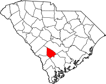 | |
| Towns | ||
| Unincorporated communities | ||