Walterboro, South Carolina
| Walterboro, South Carolina | |
|---|---|
| City | |
|
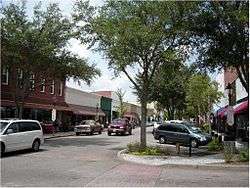
E. Washington Street in downtown Walterboro | |
| Motto: The Front Porch of the Lowcountry | |
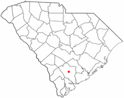 Location of Walterboro, South Carolina | |
| Coordinates: 32°54′15″N 80°39′58″W / 32.90417°N 80.66611°WCoordinates: 32°54′15″N 80°39′58″W / 32.90417°N 80.66611°W | |
| Country | United States |
| State | South Carolina |
| County | Colleton |
| Area | |
| • Total | 6.5 sq mi (16.8 km2) |
| • Land | 6.5 sq mi (16.8 km2) |
| • Water | 0.0 sq mi (0.0 km2) |
| Elevation | 59 ft (18 m) |
| Population (2010)[1] | |
| • Total | 5,398 |
| • Density | 832/sq mi (321.2/km2) |
| Time zone | Eastern (EST) (UTC-5) |
| • Summer (DST) | EDT (UTC-4) |
| ZIP code | 29488 |
| Area code(s) | 843 |
| FIPS code | 45-74275[2] |
| GNIS feature ID | 1251318[3] |
| Website |
www |
Walterboro is a city in Colleton County, South Carolina, United States. The population was 5,398 at the 2010 census.[1] It is the county seat of Colleton County.[4] Walterboro is located 48 miles (77 km) west of Charleston and is located near the ACE Basin region in the South Carolina Lowcountry.
History
Walterboro (originally spelled "Walterborough") was founded in 1783 as a summer retreat for local planters looking to escape their malaria-ridden, Lowcountry plantations. The original settlement was located on a hilly area, covered with pine and hickory trees and named "Hickory Valley". Two of the earliest settlers were Paul and Jacob Walter. The two brothers owned plantations in nearby Jacksonboro. Paul's small daughter Mary was taken ill with malaria, a common disease amongst the families who built their plantations in the marshy areas of the Lowcountry, suitable to rice production. To save Mary's life the two brothers went looking for a more healthy location in which to live during the summer months and started the town that was later named for them. In 1817, Walterboro was named the third county seat of Colleton County, and has remained such until the present. This was followed by the construction of a county courthouse and jail in 1821, the courthouse being design by well-known architect Robert Mills. The town quickly spread out from the original Hickory Valley location, its population growth fueled successively by the town becoming the county seat in 1821, the establishment of a railroad line connecting the city with Columbia and Charleston in the 1880s, the establishment of an airfield in the 1930s and more recently the establishment of Interstate 95 in the 1960s, making the town a prime overnight stop on the road to Florida or New York.
In 1942, Walterboro became home to the Walterboro Army Air Field, a sub-base of Columbia Army Air Base and part of the overall network of army air training facilities that sprang up across the US during World War II. The base was established to provide advanced air combat training to fighter and bomber groups. It also hosted the largest camouflage school in the United States, as well as a 250-person prisoner of war camp. In 1944 the airfield changed commands and became an advanced combat training base for individual fighters, primarily the black trainees graduating from Tuskegee Army Air Field in Tuskegee, Alabama. Over 500 of the famed Tuskegee Airmen trained at Walterboro Army Air Field between April 1944 and October 1945, including individuals training as replacement pilots for the 332nd Fighter Squadron and the entire 447th Bombardment Group. The base closed in October 1945 and returned to its origins as a local airfield.
Today Walterboro is dotted with historic homes dating back to 1820, and a charming downtown that has kept many of its historic buildings. The city has become increasingly known as an antiquing destination and is a popular day trip from Charleston and Beaufort.
Geography
Walterboro is located somewhat north of the center of Colleton County at 32°54′15″N 80°39′58″W / 32.90417°N 80.66611°W (32.904289, -80.666238).[5] Interstate 95 passes west of the city, leading northeast 110 miles (180 km) to Florence and southwest 67 miles (108 km) to Savannah, Georgia. The southern terminus of U.S. Route 15 is in the center of Walterboro; it leads north, running roughly parallel to I-95, reaching St. George in 21 miles (34 km). U.S. Route 17 Alt leads east from US 15 32 miles (51 km) to Summerville in the Charleston vicinity and southwest 21 miles (34 km) to Yemassee. South Carolina Highway 64 leads northwest past I-95 Exit 57 25 miles (40 km) to Ehrhardt and southeast 16 miles (26 km) to Jacksonboro.
According to the United States Census Bureau, Walterboro has a total area of 6.5 square miles (16.8 km2), all land.[1]
Culture
Rice Festival
The Colleton County Rice Festival takes place to celebrate the county's history with the rice crop, the staple crop until the Civil War. After that it still impacted the county. The festival is held at the end of April each year. The 2014 festival was the 39th year it has taken place. For each festival there is a parade, pageant, run/walk, and cooking contest. The Rice Festival is usually held on Friday and Saturday.
Great Swamp Sanctuary
The Sanctuary is 800 acres (3.2 km2) of braided-creek hardwood flats bottomland swamp. It consists of boardwalks, walking trails, bicycle paths, a canoe/kayak trail, observation areas, and a 10,000-square-foot (1,000 m2) Discovery Center is planned. When it is completely finished the sanctuary will be the most significant nature-based facility in the lower part of South Carolina. It is open every day from dawn until dusk and is free. It is located on Detreville Street in Walterboro.
Slave Relic Museum
The museum houses many of the relics slaves made and used during the period that they were enslaved (1750-1860s). The museum is located on Carn Street. The hours of operation are Monday through Thursday 9:30 am to 5:00 pm and Saturdays 10:00 am to 3:00 pm.
The South Carolina Artisan Center
The South Carolina Artisan Center is the official folk art and craft center of the state. The center is located on Wichman Street. The hours are Monday - Saturday 10am to 5:30pm and Sunday 1pm to 5pm.
Other attractions
- Colleton Museum & Farmer's Market (East Washington Street)
- SC Artisans Center (Wichman Street)
- Little Library (Wichman/Fishburne Street)
- Colleton County Historical & Preservation Society (Church Street)
- Old Water Tower (Memorial Ave/Washington Street)
- Tuskegee Airmen Memorial (Walterboro Army Airfield)
Demographics
| Historical population | |||
|---|---|---|---|
| Census | Pop. | %± | |
| 1870 | 636 | — | |
| 1880 | 691 | 8.6% | |
| 1890 | 1,171 | 69.5% | |
| 1900 | 1,491 | 27.3% | |
| 1910 | 1,677 | 12.5% | |
| 1920 | 1,853 | 10.5% | |
| 1930 | 2,592 | 39.9% | |
| 1940 | 3,373 | 30.1% | |
| 1950 | 4,616 | 36.9% | |
| 1960 | 5,417 | 17.4% | |
| 1970 | 6,257 | 15.5% | |
| 1980 | 6,209 | −0.8% | |
| 1990 | 5,492 | −11.5% | |
| 2000 | 5,153 | −6.2% | |
| 2010 | 5,398 | 4.8% | |
| Est. 2015 | 5,278 | [6] | −2.2% |
| U.S. Decennial Census | |||
As of the census[2] of 2010, there were 5,401 people residing in the city. The population density was 832.0 people per square mile (401.1/km²). There were 2,571 housing units at an average density of 475.8 per square mile (183.9/km²). The racial makeup of the city was 44.1% Non-Hispanic White, 50.5% African American, 0.3% Native American, 1.0% Asian, 0.0% Pacific Islander, and 1.5% from two or more races. Hispanic or Latino of any race were 2.9% of the population.
There were 2,231 households out of which 28.2% had children under the age of 18 years living with them, 39.0% were married couples living together, 23.5% had a female householder with no husband present, and 33.8% were non-families. 30.4% of all households were made up of individuals and 14.9% had someone living alone who was 65 years of age or older. The average household size was 2.32 and the average family size was 2.90.
In the city the population was spread out with 25.8% under the age of 18, 7.5% from 18 to 24, 24.6% from 25 to 44, 23.0% from 45 to 64, and 17.9% who were 65 years of age or older. The median age was 39 years. For every 100 females there were 79.7 males. For every 100 females age 18 and over, there were 73.1 males.
The median income for a household in the city was $24,135, and the median income for a family was $32,549. Males had a median income of $27,488 versus $20,351 for females. The per capita income for the city was $20,223. About 20.6% of families and 30.1% of the population were below the poverty line, including 37.1% of those under age 18 and 10.4% of those age 65 or over.
Education
Walterboro has several public and private schools in its surrounding area. There are five public elementary schools (Bells Elementary,Cottageville Elementary, Hendersonville Elementary, Forest Hills Elementary, and Northside Elementary, one public middle school (Colleton County Middle School), and one public high school (Colleton County High School). There are two private K-12 schools: Colleton Preparatory Academy and North Walterboro Christian Academy. The University of South Carolina Salkehatchie has a branch in Walterboro, and Clemson University has a county extension office in the city.
Notable residents
- William Jones Boone, first Episcopal bishop of Shanghai
- Norman Hand, NFL defensive tackle
- Craig Mack, hip hop artist
- Dean Meminger, basketball player and coach
- John Peurifoy, diplomat
- Young Scooter, hip hop artist
- Brother Stair, radio preacher
- Darwin Walker, NFL defensive tackle
- Bill Workman, former economic development consultant; mayor of Greenville, South Carolina, from 1983 to 1995; retired in Walterboro, where he was also reared in early childhood
Infrastructure
Walterboro is accessible from Interstate 95 (access at exits 53 and 57), where lodging, dining, and gas station facilities make it a popular stopping point for travelers. Other roads of importance include U.S. Highway 15, Alternate U.S. Highway 17, and several state highways. The Lowcountry Regional Airport provides general aviation services to Walterboro and Colleton County.
References
- 1 2 3 "Geographic Identifiers: 2010 Census Summary File 1 (G001): Walterboro city, South Carolina". U.S. Census Bureau, American Factfinder. Retrieved July 1, 2015.
- 1 2 "American FactFinder". United States Census Bureau. Retrieved 2008-01-31.
- ↑ "US Board on Geographic Names". United States Geological Survey. 2007-10-25. Retrieved 2008-01-31.
- ↑ "Find a County". National Association of Counties. Retrieved 2011-06-07.
- ↑ "US Gazetteer files: 2010, 2000, and 1990". United States Census Bureau. 2011-02-12. Retrieved 2011-04-23.
- ↑ "Annual Estimates of the Resident Population for Incorporated Places: April 1, 2010 to July 1, 2015". Retrieved July 2, 2016.
External links
- City of Walterboro official website
- Rice Festival
- Great Swamp Sanctuary
- Slave Relic Museum
- South Carolina Artisan Center
Municipalities and communities of Colleton County, South Carolina, United States | ||
|---|---|---|
| City |  | |
| Towns | ||
| CDPs | ||
| Unincorporated communities | ||
The Lowcountry of South Carolina | ||
|---|---|---|
| Counties |  | |
| Major communities | ||
| Sea Islands | ||
| History & culture | ||
| Military installations | ||
| Natural areas | ||
| Other articles | ||