El M'Ghair
| El M'Ghair اﻟﻤﻐﻴﺮ | |
|---|---|
| Commune and town | |
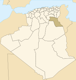
 Location of El M'Ghair commune within El Oued Province | |
 El M'Ghair Location of El M'Ghair within Algeria | |
| Coordinates: DZ 33°57′2″N 5°55′27″E / 33.95056°N 5.92417°ECoordinates: DZ 33°57′2″N 5°55′27″E / 33.95056°N 5.92417°E | |
| Country |
|
| Province | El Oued Province |
| District | El M'Ghair District |
| Elevation | 2 m (7 ft) |
| Population (2008)[1] | |
| • Total | 49,793 |
| Time zone | CET (UTC+1) |
El M'Ghair (Arabic: اﻟﻤﻐﻴﺮ) is a town and commune, and capital of El M'Ghair District, in El Oued Province, Algeria. According to the 1998 census it has a population of 49,793,[1] up from 40,228 in 1998,[2] and is the third largest town in the province after the capital El Oued and Djamaa. Its annual population growth rate is 2.2%.[1]
Geography
El M'Ghair lies southwest of Chott Felrhir, a large endorheic salt lake. Between the town and the lake there is an extensive palm plantation.
Climate
El M'Ghair has a hot desert climate (Köppen climate classification BWh), with very hot summers and mild winters, and very little precipitation throughout the year.
| Climate data for El M'Ghair | |||||||||||||
|---|---|---|---|---|---|---|---|---|---|---|---|---|---|
| Month | Jan | Feb | Mar | Apr | May | Jun | Jul | Aug | Sep | Oct | Nov | Dec | Year |
| Average high °C (°F) | 16.9 (62.4) |
19.4 (66.9) |
23.5 (74.3) |
28.0 (82.4) |
33.3 (91.9) |
38.0 (100.4) |
41.5 (106.7) |
40.7 (105.3) |
35.4 (95.7) |
28.9 (84) |
22.1 (71.8) |
17.6 (63.7) |
28.78 (83.79) |
| Daily mean °C (°F) | 10.9 (51.6) |
13.3 (55.9) |
16.8 (62.2) |
20.8 (69.4) |
25.9 (78.6) |
30.8 (87.4) |
33.8 (92.8) |
33.3 (91.9) |
28.7 (83.7) |
22.5 (72.5) |
16.2 (61.2) |
11.9 (53.4) |
22.07 (71.72) |
| Average low °C (°F) | 5.0 (41) |
7.2 (45) |
10.1 (50.2) |
13.7 (56.7) |
18.5 (65.3) |
23.7 (74.7) |
26.1 (79) |
25.9 (78.6) |
22.1 (71.8) |
16.2 (61.2) |
10.3 (50.5) |
6.2 (43.2) |
15.42 (59.77) |
| Average precipitation mm (inches) | 8 (0.31) |
5 (0.2) |
12 (0.47) |
9 (0.35) |
7 (0.28) |
1 (0.04) |
0 (0) |
2 (0.08) |
9 (0.35) |
12 (0.47) |
12 (0.47) |
10 (0.39) |
87 (3.41) |
| Source: climate-data.org[3] | |||||||||||||
Transportation
El M'Ghair has a station on the Biskra-Touggourt railway line, which passes by the east side of the city. The N3 highway, which also connects Biskra to the north with Touggourt to the south, also passes through the city on the west side.
Education
5.4% of the population has a tertiary education, and another 18.0% has completed secondary education.[4] The overall literacy rate is 77.4%, and is 83.4% among males and 73.4% among females.[5]
Notable buildings
There are two mosques in the town; Mosque Akbar in the centre of the city and Mosque Atik to the west near the highway.
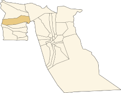
Localities
The commune of El M'Ghair is composed of four localities:[6]
References
- 1 2 3 "Population: El Oued Wilaya" (PDF) (in French). Office National des Statistiques Algérie. Retrieved 12 February 2013.
- ↑ "Algeria Communes". Statoids. Retrieved 9 March 2013.
- ↑ "Climate data for: El M'Ghair". climate-data.org. Retrieved 10 April 2013.
- ↑ "Structure relative de la population résidente des ménages ordinaires et collectifs âgée de 6 ans et plus selon le niveau d'instruction et la commune de résidence." (PDF) (in French). Office National des Statistiques Algérie. Retrieved 13 February 2013.
- ↑ "Taux d'analphabétisme et taux d'alphabétisation de la population âgée de 15 ans et plus, selon le sexe et la commune de résidence ." (PDF) (in French). Office National des Statistiques Algérie. Retrieved 13 February 2013.
- ↑ "Décret n° 84-365, fixant la composition, la consistance et les limites territoriale des communes. Wilaya d'El Oued" (PDF) (in French). Journal officiel de la République Algérienne. 19 December 1984. p. 1564. Archived from the original (PDF) on 2 March 2013 or before. Retrieved 2 March 2013. Check date values in:
|archive-date=(help)
 |
Ouled Djellal (Biskra) | Biskra Oum Touyour N'Sigha |
Hamraia Chott Felrhir |
|
| Laghouat | |
Dendouga Chott Felrhir | ||
| ||||
| | ||||
| M'Rara | Sidi Khellil Djamaa Touggourt |
Reguiba El Oued |