Chégamat
| Chégamat | |
|---|---|
| Village | |
 Chégamat | |
| Coordinates: DZ 33°14′32″N 6°47′36″E / 33.24222°N 6.79333°ECoordinates: DZ 33°14′32″N 6°47′36″E / 33.24222°N 6.79333°E | |
| Country |
|
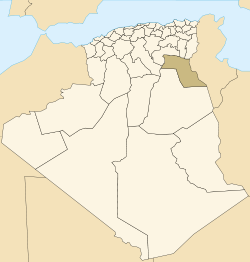
| Province | El Oued Province |
| District | Mih Ouensa District |
| Commune | Oued El Alenda[1] |
| Elevation | 94 m (308 ft) |
| Time zone | CET (UTC+1) |
Chégamat (also written Chegamate) is a village in the commune of Oued El Alenda,[1] in Mih Ouensa District, El Oued Province, Algeria. The village is located 3 kilometres (1.9 mi) southeast of Oued El Alenda and 15 kilometres (9.3 mi) southwest of the provincial capital El Oued.[2]
References
- 1 2 "Décret n° 84-365, fixant la composition, la consistance et les limites territoriale des communes. Wilaya d'El Oued" (PDF) (in French). Journal officiel de la République Algérienne,. 19 December 1984. p. 1564. Archived from the original (PDF) on 2 March 2013 or before. Retrieved 2 March 2013. Check date values in:
|archive-date=(help) - ↑ "Chegamate, El Oued, Algeria". Google Maps. Retrieved 28 April 2013.
Neighbouring towns and cities
 |
El M'Ghair | Ourmes | El Oued Oum Sahaouine |
|
| Oued El Alenda Touggourt |
|
Débidibi Robbah El Ogla | ||
| ||||
| | ||||
| Mih Ouensa Ouargla |
Debadib | El Borma (Ouargla) |
This article is issued from Wikipedia - version of the 5/4/2013. The text is available under the Creative Commons Attribution/Share Alike but additional terms may apply for the media files.