Ela, North Carolina
| Ela, North Carolina | |
|---|---|
| Unincorporated community | |
 Ela, North Carolina  Ela, North Carolina | |
| Coordinates: 35°26′58″N 83°23′27″W / 35.44944°N 83.39083°WCoordinates: 35°26′58″N 83°23′27″W / 35.44944°N 83.39083°W | |
| Country | United States |
| State | North Carolina |
| County | Swain |
| Elevation | 1,795 ft (547 m) |
| Time zone | Eastern (EST) (UTC-5) |
| • Summer (DST) | EDT (UTC-4) |
| ZIP Code(s) | 28713, 28719 |
| Area code(s) | 828 |
| GNIS feature ID | 1011035[1] |
Ela is an unincorporated community in Swain County, North Carolina, United States, located along US 19, northwest of Whittier and east of Bryson City. The name is derived from ᎡᎳᏬᏗ (Elawodi) in the Cherokee language, which translates as "yellow hill."
Ela was once the junction of the Appalachian Railway (1906-1935) and Southern Railway's Murphy Branch.[2]
References
- ↑ "Geographic Names Information System". United States Geological Survey. Retrieved 2008-01-31.
- ↑ Poole, Cary Franklin (1995). A History of Railroading in Western North Carolina. Johnson City, TN: The Overmountain Press. pp. 172–3.
External links
Municipalities and communities of Swain County, North Carolina, United States | ||
|---|---|---|
| Town | 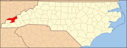 | |
| CDP | ||
| Unincorporated communities | ||
| Footnotes | ‡This populated place also has portions in an adjacent county or counties | |
This article is issued from Wikipedia - version of the 7/27/2016. The text is available under the Creative Commons Attribution/Share Alike but additional terms may apply for the media files.