Elberta, Utah
| Elberta, Utah | |
|---|---|
| CDP | |
|
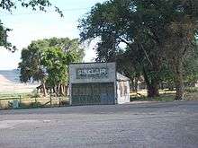
Elberta Post Office | |
 Location in Utah County and the state of Utah | |
| Coordinates: 39°58′41″N 111°57′8″W / 39.97806°N 111.95222°WCoordinates: 39°58′41″N 111°57′8″W / 39.97806°N 111.95222°W | |
| Country | United States |
| State | Utah |
| County | Utah |
| Named for | Early Elberta peach |
| Area | |
| • Total | 13.7 sq mi (35.4 km2) |
| • Land | 13.7 sq mi (35.4 km2) |
| • Water | 0.04 sq mi (0.1 km2) |
| Elevation | 4,701 ft (1,433 m) |
| Population (2010) | |
| • Total | 256 |
| • Density | 19/sq mi (7.2/km2) |
| Time zone | Mountain (MST) (UTC-7) |
| • Summer (DST) | MDT (UTC-6) |
| ZIP code | 84626 |
| Area code(s) | 801 |
| FIPS code | 49-22210[1] |
| GNIS feature ID | 1427772[2] |

Elberta is a census-designated place (CDP) in Utah County, Utah, United States. It is part of the Provo–Orem Metropolitan Statistical Area. The population was 256 at the 2010 census.[3] It is also known as "The Slant". It was founded as "Mt. Nebo". After the water failed in 1901 most of the early settlers moved away. It was purchased by Mr. Matthew B. Whitney, a native of New York, on November 7, 1907, and Mr. Whitney renamed it "Elberta" after the peach.[4]
Geography
Elberta is located at 39°58′41″N 111°57′8″W / 39.97806°N 111.95222°W (39.977979, -111.952350),[5] near the center of Goshen Valley.
According to the United States Census Bureau, the CDP has a total area of 13.68 square miles (35.43 km2), of which 13.65 square miles (35.36 km2) is land and 0.03 square miles (0.07 km2), or 0.20%, is water.[6]
Demographics

As of the census[1] of 2000, there were 278 people, 56 households, and 53 families residing in the CDP. The population density was 20.1 people per square mile (7.7/km²). There were 58 housing units at an average density of 4.2/sq mi (1.6/km²). The racial makeup of the CDP was 80.22% White, 19.42% from other races, and 0.36% from two or more races. Hispanic or Latino of any race were 27.70% of the population.
There were 56 households out of which 62.5% had children under the age of 18 living with them, 82.1% were married couples living together, 12.5% had a female householder with no husband present, and 3.6% were non-families. 3.6% of all households were made up of individuals and none had someone living alone who was 65 years of age or older. The average household size was 4.27 and the average family size was 4.26.
In the CDP the population was spread out with 41.7% under the age of 18, 13.3% from 18 to 24, 24.8% from 25 to 44, 14.7% from 45 to 64, and 5.4% who were 65 years of age or older. The median age was 23 years. For every 100 females there were 115.5 males. For every 100 females age 18 and over, there were 113.2 males.
The median income for a household in the CDP was $45,313, and the median income for a family was $45,313. Males had a median income of $26,250 versus $16,250 for females. The per capita income for the CDP was $9,356. None of the families and 12.9% of the population were living below the poverty line.
References
- 1 2 "American FactFinder". United States Census Bureau. Retrieved 2008-01-31.
- ↑ "US Board on Geographic Names". United States Geological Survey. 2007-10-25. Retrieved 2008-01-31.
- ↑ "Profile of General Population and Housing Characteristics: 2010 Demographic Profile Data (DP-1): Elberta CDP, Utah". U.S. Census Bureau, American Factfinder. Retrieved March 9, 2012.
- ↑ Steele, Raymond D. Goshen Valley History, 1960, pp.153–154.
- ↑ "US Gazetteer files: 2010, 2000, and 1990". United States Census Bureau. 2011-02-12. Retrieved 2011-04-23.
- ↑ "Geographic Identifiers: 2010 Demographic Profile Data (G001): Elberta CDP, Utah". U.S. Census Bureau, American Factfinder. Retrieved March 9, 2012.
Municipalities and communities of Utah County, Utah, United States | ||
|---|---|---|
| Cities |  | |
| Towns | ||
| CDPs | ||
| Unincorporated communities | ||
| Indian reservation | ||
| Ghost towns | ||
| Footnotes | ‡This populated place also has portions in an adjacent county or counties | |