Elgin, Kershaw County, South Carolina
| Elgin | |
|---|---|
| Town | |
 Elgin Location within the state of South Carolina | |
| Coordinates: 34°10′11″N 80°47′30″W / 34.16972°N 80.79167°WCoordinates: 34°10′11″N 80°47′30″W / 34.16972°N 80.79167°W | |
| Country | United States |
| State | South Carolina |
| County | Kershaw |
| Area | |
| • Total | 1.0 sq mi (2.5 km2) |
| • Land | 1.0 sq mi (2.5 km2) |
| Population (2000) | |
| • Total | 806 |
| • Density | 840/sq mi (320/km2) |
| Time zone | Eastern (EST) (UTC-5) |
| • Summer (DST) | EDT (UTC-4) |
| ZIP codes | 29045 |
Elgin is a town in Kershaw County, South Carolina, United States. It is located approximately 20 miles to the northeast of Columbia's center, the state's capital, and is one of the nine townships that make up Kershaw County.[1] The town held a population of 1,311 people in the 2010 census with the surrounding countryside bringing the total population up to 2,607.[2] It is part of the Columbia, South Carolina Metropolitan Statistical Area.
Geography
Elgin is located at 34°10′11″N 80°47′30″W / 34.16972°N 80.79167°W (34.169773, -80.791782).[3] Its Main Street is U.S. 1. According to the United States Census Bureau, the town has a total area of 1.0 square mile (2.6 km2), all land.
Mainly rural countryside or lightly developed areas, Elgin holds few notable natural landmarks. White Pond has been noted as a landmark on maps since the early 1800s. Recently it has attracted scientific attention from around the world. White Pond's undisturbed nature allowed scientists to take various core samples that could be studied for information on temperatures for non-glaciated areas during the Ice Age and of plant and animal life in the area during ancient times.[1]
Demographics
| Historical population | |||
|---|---|---|---|
| Census | Pop. | %± | |
| 1910 | 116 | — | |
| 1920 | 156 | 34.5% | |
| 1930 | 175 | 12.2% | |
| 1940 | 146 | −16.6% | |
| 1950 | 183 | 25.3% | |
| 1960 | 329 | 79.8% | |
| 1970 | 374 | 13.7% | |
| 1980 | 595 | 59.1% | |
| 1990 | 622 | 4.5% | |
| 2000 | 806 | 29.6% | |
| 2010 | 1,311 | 62.7% | |
| Est. 2015 | 1,475 | [4] | 12.5% |
The United States Census Bureau stated in the 2010 census that the town of Elgin held 1,311 individuals, 521 housing units (of which only 484 were occupied), and 375 families of the 1,311 people 1,095 (83.5%) were white, 146 (11.1%) black, 6 (.5%) American Indian, 3 (.2%) Asian, 32 (2.4%) some other race, and 29 (2.2%) of mixed race. About 5% are of Hispanic or Latino descent.
Of the 484 households, over 375 of them held families and of those families 185, or 38.2% of the total households with children under the age of 18. 61.2% of households were of married couples, 4.5% were only male householders, 11.8% were only female householders, and 22.5% of households were nonfamily residences. The average household size was 2.71 and the average family size was 3.05 people.
Elgin's population age is fairly evenly spread, leaning only slightly toward the younger generations. 29.9% of people are under the age of 20, 26.1% are between the age of 20 and 40, 28.3% are between the age of 40 and 60, 15.7% are over the age of 60. The median for the town is 36.8 years of age.
As of the 2010 census, most of the population, 89.1%, of Elgin is a high school graduate or higher. The median income for a single household was $58,500, with the median family income being $66,350. The median earnings for male workers was $50,341, while median earnings for female workers was only $34,471. 7.8% of families and 9.7% of all people were listed as below the poverty level.[2]
History
Elgin, previously named Blaney, and originally Jeffers, traces its European-American history to a post office established in the area in 1898. The small community that the post office served adopted the name Jeffers after its first postmaster, William T. Jeffers.[1] The community did not see much growth until the Seaboard Air Line Railroad began expansion in the area in 1900. Development occurred near the railroad depot and post office. Seaboard agents, in an effort to increase use of the rail line, promoted business all along its route, including Jeffers. The town, and post office, was eventually renamed Blaney in honor of a New York banker who helped fund the railroad expansion in the region.[1][6] The town of Blaney was officially chartered and incorporated on January 23, 1908.
The Blaney's first postmaster, Jesse T. Ross (who served for forty-seven years), was the first man to open a business, together with D. D. Evans. The village erected a brick schoolhouse was erected in 1912. Very little growth was seen in the town during the next 15 years; the Camden Chronicle said in 1927: "I don't think there were fifty people in [Blaney], in fact you wouldn't know it was a town." However, by 1930, Blaney had built its own high school. In 1931 U.S. Highway 1 was completed. A fully paved road extending along the length of the eastern seaboard, it ran parallel to the already established rail line as it cut through Blaney. This offered a new route to bring in tourism and business to the area. It is still the main route into the town today.[1]
In the late 1950s, postwar industrial development took place throughout the West Wateree Area along U.S. Highway 1. In 1958 a deal was closed with the Whitehead Brothers Sand Company, which opened up a $300,000 sand foundry between Lugoff and Blaney.[1] State Senator John West recruited the Elgin National Watch Company in 1962 to relocate to the area. The company was attracted to the unused land and potential labor market to be recruited from nearby Columbia.[6] Residents voted to change the town's name from Blaney to Elgin in a landslide 61-16 vote. In September 1962, plans were confirmed to build a $1 million assembly plant in the town. The plant offered 240 jobs and received over a thousand applications when the hiring process started.
Due to the new plant, the town upgraded the area's water supply system. By 1963, Elgin was drilling wells as part of a new $150,000 water system, and the plant had begun production.[1] In 1967, officials from the Elgin National Watch Company announced that the plant would be sold to B. F. Goodrich, a manufacturer of tennis shoes, due to the company's inability to compete with foreign-made products. That year, the Hardwicke Chemical Company broke ground at a 15-acre site near Elgin.[1]
Elgin's growth has continued in recent years. In 2005, a new sewer system was completed for the town and a new municipal complex was finished to house the town hall, police department, and fire station.[7] The town grew by over 50% between the 2000 and 2010 census, going from 806 to 1311 residents with continued growth expected in the future. Elgin's current mayor is Melissa Emmons.[2]
Education
Elgin only holds two schools within its immediate vicinity. Blaney Elementary and Leslie M. Stover Middle School serve as the town's primary schools for the children through grades K−8. However just one town over in Lugoff are three more schools that Elgin residents feed into. Wateree Elementary, Lugoff-Elgin Middle school, and Lugoff-Elgin High School which has served as the consolidated high school for both towns since 1971.[8]
References
- 1 2 3 4 5 6 7 8 Joan A. Inabinet and L.Glen Inabinet (2011). A History of Kershaw County South Carolina. Columbia, South Carolina: University of South Carolina Press.
- 1 2 3 "Elgin CDP". American FactFinder. United States Census Bureau. Retrieved 7 June 2013.
- ↑ "US Gazetteer files: 2010, 2000, and 1990". United States Census Bureau. 2011-02-12. Retrieved 2011-04-23.
- ↑ "Annual Estimates of the Resident Population for Incorporated Places: April 1, 2010 to July 1, 2015". Retrieved July 2, 2016.
- ↑ "Census of Population and Housing". Census.gov. Retrieved June 4, 2015.
- 1 2 "About Elgin, South Carolina". Town of Elgin, South Carolina.
- ↑ "Elgin". Kershaw County Chamber of Commerce and Visitors Center. Retrieved 7 June 2013.
- ↑ "Kershaw County School District". Retrieved 11 June 2013.
External links
Municipalities and communities of Kershaw County, South Carolina, United States | ||
|---|---|---|
| City | 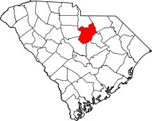 | |
| Towns | ||
| CDPs | ||
| Unincorporated communities | ||