Elk River, Idaho
| Elk River, Idaho | |
|---|---|
| City | |
|
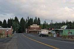
Elk River Streetscape | |
|
Location in Clearwater County and the state of Idaho | |
| Coordinates: 46°46′58″N 116°10′48″W / 46.78278°N 116.18000°WCoordinates: 46°46′58″N 116°10′48″W / 46.78278°N 116.18000°W | |
| Country | United States |
| State | Idaho |
| County | Clearwater |
| Area[1] | |
| • Total | 0.15 sq mi (0.39 km2) |
| • Land | 0.15 sq mi (0.39 km2) |
| • Water | 0 sq mi (0 km2) |
| Elevation | 2,854 ft (870 m) |
| Population (2010)[2] | |
| • Total | 125 |
| • Estimate (2012[3]) | 123 |
| • Density | 833.3/sq mi (321.7/km2) |
| Time zone | Pacific (PST) (UTC-8) |
| • Summer (DST) | PDT (UTC-7) |
| ZIP code | 83827 |
| Area code(s) | 208 |
| FIPS code | 16-25120 |
| GNIS feature ID | 0396456 |
Elk River is a city in Clearwater County, Idaho, United States. The population was 125 at the 2010 census, down from 156 in 2000.[4] It is accessed from State Highway 8 from Bovill, to the west in adjacent Latah County. Elk River was formerly the site of a Potlatch sawmill, phased out after several decades during the 1930s.[5]
Geography
Elk River is located at 46°46′58″N 116°10′48″W / 46.78278°N 116.18000°W (46.782796, -116.180049),[6] at an elevation of 2,854 feet (870 m) above sea level.
According to the United States Census Bureau, the city has a total area of 0.15 square miles (0.39 km2), all of it land.[1]
Climate
This region experiences warm (but not hot) and dry summers, with no average monthly temperatures above 71.6 °F. According to the Köppen Climate Classification system, Elk River has a dry-summer humid continental climate, abbreviated "Dsb" on climate maps.
| Climate data for Elk River (1952-2012) | |||||||||||||
|---|---|---|---|---|---|---|---|---|---|---|---|---|---|
| Month | Jan | Feb | Mar | Apr | May | Jun | Jul | Aug | Sep | Oct | Nov | Dec | Year |
| Record high °F (°C) | 54 (12) |
63 (17) |
72 (22) |
87 (31) |
95 (35) |
96 (36) |
104 (40) |
107 (42) |
100 (38) |
88 (31) |
66 (19) |
58 (14) |
107 (42) |
| Average high °F (°C) | 34.1 (1.2) |
39.7 (4.3) |
45.8 (7.7) |
54 (12) |
63.8 (17.7) |
71.4 (21.9) |
81.5 (27.5) |
81.5 (27.5) |
72 (22) |
58.3 (14.6) |
42 (6) |
34 (1) |
56.5 (13.6) |
| Average low °F (°C) | 18.3 (−7.6) |
20.5 (−6.4) |
24.2 (−4.3) |
30.4 (−0.9) |
36.7 (2.6) |
43 (6) |
45.7 (7.6) |
44.2 (6.8) |
37.5 (3.1) |
30.6 (−0.8) |
25.6 (−3.6) |
19.6 (−6.9) |
31.4 (−0.3) |
| Record low °F (°C) | −31 (−35) |
−25 (−32) |
−23 (−31) |
11 (−12) |
19 (−7) |
27 (−3) |
26 (−3) |
27 (−3) |
20 (−7) |
4 (−16) |
−24 (−31) |
−37 (−38) |
−37 (−38) |
| Average precipitation inches (mm) | 5.37 (136.4) |
3.98 (101.1) |
3.4 (86) |
2.9 (74) |
2.89 (73.4) |
2.48 (63) |
1.04 (26.4) |
1.1 (28) |
1.67 (42.4) |
2.76 (70.1) |
4.74 (120.4) |
5.05 (128.3) |
37.38 (949.5) |
| Average snowfall inches (cm) | 30.1 (76.5) |
16.8 (42.7) |
11.5 (29.2) |
2.7 (6.9) |
0.3 (0.8) |
0 (0) |
0 (0) |
0 (0) |
0 (0) |
0.3 (0.8) |
11.9 (30.2) |
25.4 (64.5) |
99 (251) |
| Average precipitation days | 16 | 12 | 12 | 11 | 11 | 10 | 5 | 5 | 6 | 10 | 14 | 14 | 126 |
| Source: WRCC[7] | |||||||||||||
Demographics
| Historical population | |||
|---|---|---|---|
| Census | Pop. | %± | |
| 1920 | 847 | — | |
| 1930 | 862 | 1.8% | |
| 1940 | 337 | −60.9% | |
| 1950 | 312 | −7.4% | |
| 1960 | 382 | 22.4% | |
| 1970 | 383 | 0.3% | |
| 1980 | 265 | −30.8% | |
| 1990 | 149 | −43.8% | |
| 2000 | 156 | 4.7% | |
| 2010 | 125 | −19.9% | |
| Est. 2015 | 119 | [8] | −4.8% |
2010 census
As of the census[2] of 2010, there were 125 people, 65 households, and 31 families residing in the city. The population density was 833.3 inhabitants per square mile (321.7/km2). There were 152 housing units at an average density of 1,013.3 per square mile (391.2/km2). The racial makeup of the city was 100.0% White. Hispanic or Latino of any race were 3.2% of the population.
There were 65 households of which 9.2% had children under the age of 18 living with them, 46.2% were married couples living together, 1.5% had a female householder with no husband present, and 52.3% were non-families. 50.8% of all households were made up of individuals and 20% had someone living alone who was 65 years of age or older. The average household size was 1.92 and the average family size was 2.90.
The median age in the city was 52.4 years. 12.8% of residents were under the age of 18; 2.4% were between the ages of 18 and 24; 19.2% were from 25 to 44; 44% were from 45 to 64; and 21.6% were 65 years of age or older. The gender makeup of the city was 52.8% male and 47.2% female.
2000 census
As of the census[10] of 2000, there were 156 people, 75 households, and 54 families residing in the city. The population density was 1,116.6 people per square mile (430.2/km²). There were 136 housing units at an average density of 973.5 per square mile (375.1/km²). The racial makeup of the city was 95.51% White, 0.64% Asian, and 3.85% from two or more races. Hispanic or Latino of any race were 0.64% of the population.
There were 75 households out of which 13.3% had children under the age of 18 living with them, 66.7% were married couples living together, 2.7% had a female householder with no husband present, and 26.7% were non-families. 21.3% of all households were made up of individuals and 8.0% had someone living alone who was 65 years of age or older. The average household size was 2.08 and the average family size was 2.38.
In the city the population was spread out with 13.5% under the age of 18, 1.9% from 18 to 24, 19.2% from 25 to 44, 41.0% from 45 to 64, and 24.4% who were 65 years of age or older. The median age was 53 years. For every 100 females there were 116.7 males. For every 100 females age 18 and over, there were 107.7 males.
The median income for a household in the city was $30,000, and the median income for a family was $31,250. Males had a median income of $29,375 versus $17,500 for females. The per capita income for the city was $16,082. About 11.3% of families and 14.1% of the population were below the poverty line, including 27.8% of those under the age of eighteen and 8.9% of those sixty five or over.
In popular culture
Elk River was mentioned on the satirical podcast The Bugle. Hosts John Oliver and Andy Zaltzman claimed The Bugle was planning to declare war against the town.
References
- 1 2 "US Gazetteer files 2010". United States Census Bureau. Retrieved 2012-12-18.
- 1 2 "American FactFinder". United States Census Bureau. Retrieved 2012-12-18.
- ↑ "Population Estimates". United States Census Bureau. Retrieved 2013-06-03.
- ↑ Spokesman-Review - 2010 census - Elk River, Idaho - accessed 2011-12-27
- ↑ "Idaho for the Curious", by Cort Conley, ©1982, ISBN 0-9603566-3-0, p.58-59
- ↑ "US Gazetteer files: 2010, 2000, and 1990". United States Census Bureau. 2011-02-12. Retrieved 2011-04-23.
- ↑ "ELK RIVER 1 S, ID (102892)". Western Regional Climate Center. Retrieved November 26, 2015.
- ↑ "Annual Estimates of the Resident Population for Incorporated Places: April 1, 2010 to July 1, 2015". Retrieved July 2, 2016.
- ↑ "Census of Population and Housing". Census.gov. Retrieved June 4, 2015.
- ↑ "American FactFinder". United States Census Bureau. Retrieved 2008-01-31.
External links
Municipalities and communities of Clearwater County, Idaho, United States | ||
|---|---|---|
| Cities | ||
| Unincorporated communities | ||