Bovill, Idaho
| Bovill, Idaho | |
|---|---|
| City | |
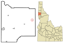 Location in Latah County and the state of Idaho | |
| Coordinates: 46°51′33″N 116°23′40″W / 46.85917°N 116.39444°WCoordinates: 46°51′33″N 116°23′40″W / 46.85917°N 116.39444°W | |
| Country | United States |
| State | Idaho |
| County | Latah |
| Area[1] | |
| • Total | 0.19 sq mi (0.49 km2) |
| • Land | 0.19 sq mi (0.49 km2) |
| • Water | 0 sq mi (0 km2) |
| Elevation | 2,874 ft (876 m) |
| Population (2010)[2] | |
| • Total | 260 |
| • Estimate (2012[3]) | 259 |
| • Density | 1,368.4/sq mi (528.3/km2) |
| Time zone | Pacific (PST) (UTC-8) |
| • Summer (DST) | PDT (UTC-7) |
| ZIP code | 83806 |
| Area code(s) | 208 |
| FIPS code | 16-09730 |
| GNIS feature ID | 0399805 |
| Website | bovill-id.com |
Bovill is a city in Latah County, Idaho, United States. The population was 260 at the 2010 census, down from 305 in 2000.[4]
History
Bovill was named for a settler.[5] Hugh Bovill was an Englishman who bought the Warren Meadows homestead in 1901 to ranch.[6] With the rapid infusion of loggers, homesteaders, and sportsmen, Bovill and his wife Charlotte opened a hotel in 1903, which included a store and post office in 1907. The railroad arrived that same year and as logging activity increased nearby, the town became too wild for the couple and their two daughters, and they left in 1911[6] (Hugh died in 1935 in Oregon, Charlotte in 1947 in California).[7]
On 15 April 1912, the workers at the Number 4 and Number 8 camp near Bovill of the Potlatch Lumber Company went on strike for better rations and a twenty-five cent per day pay raise.[8] Notice of the strike was published in the Industrial Worker, a weekly newspaper of the Industrial Workers of the World which was published out of Spokane, Washington at the time.[9]
The Bovill Opera House, at 2nd and Pine, was listed on the National Register of Historic Places in 2010.
Geography
Bovill is located at 46°51′33″N 116°23′40″W / 46.85917°N 116.39444°W (46.859187, -116.394491),[10] at an elevation of 2,874 feet (876 m) above sea level on the east bank of the Potlatch River.
According to the United States Census Bureau, the city has a total area of 0.19 square miles (0.49 km2), all of it land.[1]
Demographics
| Historical population | |||
|---|---|---|---|
| Census | Pop. | %± | |
| 1920 | 589 | — | |
| 1930 | 572 | −2.9% | |
| 1940 | 447 | −21.9% | |
| 1950 | 437 | −2.2% | |
| 1960 | 357 | −18.3% | |
| 1970 | 350 | −2.0% | |
| 1980 | 289 | −17.4% | |
| 1990 | 256 | −11.4% | |
| 2000 | 305 | 19.1% | |
| 2010 | 260 | −14.8% | |
| Est. 2015 | 253 | [11] | −2.7% |
2010 census
As of the census[2] of 2010, there were 260 people, 105 households, and 68 families residing in the city. The population density was 1,368.4 inhabitants per square mile (528.3/km2). There were 127 housing units at an average density of 668.4 per square mile (258.1/km2). The racial makeup of the city was 96.5% White and 3.5% from two or more races. Hispanic or Latino of any race were 0.4% of the population.
There were 105 households of which 29.5% had children under the age of 18 living with them, 52.4% were married couples living together, 9.5% had a female householder with no husband present, 2.9% had a male householder with no wife present, and 35.2% were non-families. 27.6% of all households were made up of individuals and 11.5% had someone living alone who was 65 years of age or older. The average household size was 2.48 and the average family size was 3.03.
The median age in the city was 43 years. 25.4% of residents were under the age of 18; 7.4% were between the ages of 18 and 24; 20.3% were from 25 to 44; 32% were from 45 to 64; and 15% were 65 years of age or older. The gender makeup of the city was 51.5% male and 48.5% female.
2000 census
As of the census[13] of 2000, there were 305 people, 116 households, and 82 families residing in the city. The population density was 1,701.6 people per square mile (654.2/km²). There were 128 housing units at an average density of 714.1 per square mile (274.6/km²). The racial makeup of the city was 96.07% White, 0.33% Native American, 0.98% Asian, 0.33% from other races, and 2.30% from two or more races. Hispanic or Latino of any race were 2.95% of the population.
There were 116 households out of which 36.2% had children under the age of 18 living with them, 62.9% were married couples living together, 6.0% had a female householder with no husband present, and 29.3% were non-families. 22.4% of all households were made up of individuals and 8.6% had someone living alone who was 65 years of age or older. The average household size was 2.63 and the average family size was 3.13.
In the city the population was spread out with 28.2% under the age of 18, 6.9% from 18 to 24, 29.8% from 25 to 44, 27.2% from 45 to 64, and 7.9% who were 65 years of age or older. The median age was 36 years. For every 100 females there were 106.1 males. For every 100 females age 18 and over, there were 102.8 males.
The median income for a household in the city was $36,875, and the median income for a family was $41,827. Males had a median income of $33,750 versus $21,875 for females. The per capita income for the city was $12,471. About 14.1% of families and 18.1% of the population were below the poverty line, including 24.0% of those under the age of eighteen and none of those sixty five or over.
Bovill in literature
In the 2009 novel Patriots: A Novel of Survival in the Coming Collapse,[14] a handful of Midwestern people relocate from Chicago to a retreat near Bovill due to hyperinflation and subsequent economic collapse of the United States.[15]
Bovill is also briefly mentioned in the novel "The Last Full Measure" by Trent Reedy, the third book of Reedy's "Divided We Fall" trilogy.
References
- 1 2 "US Gazetteer files 2010". United States Census Bureau. Archived from the original on 2012-01-24. Retrieved 2012-12-18.
- 1 2 "American FactFinder". United States Census Bureau. Retrieved 2012-12-18.
- ↑ "Population Estimates". United States Census Bureau. Archived from the original on 2013-06-17. Retrieved 2013-06-03.
- ↑ Spokesman-Review - 2010 census - Bovill, Idaho - accessed 2011-12-26
- ↑ Suzanne Julin (December 2009). "National Register of Historic Places Registration: Bovill Opera House" (PDF). National Park Service. Archived from the original (PDF) on June 5, 2011. Retrieved 2010-03-05. (26 pages, including 6 photos from 2009)
- 1 2 Wickline, Michael R. (May 6, 1990). "Resort business has its roots in early 1900s". Lewiston Morning Tribune. p. 26-Centennial.
- ↑ "Idaho for the Curious", by Cort Conley, ©1982, ISBN 0-9603566-3-0, p.56-57
- ↑ Hanley, Michael. "IWW Yearbook 1912". IWW History Project. University of Washington. Retrieved 18 April 2016.
- ↑ "Strike at Bovill, Idaho". Industrial Worker. 4 (5). 25 April 1912. p. 1.
On April 15 all the men at camp No. 8, Potlatch Lumber Company, Bovill, Idaho, went on strike for better food and twenty-five cents increase per day. Ninety men are out, and all are standing solidly together. The men at camp No. 4 are also out, as conditions there are very foul and the men have had to work about twelve hours per day. At camp 8 the work is so dangerous that two men were killed and several badly crippled in one week's time. One of the men writes in that the balance of the men are willing to join the ONE BIG UNION, and asks that any organizers in that district to give the matter immediate attention.
- ↑ "US Gazetteer files: 2010, 2000, and 1990". United States Census Bureau. 2011-02-12. Retrieved 2011-04-23.
- ↑ "Annual Estimates of the Resident Population for Incorporated Places: April 1, 2010 to July 1, 2015". Retrieved July 2, 2016.
- ↑ "Census of Population and Housing". Census.gov. Archived from the original on May 11, 2015. Retrieved June 4, 2015.
- ↑ "American FactFinder". United States Census Bureau. Archived from the original on 2013-09-11. Retrieved 2008-01-31.
- ↑ Amazon.com
- ↑ James Wesley Rawles (2009). Patriots: A Novel of Survival in the Coming Collapse. Ulysses Press (Berkeley, California), 4th ed., paperback,. p. 400. ISBN 978-1-56975-599-0.
External links
- bovill-id.com - community site
- Latah County Historical Society
- Public Library
- Regional information
Municipalities and communities of Latah County, Idaho, United States | ||
|---|---|---|
| Cities | ||
| CDP | ||
| Unincorporated communities | ||