Eminence, Kentucky
| Eminence, Kentucky | |
|---|---|
| City | |
|
Sunset in Eminence | |
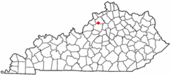 Location of Eminence, Kentucky | |
| Coordinates: 38°22′5″N 85°10′50″W / 38.36806°N 85.18056°WCoordinates: 38°22′5″N 85°10′50″W / 38.36806°N 85.18056°W | |
| Country | United States |
| State | Kentucky |
| County | Henry |
| Government | |
| • Mayor | Drane Stephens |
| Area | |
| • Total | 2.2 sq mi (5.6 km2) |
| • Land | 2.1 sq mi (5.6 km2) |
| • Water | 0.0 sq mi (0.0 km2) |
| Elevation | 935 ft (285 m) |
| Population (2000) | |
| • Total | 2,231 |
| • Density | 1,039.2/sq mi (401.3/km2) |
| Time zone | Eastern (EST) (UTC-5) |
| • Summer (DST) | EDT (UTC-4) |
| ZIP code | 40019 |
| Area code(s) | 502 |
| FIPS code | 21-24904 |
| GNIS feature ID | 0491762 |
| Website | http://www.eminencekentucky.com |

Eminence is a home rule-class city[1] in Henry County, Kentucky, in the United States. The population was 2,231 at the 2000 census. Eminence is the largest city in Henry County. Eminence is home to the loudspeaker manufacturing company, Eminence Speaker. Eminence is also home to The Highland Renaissance Festival, which runs from May through July; it also hosts a Celtic Fest in September.
Geography
Eminence is located at 38°22′5″N 85°10′50″W / 38.36806°N 85.18056°W (38.368127, -85.180449).[2]
According to the United States Census Bureau, the city has a total area of 2.2 square miles (5.7 km2), of which 2.2 square miles (5.7 km2) is land and 0.47% is water.
History
The area post office, established in 1836, was moved to Eminence in 1850, and named for its supposed location at the highest point on the railroad line between Louisville and Lexington.[3][4] The city was formally incorporated in 1851.[5][6]
Demographics
| Historical population | |||
|---|---|---|---|
| Census | Pop. | %± | |
| 1880 | 1,043 | — | |
| 1890 | 1,002 | −3.9% | |
| 1900 | 1,018 | 1.6% | |
| 1910 | 1,274 | 25.1% | |
| 1920 | 1,317 | 3.4% | |
| 1930 | 1,323 | 0.5% | |
| 1940 | 1,411 | 6.7% | |
| 1950 | 1,462 | 3.6% | |
| 1960 | 1,958 | 33.9% | |
| 1970 | 2,225 | 13.6% | |
| 1980 | 2,260 | 1.6% | |
| 1990 | 2,055 | −9.1% | |
| 2000 | 2,231 | 8.6% | |
| 2010 | 2,498 | 12.0% | |
| Est. 2015 | 2,535 | [7] | 1.5% |
As of the census[9] of 2000, there were 2,231 people, 944 households, and 623 families residing in the city. The population density was 1,039.2 people per square mile (400.6/km²). There were 998 housing units at an average density of 464.9 per square mile (179.2/km²). The racial makeup of the city was 83.59% White, 11.65% Black or African American, 0.31% Native American, 0.36% Asian, 2.11% from other races, and 1.97% from two or more races. Hispanic or Latino of any race were 3.81% of the population.
There were 944 households out of which 30.8% had children under the age of 18 living with them, 42.4% were married couples living together, 18.0% had a female householder with no husband present, and 34.0% were non-families. 30.6% of all households were made up of individuals and 12.9% had someone living alone who was 65 years of age or older. The average household size was 2.36 and the average family size was 2.91.
In the city the population was spread out with 25.3% under the age of 18, 9.6% from 18 to 24, 28.2% from 25 to 44, 22.1% from 45 to 64, and 14.8% who were 65 years of age or older. The median age was 36 years. For every 100 females there were 89.1 males. For every 100 females age 18 and over, there were 82.4 males.
The median income for a household in the city was $30,323, and the median income for a family was $36,053. Males had a median income of $30,893 versus $21,042 for females. The per capita income for the city was $15,337. About 14.9% of families and 17.1% of the population were below the poverty line, including 21.0% of those under age 18 and 21.5% of those age 65 or over.
References
- ↑ "Summary and Reference Guide to House Bill 331 City Classification Reform" (PDF). Kentucky League of Cities. Retrieved December 30, 2014.
- ↑ "US Gazetteer files: 2010, 2000, and 1990". United States Census Bureau. 2011-02-12. Retrieved 2011-04-23.
- ↑ Rennick, Robert M. (1987). Kentucky Place Names. University Press of Kentucky. p. 93. Retrieved 2013-04-28.
- ↑ Gannett, Henry (1905). The Origin of Certain Place Names in the United States. Govt. Print. Off. p. 119.
- ↑ Collins, Lewis (1877). History of Kentucky. p. 338.
- ↑ Commonwealth of Kentucky. Office of the Secretary of State. Land Office. "Eminence, Kentucky". Accessed 25 Jul 2013.
- ↑ "Annual Estimates of the Resident Population for Incorporated Places: April 1, 2010 to July 1, 2015". Retrieved July 2, 2016.
- ↑ "Census of Population and Housing". Census.gov. Retrieved June 4, 2015.
- ↑ "American FactFinder". United States Census Bureau. Retrieved 2008-01-31.
External links
Municipalities and communities of Henry County, Kentucky, United States | ||
|---|---|---|
| Cities | 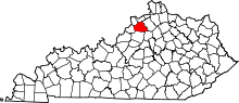 | |
| Unincorporated communities | ||
| Footnotes | ‡This populated place also has portions in an adjacent county or counties | |