Pleasureville, Kentucky
| Pleasureville, Kentucky | |
|---|---|
| City | |
|
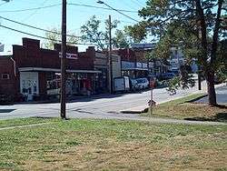
Downtown Pleasureville, KY (South Town) | |
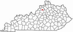 Location of Pleasureville, Kentucky | |
| Coordinates: 38°20′57″N 85°6′51″W / 38.34917°N 85.11417°WCoordinates: 38°20′57″N 85°6′51″W / 38.34917°N 85.11417°W | |
| Country | United States |
| State | Kentucky |
| Counties | Henry & Shelby |
| Incorporated | 1842[1] |
| Government | |
| • Mayor | Wm. Rodney Young |
| Area | |
| • Total | 0.5 sq mi (1.4 km2) |
| • Land | 0.5 sq mi (1.4 km2) |
| • Water | 0.0 sq mi (0.0 km2) |
| Elevation | 892 ft (272 m) |
| Population (2000) | |
| • Total | 869 |
| • Density | 1,642.9/sq mi (634.3/km2) |
| Time zone | Eastern (EST) (UTC-5) |
| • Summer (DST) | EDT (UTC-4) |
| ZIP code | 40057 |
| Area code(s) | 502 |
| FIPS code | 21-61788 |
| GNIS feature ID | 0500958 |
Pleasureville is a 6th-class city in Henry and Shelby counties in the Commonwealth of Kentucky, United States. The population was 869 at the time of the 2000 U.S. Census.
History
In 1784, 30-odd Dutch Huguenot families colonizing present-day Mercer County purchased 10,000 acres (4,000 ha) from Squire Boone. They erected a fort for their protection about 1.5 miles (2.4 km) east of present-day north Pleasureville. Their land was held and cultivated in common, but managed by Abraham Banta. It was variously known as The Dutch Tract, the Low Dutch Settlement or Station, and Bantatown, but the post office was established as Pleasureville c. 1828[2] and the city was incorporated under that name in 1842.[3][1] Rennick relates the local story that it derived from a visitor expressing what a pleasure it was to stay among such pleasant people[2] but others say the area of the post office housed a bordello (at the site of the later Pleasureville Hotel and a present-day apartment building).[4]
In 1858, the Louisville and Nashville Railroad arrived but its course ran about a mile south of the former community. The post office relocated to the new settlement around the depot in 1874, which received the name Pleasureville, and the former city became known as North Pleasureville. It received a separate post office under that name in 1879. The town and city merged in 1962, although the two halves are still sometimes called North Town and South Town by locals.[2]
Geography
Pleasureville is located at 38°20′57″N 85°6′51″W / 38.34917°N 85.11417°W (38.349165, -85.114201)[5] in the Bluegrass region of Kentucky. According to the United States Census Bureau, the city has a total area of 0.5 square mile (1.4 km²), all land. The community is located on State Highway 241, south of U.S. Route 421.
Demographics
| Historical population | |||
|---|---|---|---|
| Census | Pop. | %± | |
| 1880 | 175 | — | |
| 1890 | 202 | 15.4% | |
| 1900 | 272 | 34.7% | |
| 1910 | 522 | 91.9% | |
| 1920 | 308 | −41.0% | |
| 1930 | 341 | 10.7% | |
| 1940 | 438 | 28.4% | |
| 1950 | 355 | −18.9% | |
| 1960 | 466 | 31.3% | |
| 1970 | 747 | 60.3% | |
| 1980 | 837 | 12.0% | |
| 1990 | 761 | −9.1% | |
| 2000 | 869 | 14.2% | |
| 2010 | 834 | −4.0% | |
| Est. 2015 | 844 | [6] | 1.2% |
As of the census[8] of 2000, there were 869 people, 340 households, and 236 families residing in the city. The population density was 1,642.9 people per square mile (633.1/km²). There were 367 housing units at an average density of 693.8 per square mile (267.4/km²). The racial makeup of the city was 92.98% White, 1.73% African American, 0.12% Native American, 4.26% from other races, and 0.92% from two or more races. Hispanic or Latino of any race were 7.48% of the population.
There were 340 households out of which 33.2% had children under the age of 18 living with them, 53.8% were married couples living together, 9.4% had a female householder with no husband present, and 30.3% were non-families. 23.8% of all households were made up of individuals and 14.4% had someone living alone who was 65 years of age or older. The average household size was 2.56 and the average family size was 2.98.
In the city the population was spread out with 25.1% under the age of 18, 7.6% from 18 to 24, 31.5% from 25 to 44, 19.3% from 45 to 64, and 16.5% who were 65 years of age or older. The median age was 36 years. For every 100 females there were 104.5 males. For every 100 females age 18 and over, there were 100.9 males.
The median income for a household in the city was $33,839, and the median income for a family was $36,875. Males had a median income of $26,875 versus $21,912 for females. The per capita income for the city was $16,279. About 5.9% of families and 13.8% of the population were below the poverty line, including 22.3% of those under age 18 and 9.9% of those age 65 or over.
Climate
The climate in this area is characterized by hot, humid summers and generally mild to cool winters. According to the Köppen Climate Classification system, Pleasureville has a humid subtropical climate, abbreviated "Cfa" on climate maps.[9]
See also
References
- 1 2 Commonwealth of Kentucky. Office of the Secretary of State. Land Office. "Pleasureville, Kentucky". Accessed 27 Sept 2013.
- 1 2 3 Rennick, Robert. Kentucky Place Names, p. 238. University Press of Kentucky (Lexington), 1987. Accessed 27 September 2013.
- ↑ Collins, Lewis (1877). History of Kentucky. p. 339.
- ↑ University of Kentucky. Kentucky Atlas & Gazetteer. "Pleasureville".
- ↑ "US Gazetteer files: 2010, 2000, and 1990". United States Census Bureau. 2011-02-12. Retrieved 2011-04-23.
- ↑ "Annual Estimates of the Resident Population for Incorporated Places: April 1, 2010 to July 1, 2015". Retrieved July 2, 2016.
- ↑ "Census of Population and Housing". Census.gov. Retrieved June 4, 2015.
- ↑ "American FactFinder". United States Census Bureau. Retrieved 2008-01-31.
- ↑ Climate Summary for Pleasureville, Kentucky
External links
- Sweet Home Spun Original Low Dutch Meetinghouse
Municipalities and communities of Henry County, Kentucky, United States | ||
|---|---|---|
| Cities | 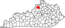 | |
| Unincorporated communities | ||
| Footnotes | ‡This populated place also has portions in an adjacent county or counties | |
Municipalities and communities of Shelby County, Kentucky, United States | ||
|---|---|---|
| Cities | 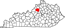 | |
| Unincorporated communities | ||
| Footnotes | ‡This populated place also has portions in an adjacent county or counties | |