Ergun City
| Ergun 额尔古纳市 • ᠡᠷᠬᠥᠨᠠᠬᠣᠲᠠ | |
|---|---|
| County-level city | |
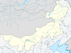 Ergun Location in Inner Mongolia | |
| Coordinates: 50°14′N 120°10′E / 50.233°N 120.167°ECoordinates: 50°14′N 120°10′E / 50.233°N 120.167°E | |
| Country | China |
| Region | Inner Mongolia |
| Prefecture-level city | Hulunbuir |
| Area | |
| • Total | 28,400 km2 (11,000 sq mi) |
| Population | |
| • Total | 85,162 |
| • Density | 3.0/km2 (7.8/sq mi) |
| Time zone | China Standard (UTC+8) |
| Postal code | 022050 |
| Area code(s) | 0470 |
| Website | http://www.eegn.gov.cn/ |
Ergun (Chinese: 额尔古纳市, É'ěrgǔnà Shì; Mongolian: Эргүн Ergün), formerly Ergun Right Banner (Mongolian: ᠡᠷᠬᠥᠨᠠ ᠬᠣᠲᠠ Эргүнэ хот; Chinese: 额尔古纳右旗; pinyin: E'erguna You Qi), is a county-level city in China's autonomous region of Inner Mongolia. Administratively, Ergun is part of the prefecture-level city of Hulunbuir. It occupies 28,400 km² on the right (south-eastern) bank of the Argun River, which forms China's border with Russia's Zabaykalsky Krai (formerly, Chita Oblast).[1]
The county-level city had the population of 85162 people as of 2006.[2]
Subdivisions
The county-level city of Ergun is divided into 2 towns, 2 ethnic townships, and two subdistricts (街道办事处).[2] As of 2006, their population was reported as follows:
- Labudalin Subdistrict (拉布大林街道办事处), 35,994 - seat of the city government.[3]
- Shangkuli Subdistrict (上库力街道办事处), 7,032
- Moridaga (Mo'erdaoga) Town (莫尔道嘎镇), 25,309
- Heishantou Town (黑山头镇), 1,797
- Sanhe Hui Ethnic Township (三河回族乡), 11,497
- Shiwei Russian Ethnic Township (室韦俄罗斯民族乡), 3,533
Ethnic composition of the county-level city of Ergun, as of 2006, was reported as follows:[2]
There are two international border crossings in the county-level city.[1]