Fairfax, Vermont
| Fairfax, Vermont | |
|---|---|
| Town | |
 Fairfax, Vermont | |
| Coordinates: 44°41′50″N 72°59′52″W / 44.69722°N 72.99778°WCoordinates: 44°41′50″N 72°59′52″W / 44.69722°N 72.99778°W | |
| Country | United States |
| State | Vermont |
| County | Franklin |
| Area | |
| • Total | 40.4 sq mi (104.7 km2) |
| • Land | 39.8 sq mi (103.2 km2) |
| • Water | 0.6 sq mi (1.5 km2) |
| Elevation | 659 ft (201 m) |
| Population (2010) | |
| • Total | 4,285 |
| • Density | 107/sq mi (41.5/km2) |
| Time zone | Eastern (EST) (UTC-5) |
| • Summer (DST) | EDT (UTC-4) |
| ZIP code | 05454 |
| Area code(s) | 802 |
| FIPS code | 50-24925[1] |
| GNIS feature ID | 1462092[2] |
| Website |
www |
Fairfax is a town in Franklin County, Vermont, United States. The population was 4,285 at the 2010 census,[3] up from 3,765 at the 2000 census.
Geography
The town of Fairfax is in southern Franklin County and is bordered by Chittenden County to the south. According to the United States Census Bureau, the town has a total area of 40.4 square miles (104.7 km2), of which 39.8 square miles (103.2 km2) is land and 0.58 square miles (1.5 km2), or 1.44%, is water.[3] The Lamoille River, a tributary of Lake Champlain, flows from east to west across the southern part of the town, passing through the communities of Fairfax and Fairfax Falls.
Demographics
| Historical population | |||
|---|---|---|---|
| Census | Pop. | %± | |
| 1790 | 254 | — | |
| 1800 | 786 | 209.4% | |
| 1810 | 1,301 | 65.5% | |
| 1820 | 1,359 | 4.5% | |
| 1830 | 1,729 | 27.2% | |
| 1840 | 1,919 | 11.0% | |
| 1850 | 2,111 | 10.0% | |
| 1860 | 1,987 | −5.9% | |
| 1870 | 1,956 | −1.6% | |
| 1880 | 1,820 | −7.0% | |
| 1890 | 1,523 | −16.3% | |
| 1900 | 1,338 | −12.1% | |
| 1910 | 1,318 | −1.5% | |
| 1920 | 1,244 | −5.6% | |
| 1930 | 1,249 | 0.4% | |
| 1940 | 1,229 | −1.6% | |
| 1950 | 1,129 | −8.1% | |
| 1960 | 1,244 | 10.2% | |
| 1970 | 1,366 | 9.8% | |
| 1980 | 1,805 | 32.1% | |
| 1990 | 2,486 | 37.7% | |
| 2000 | 3,765 | 51.4% | |
| 2010 | 4,285 | 13.8% | |
| Est. 2014 | 4,524 | [4] | 5.6% |
| U.S. Decennial Census[5] | |||
As of the census[1] of 2010, there were 4,285 people, 1,591 households, and 1,226 families residing in the town. The population density was 105.8 people per square mile (40.8/km2). There were 1,683 housing units at an average density of 41.6 per square mile (16.0/km2). The racial makeup of the town was 97.8% White and 1.3% Hispanic or Latino. There were 39.8% of households under the age of 18 living with them, 64.2% were married couples living together, 8.2% had a female householder with no husband present, and 22.9% were non-families and 16.0% of all households were made up of individuals and 16.2% had someone living alone who was 65 years of age or older. The average household size was 2.69 and the average family size was 3.00.
The median income for a household in the town was $70,348, and the median income for a family was $77,159. The per capita income for the town was $18,632. About 2.7% of families and 4.8% of the population were below the poverty line, including 6.7% of those under age 18 and 4.1% of those age 65 or over.
References
- 1 2 "American FactFinder". United States Census Bureau. Retrieved 2008-01-31.
- ↑ "US Board on Geographic Names". United States Geological Survey. 2007-10-25. Retrieved 2008-01-31.
- 1 2 "Geographic Identifiers: 2010 Demographic Profile Data (G001): Fairfax town, Franklin County, Vermont". U.S. Census Bureau, American Factfinder. Retrieved September 7, 2016.
- ↑ "Annual Estimates of the Resident Population for Incorporated Places: April 1, 2010 to July 1, 2014". Retrieved June 4, 2015.
- ↑ "U.S. Decennial Census". United States Census Bureau. Retrieved May 16, 2015.
External links
- Town of Fairfax official website
- Fairfax unofficial website
- Fairfax Community Library
- Bellows Free Academy
Municipalities and communities of Franklin County, Vermont, United States | ||
|---|---|---|
| City | 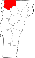 | |
| Towns | ||
| Villages | ||
| CDP | ||
| Unincorporated communities | ||