Montgomery, Vermont
| Montgomery, Vermont | |
|---|---|
| Town | |
| Nickname(s): "The Covered Bridge Town"[1] | |
 Montgomery, Vermont | |
| Coordinates: 44°52′45″N 72°36′42″W / 44.87917°N 72.61167°WCoordinates: 44°52′45″N 72°36′42″W / 44.87917°N 72.61167°W | |
| Country | United States |
| State | Vermont |
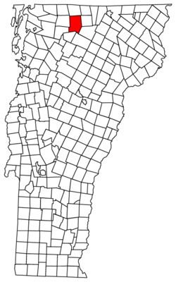
| County | Franklin |
| Area | |
| • Total | 56.7 sq mi (146.9 km2) |
| • Land | 56.6 sq mi (146.7 km2) |
| • Water | 0.08 sq mi (0.2 km2) |
| Elevation | 650 ft (198 m) |
| Population (2010) | |
| • Total | 1,201 |
| • Density | 21/sq mi (8.2/km2) |
| Time zone | Eastern (EST) (UTC-5) |
| • Summer (DST) | EDT (UTC-4) |
| ZIP code | 05470-05471 |
| Area code(s) | 802 |
| FIPS code | 50-45850[2] |
| GNIS feature ID | 1462151[3] |
| Website |
www |
Montgomery is a town in Franklin County, Vermont, United States. The population as of the 2010 census was 1,201,[4] up from 992 in 2000. In 1963, part of Avery's Gore in Franklin County became part of Montgomery, with the other section becoming part of Belvidere in Lamoille County.
Geography
The town is in eastern Franklin County, bordered to the south by Lamoille County and to the east by Orleans County. Vermont Route 118 passes through the town, leading northwest to Berkshire and south to Eden. Vermont Route 58 intersects Route 118 at Montgomery Center, leading southwest over Hazens Notch to Lowell. Vermont Route 242 also terminates at Montgomery Center, leading northeast over the Green Mountains to Jay. The higheast point in Montgomery is the 3,786-foot (1,154 m) summit of Big Jay, a spur of Jay Peak. Big Jay is in the northeast corner of Montgomery.
According to the United States Census Bureau, the town has a total area of 56.7 square miles (146.9 km2), of which 56.6 square miles (146.7 km2) is land and 0.1 square miles (0.2 km2), or 0.13%, is water.[4] Nearly all of the town is drained by the Trout River, a northwest-flowing tributary of the Missisquoi River. The southeast corner of the town is drained by Calavale Brook, a tributary of the Lamoille River. Both rivers flow to Lake Champlain.
The following are named villages and places in the town of Montgomery, according to the Vermont Secretary of State.[5]
- Hectorville
- Hutchins
- Montgomery Center (ZIP Code 05471)
- Montgomery Village (ZIP Code 05470)
Hazen's Notch State Park is located on Vermont Route 58, the Hazen's Notch Road. The undeveloped park is located in three towns, including Montgomery. It is midway between Lowell to the east and Montgomery to the west.
History
The town of Montgomery was granted a charter by the Vermont General Assembly on March 15, 1780. Montgomery was named in honor of General Richard Montgomery (1738–1775), Revolutionary War hero.[6]
The Montgomery Historical Society was formed in 1974. The society was initially created to acquire and restore the St. Bartholomew's Episcopal Church in Montgomery Village.[6]
The following buildings and bridges in Montgomery are listed on the National Register of Historic Places:[7]
- Comstock Covered Bridge
- Fuller Covered Bridge
- Hectorville Covered Bridge (Disassembled and stored awaiting restoration)
- Hopkins Covered Bridge
- Hutchins Covered Bridge
- Longley Covered Bridge
- West Hill Covered Bridge
- Montgomery House (Montgomery, Vermont)
- St. Bartholomew's Episcopal Church (Now known as Pratt Hall, Montgomery Historical Society)
In 2008, the state notified residents of the town and twelve towns in the adjacent counties of Lamoille and Orleans, that a review of health records from 1995 to 2006 had revealed that residents within 10 miles (16 km) of the former asbestos mine on Belvidere Mountain had higher than normal rates of contracting asbestosis. The state and federal government continues to study this problem.[8][9] A critic replied that the entire basis of the study were three unidentified people who died from asbestosis 1995-2005 out of a total population of 16,700.[10]
Government
Town offices (Town Clerk, Select Board, etc.) are located on Main Street (Route 118) in Montgomery Center in the same building as the post office for Montgomery Center (05471). Montgomery Village has its own post office located near the intersection of Fuller Bridge Road and Black Falls Road in Montgomery Village (05470).
Legislators
The Essex-Orleans Senate district includes the town of Montgomery, as well as parts or all of Essex County, Orleans County, Franklin County and Lamoille County. It is represented in the Vermont Senate by Vincent Illuzzi (R) and Robert A. Starr (D).
Demographics
| Historical population | |||
|---|---|---|---|
| Census | Pop. | %± | |
| 1800 | 41 | — | |
| 1810 | 237 | 478.0% | |
| 1820 | 293 | 23.6% | |
| 1830 | 460 | 57.0% | |
| 1840 | 548 | 19.1% | |
| 1850 | 1,001 | 82.7% | |
| 1860 | 1,262 | 26.1% | |
| 1870 | 1,423 | 12.8% | |
| 1880 | 1,642 | 15.4% | |
| 1890 | 1,734 | 5.6% | |
| 1900 | 1,876 | 8.2% | |
| 1910 | 1,721 | −8.3% | |
| 1920 | 1,658 | −3.7% | |
| 1930 | 1,386 | −16.4% | |
| 1940 | 1,208 | −12.8% | |
| 1950 | 1,091 | −9.7% | |
| 1960 | 876 | −19.7% | |
| 1970 | 651 | −25.7% | |
| 1980 | 681 | 4.6% | |
| 1990 | 823 | 20.9% | |
| 2000 | 992 | 20.5% | |
| 2010 | 1,201 | 21.1% | |
| Est. 2014 | 1,195 | [11] | −0.5% |
| U.S. Decennial Census[12] | |||
As of the census[2] of 2000, there were 992 people, 412 households, and 288 families residing in the town. The population density was 17.5 people per square mile (6.7/km2). There were 666 housing units at an average density of 11.7 per square mile (4.5/km2). The racial makeup of the town was 96.88% White, 0.20% African American, 0.71% Native American, 0.10% from other races, and 2.12% from two or more races. Hispanic or Latino of any race were 0.50% of the population.
There were 412 households out of which 28.4% had children under the age of 18 living with them, 55.8% were married couples living together, 7.5% had a female householder with no husband present, and 29.9% were non-families. 22.8% of all households were made up of individuals and 7.3% had someone living alone who was 65 years of age or older. The average household size was 2.41 and the average family size was 2.75.
In the town the population was spread out with 23.6% under the age of 18, 5.6% from 18 to 24, 26.9% from 25 to 44, 30.3% from 45 to 64, and 13.5% who were 65 years of age or older. The median age was 42 years. For every 100 females there were 101.6 males. For every 100 females age 18 and over, there were 102.1 males.
Economy
Montgomery's economy centers on tourism due to its proximity to Jay Peak Resort. Agribusiness is also a significant contributor to the town's economy.
Personal income
The median income for a household in the town was $33,958, and the median income for a family was $38,839. Males had a median income of $27,917 versus $22,273 for females. The per capita income for the town was $16,570. About 8.7% of families and 14.4% of the population were below the poverty line, including 14.2% of those under age 18 and 8.9% of those age 65 or over.
Tourism
There are a number of overnight accommodations for travelers.[13] There are four restaurants.[14]
Notable people
- Dana Reed Bailey, politician
- Percival L. Shangraw, Vermont Supreme Court 1958-1974 (Chief Justice 1972-1974) [15]
References
- ↑ Town of Montgomery official website
- 1 2 "American FactFinder". United States Census Bureau. Retrieved 2008-01-31.
- ↑ "US Board on Geographic Names". United States Geological Survey. 2007-10-25. Retrieved 2008-01-31.
- 1 2 "Geographic Identifiers: 2010 Demographic Profile Data (G001): Montgomery town, Franklin County, Vermont". U.S. Census Bureau, American Factfinder. Retrieved September 13, 2016.
- ↑ List of place names in Vermont
- 1 2 Branthoover, W.R. & Taylor, Sara, Montgomery Vermont - The History of a Town (1976, 1991, 2013) Montgomery Historical Society, Montgomery, Vermont
- ↑ National Register of Historic Places listings in Franklin County, Vermont
- ↑ Rathke, Lisa (December 12, 2008). Neighbors worry about mine's impact on health. Burlington Free Press.
- ↑
- ↑ Avery, Don (January 7, 2009). Letter to the editor:The Vermont Department of Health has done a great disservice to the people of Eden and Lowell. the Chronicle.
- ↑ "Annual Estimates of the Resident Population for Incorporated Places: April 1, 2010 to July 1, 2014". Retrieved June 4, 2015.
- ↑ "U.S. Decennial Census". United States Census Bureau. Retrieved May 16, 2015.
- ↑ "TripAdvisor". TripAdvisor. Retrieved 19 April 2015.
- ↑ "TripAdvisor". TripAdvisor. Retrieved 19 April 2015.
- ↑ List of Justices of the Vermont Supreme Court
External links
Municipalities and communities of Franklin County, Vermont, United States | ||
|---|---|---|
| City | 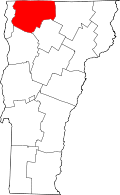 | |
| Towns | ||
| Villages | ||
| CDP | ||
| Unincorporated communities | ||