Fairfield, Kentucky
| Fairfield, Kentucky | |
|---|---|
| City | |
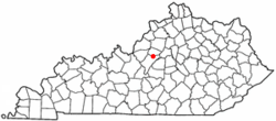 Location of Fairfield, Kentucky | |
| Coordinates: 37°55′57″N 85°22′55″W / 37.93250°N 85.38194°WCoordinates: 37°55′57″N 85°22′55″W / 37.93250°N 85.38194°W | |
| Country | United States |
| State | Kentucky |
| County | Nelson |
| Area | |
| • Total | 0.3 sq mi (0.8 km2) |
| • Land | 0.3 sq mi (0.8 km2) |
| • Water | 0.0 sq mi (0.0 km2) |
| Elevation | 719 ft (219 m) |
| Population (2000) | |
| • Total | 72 |
| • Density | 248.3/sq mi (95.9/km2) |
| Time zone | Eastern (EST) (UTC-5) |
| • Summer (DST) | EDT (UTC-4) |
| ZIP code | 40020 |
| Area code(s) | 502 |
| FIPS code | 21-26020 |
| GNIS feature ID | 0491876 |
Fairfield is a 6th-class city in Nelson County, Kentucky, in the United States. The population was 72 at the 2000 census.
History
Fairfield was originally known as Turkey Town.[1]
Fairfield was established by the state assembly in 1818 and incorporated as a city in 1870.[1]
Geography
Fairfield is located at 37°55′57″N 85°22′55″W / 37.93250°N 85.38194°W (37.932437, -85.381935).[2]
According to the United States Census Bureau, the city has a total area of 0.3 square miles (0.78 km2), o which 0.3 square miles (0.78 km2) is land and 3.33% is water.
Demographics
| Historical population | |||
|---|---|---|---|
| Census | Pop. | %± | |
| 1870 | 167 | — | |
| 1900 | 206 | — | |
| 1910 | 292 | 41.7% | |
| 1920 | 329 | 12.7% | |
| 1930 | 148 | −55.0% | |
| 1950 | 202 | — | |
| 1960 | 290 | 43.6% | |
| 1970 | 163 | −43.8% | |
| 1980 | 169 | 3.7% | |
| 1990 | 142 | −16.0% | |
| 2000 | 72 | −49.3% | |
| 2010 | 113 | 56.9% | |
| Est. 2015 | 114 | [3] | 0.9% |
As of the census[5] of 2000, there were 72 people, 27 households, and 23 families residing in the city. The population density was 248.3 people per square mile (95.9/km²). There were 32 housing units at an average density of 110.3 per square mile (42.6/km²). The racial makeup of the city was 88.89% White and 11.11% African American.
There were 27 households out of which 40.7% had children under the age of 18 living with them, 59.3% were married couples living together, 25.9% had a female householder with no husband present, and 14.8% were non-families. 14.8% of all households were made up of individuals and 7.4% had someone living alone who was 65 years of age or older. The average household size was 2.63 and the average family size was 2.83.
In the city the population was spread out with 25.0% under the age of 18, 8.3% from 18 to 24, 31.9% from 25 to 44, 20.8% from 45 to 64, and 13.9% who were 65 years of age or older. The median age was 40 years. For every 100 females there were 89.5 males. For every 100 females age 18 and over, there were 86.2 males.
The median income for a household in the city was $19,375, and the median income for a family was $26,250. Males had a median income of $58,750 versus $0 for females. The per capita income for the city was $17,181. None of the population and none of the families were below the poverty line.
References
- 1 2 Commonwealth of Kentucky. Office of the Secretary of State. Land Office. "Fairfield, Kentucky". Accessed 25 Jul 2013.
- ↑ "US Gazetteer files: 2010, 2000, and 1990". United States Census Bureau. 2011-02-12. Retrieved 2011-04-23.
- ↑ "Annual Estimates of the Resident Population for Incorporated Places: April 1, 2010 to July 1, 2015". Retrieved July 2, 2016.
- ↑ "Census of Population and Housing". Census.gov. Retrieved June 4, 2015.
- ↑ "American FactFinder". United States Census Bureau. Retrieved 2008-01-31.
Municipalities and communities of Nelson County, Kentucky, United States | ||
|---|---|---|
| Cities |  | |
| CDPs |
| |
| Other unincorporated communities | ||