Fiery Fork Conservation Area
| Fiery Fork Conservation Area | |
|---|---|
|
IUCN category IV (habitat/species management area) | |
|
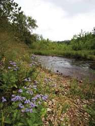
The Little Niangua River running through Fiery Fork | |
 | |
| Location | Camden County, Missouri, USA |
| Nearest city | Camdenton, MO |
| Coordinates | 38°05′17″N 92°57′22″W / 38.088056°N 92.956111°WCoordinates: 38°05′17″N 92°57′22″W / 38.088056°N 92.956111°W |
| Area | 1,606 acres (6.5 km2) |
| Governing body | Missouri Department of Conservation |
| Official website | |
Fiery Fork Conservation Area is a public area in Camden County, Missouri, along the Little Niangua River. It is 1,606 acres (6.50 km2) large. It is mostly wooded with oak trees and some open space. The park includes a small campground, fishing, hiking, hunting, wildlife viewing, and small-boat access to the Little Niangua River.
References
- Fiery Fork Conservation Area, Missouri Department of Conservation.
External links
- http://mdc.mo.gov/documents/area_brochures/8103map.pdf - for a pdf file of a map
This article is issued from Wikipedia - version of the 11/19/2016. The text is available under the Creative Commons Attribution/Share Alike but additional terms may apply for the media files.