Lake of the Ozarks State Park
| Lake of the Ozarks State Park | |
| Missouri State Park | |
 Party Cove in 2007 | |
| Country | United States |
|---|---|
| State | Missouri |
| Counties | Camden, Miller |
| Elevation | 771 ft (235 m) [1] |
| Coordinates | 38°05′53″N 92°37′01″W / 38.09806°N 92.61694°WCoordinates: 38°05′53″N 92°37′01″W / 38.09806°N 92.61694°W [1] |
| Area | 17,626.55 acres (7,133 ha) [2] |
| Established | 1946 |
| Management | Missouri Department of Natural Resources |
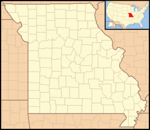 Location in Missouri | |
| Website: Lake of the Ozarks State Park | |
Lake of the Ozarks State Park is a Missouri state park on the Grand Glaize Arm of the Lake of the Ozarks and is the largest state park in the state.[3] Originally owned by the United States National Park Service as part of the Recreational Demonstration Areas when the lake was built in the 1930s, it was donated to the state after World War II.[3][2]
The park includes 85 miles (137 km) of shoreline on the lake (which has a total of 1,150 miles (1,850 km) of shoreline—mostly privately owned); two swimming beaches with imported sand, 12 trails, the Ozark Caverns, a boat launch, and the Lee C. Fine Memorial Airport which has a 6,500-foot (2,000 m) runway. In addition there are campsites and cabins within the park.
One of the most famous aspects of the park is Party Cove which is a rowdy gathering spot that has been featured on the Playboy Channel and the front page of the New York Times Travel Section.
National Register of Historic Places
The following buildings and national historic districts were individually listed on the National Register of Historic Places in 1985. They are also included in the Emergency Conservation Work (E.C.W.) Architecture in Missouri State Parks, 1933-1942, Thematic Resources.[4]
- Barn/Garage in Kaiser Area (NRIS 85000523)[4]
- Camp Clover Point Recreation Hall (NRIS 85000502)[4]
- Camp Hawthorne Central Area District (NRIS 85000526)[4]
- Camp Pin Oak Historic District (NRIS 85001477)[4]
- Camp Rising Sun Recreation Hall (NRIS 85000503)
- Highway 134 Historic District (NRIS 85000533) - This historic district encompasses 17 contributing buildings and 80 contributing structures originally constructed by the Civilian Conservation Corps between 1934 and 1942. They include several notable log structures, including a small shelter at the park entrance, the park office, the old pumphouse, and a rest room in the main picnic area.[5]
- Pin Oak Hollow Bridge (NRIS 85002737)[4]
- Rising Sun Shelter (NRIS 85000524)[4]
- Shelter at McCubbin Point (NRIS 85000525)[4]
References
- 1 2 "Lake of the Ozarks State Park". Geographic Names Information System. United States Geological Survey.
- 1 2 "State parks...estimated acres" (PDF). Revised Statewide Comprehensive Outdoor Recreation Plan: 2008-2012. Missouri Department of Natural Resources. pp. 142–143. Retrieved September 9, 2014.
- 1 2 "Lake of the Ozarks State Park". Missouri State Parks. Missouri Department of Natural Resources. Retrieved September 9, 2014.
- 1 2 3 4 5 6 7 8 National Park Service (2010-07-09). "National Register Information System". National Register of Historic Places. National Park Service.
- ↑ Bonnie Wright (n.d.). "National Register of Historic Places Inventory Nomination Form: Highway 134 Historic District" (PDF). Missouri Department of Natural Resources. Retrieved 2016-09-01.
External links
- Lake of the Ozarks State Park Missouri Department of Natural Resources