Florida's 14th congressional district
| Florida's 14th congressional district | ||
|---|---|---|
.tif.png) | ||
| Current Representative | Kathy Castor (D–Tampa) | |
| Cook PVI | D+11 | |
Florida's 14th congressional district is an electoral district for the U.S. Congress and was reassigned in 2012, effective January 2013, to western Hillsborough County, Florida and Manatee County.[1][2] The district includes downtown St. Petersburg and most of Tampa.
The former 14th district, in 2003–2012, was located in the Gulf Coast region in Southwestern Florida and included all of Lee County and portions of Charlotte and Collier counties. Fort Myers, Naples, Cape Coral and part of Port Charlotte were located in the district.
The district is currently represented by Democrat Kathy Castor.
Presidential elections
| Year | Results |
|---|---|
| 2000 | George W. Bush 60 - Al Gore 38% |
| 2004 | George W. Bush 61 - John Kerry 38% |
| 2008 | John McCain 57 - Barack Obama 42% |
| 2012 | Barack Obama 65 - Mitt Romney 34% |
List of representatives
The district was created in 1973.
| Representative | Party | Years | District home | Notes |
|---|---|---|---|---|
 Claude Pepper Claude Pepper | Democratic | January 3, 1973 – January 3, 1983 | Redistricted from the 11th district Redistricted to the 18th district | |
 Daniel A. Mica Daniel A. Mica | Democratic | January 3, 1983 – January 3, 1989 | Redistricted from the 11th district Retired in an unsuccessful run for United States Senate | |
 Harry Johnston Harry Johnston | Democratic | January 3, 1989 – January 3, 1993 | Redistricted to the 19th district | |
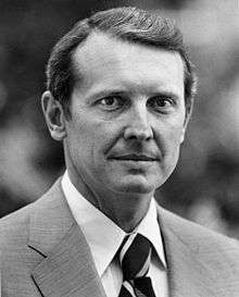
| | Republican | January 3, 1993 – September 23, 2004 | Redistricted from the 13th district Resigned to become Director of the Central Intelligence Agency | |
| Vacant | September 23, 2004 – January 3, 2005 | |||
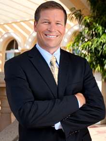
 Connie Mack IV Connie Mack IV | Republican | January 3, 2005 – January 3, 2013 | Retired to run for the US Senate | |
 Kathy Castor Kathy Castor | Democratic | January 3, 2013 – present | Redistricted from the 11th district | |
Election Results
2002
| Party | Candidate | Votes | % | |
|---|---|---|---|---|
| Republican | Porter J. Goss* | 232,566 | 100.00 | |
| Total votes | 232,566 | 100.00 | ||
| Voter turnout | 100.00% | |||
| Republican hold | ||||
2004
| Party | Candidate | Votes | % | |
|---|---|---|---|---|
| Republican | Connie Mack IV | 226,662 | 67.59 | |
| Democratic | Robert M. Neeld | 108,672 | 32.41 | |
| Total votes | 335,334 | 100.00 | ||
| Voter turnout | % | |||
| Republican hold | ||||
2006
| Party | Candidate | Votes | % | |
|---|---|---|---|---|
| Republican | Connie Mack IV* | 151,615 | 64.37 | |
| Democratic | Robert M. Neeld | 83,920 | 35.63 | |
| Total votes | 235,535 | 100.00 | ||
| Voter turnout | % | |||
| Republican hold | ||||
2008
| Party | Candidate | Votes | % | |
|---|---|---|---|---|
| Republican | Connie Mack IV* | 224,602 | 59.44 | |
| Democratic | Robert M. Neeld | 93,590 | 24.77 | |
| Independent | Burt Saunders | 54,750 | 14.49 | |
| Independent | Jeff George | 4,949 | 1.31 | |
| Total votes | 377,891 | 100.00 | ||
| Voter turnout | % | |||
| Republican hold | ||||
2010
| Party | Candidate | Votes | % | |
|---|---|---|---|---|
| Republican | Connie Mack IV* | 188,341 | 68.57 | |
| Democratic | James Lloyd Roach | 74,525 | 27.13 | |
| Independent | William Maverick St. Claire | 11,825 | 4.31 | |
| Total votes | 274,691 | 100.00 | ||
| Voter turnout | % | |||
| Republican hold | ||||
Living former Members of the U.S. House of Representatives from Florida's 14th congressional district
As of May 2015, there are three former members of the U.S. House of Representatives from Florida's 14th congressional district who are currently living at this time.
| Representative | Term of office | Date of birth (and age) |
|---|---|---|
| Harry Johnston | 1989–1993 | December 2, 1931 |
| Porter Goss | 1993–2004 | November 26, 1938 |
| Connie Mack IV | 2005–2013 | August 12, 1967 |
Historical district boundaries

References
- ↑ See whole Florida state map for 2013, with the 14th district covering Sumter County, Hernando to Marion County: h9047_35x42L.pdf Congressional Plan: H000C9047. Chapter No. 2012-2, Laws of Florida. www.flsenate.gov. February 16, 2012.
- ↑ See 2013 borders of 14th district in the 2013 districts map: H000C9047_map_bb.pdf, for the Big Bend region of Florida. Congressional Plan: H000C9047. Chapter No. 2012-2, Laws of Florida. www.flsenate.gov. February 2012.
- Martis, Kenneth C. (1989). The Historical Atlas of Political Parties in the United States Congress. New York: Macmillan Publishing Company.
- Martis, Kenneth C. (1982). The Historical Atlas of United States Congressional Districts. New York: Macmillan Publishing Company.
- Congressional Biographical Directory of the United States 1774–present
Coordinates: 27°50′01″N 82°30′46″W / 27.83361°N 82.51278°W