Flushing Township, Belmont County, Ohio
| Flushing Township, Belmont County, Ohio | |
|---|---|
| Township | |
|
Rock Hill Baptist Church (1845), on County Road 72 | |
 Location of Flushing Township in Belmont County | |
| Coordinates: 40°8′51″N 81°6′46″W / 40.14750°N 81.11278°WCoordinates: 40°8′51″N 81°6′46″W / 40.14750°N 81.11278°W | |
| Country | United States |
| State | Ohio |
| County | Belmont |
| Area | |
| • Total | 31.0 sq mi (80.2 km2) |
| • Land | 28.0 sq mi (72.5 km2) |
| • Water | 3.0 sq mi (7.7 km2) |
| Elevation[1] | 1,060 ft (323 m) |
| Population (2010) | |
| • Total | 2,021 |
| • Density | 72/sq mi (27.9/km2) |
| Time zone | Eastern (EST) (UTC-5) |
| • Summer (DST) | EDT (UTC-4) |
| ZIP code | 43977 |
| Area code(s) | 740 |
| FIPS code | 39-27566[2] |
| GNIS feature ID | 1085777[1] |

Flushing Township is one of the sixteen townships of Belmont County, Ohio, United States. The 2010 census found 2,021 people in the township,[3] of which 804 lived in unincorporated portions of the township.
Geography
Located in the northwestern corner of the county, it borders the following townships:
- Moorefield Township, Harrison County - north
- Athens Township, Harrison County - northeast
- Wheeling Township - east
- Union Township - southeast
- Kirkwood Township - south
- Londonderry Township, Guernsey County - west
- Freeport Township, Harrison County - northwest
Two villages are located in Flushing Township: Flushing in the east, and Holloway in the north.
Name and history
It is the only Flushing Township statewide.[4]
Flushing Township was organized in 1817.[5] Flushing Township was originally settled chiefly by Quakers.[6]
Government
The township is governed by a three-member board of trustees, who are elected in November of odd-numbered years to a four-year term beginning on the following January 1. Two are elected in the year after the presidential election and one is elected in the year before it. There is also an elected township fiscal officer,[7] who serves a four-year term beginning on April 1 of the year after the election, which is held in November of the year before the presidential election. Vacancies in the fiscal officership or on the board of trustees are filled by the remaining trustees.
References
- 1 2 "US Board on Geographic Names". United States Geological Survey. 2007-10-25. Retrieved 2008-01-31.
- ↑ "American FactFinder". United States Census Bureau. Retrieved 2008-01-31.
- ↑ "Geographic Identifiers: 2010 Demographic Profile Data (G001): Flushing township, Belmont County, Ohio". U.S. Census Bureau, American Factfinder. Retrieved February 18, 2014.
- ↑ "Detailed map of Ohio" (PDF). United States Census Bureau. 2000. Retrieved 2007-02-16.
- ↑ McKelvey, A. T. (1903). Centennial History of Belmont County, Ohio, and Representative Citizens. Biographical Publishing Company. p. 272.
- ↑ Kilbourn, John (1833). "The Ohio Gazetteer, or, a Topographical Dictionary". Scott and Wright. p. 196. Retrieved 12 December 2013.
- ↑ §503.24, §505.01, and §507.01 of the Ohio Revised Code. Accessed 4/30/2009.
External links
Municipalities and communities of Belmont County, Ohio, United States | ||
|---|---|---|
| Cities | 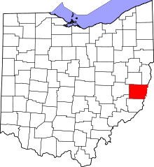 | |
| Villages | ||
| Townships | ||
| CDPs | ||
| Unincorporated communities |
| |
| Ghost town | ||
| Footnotes | ‡This populated place also has portions in an adjacent county or counties | |