Foothill Farms, California
| Foothill Farms | |
|---|---|
| census-designated place | |
 Location in Sacramento County and the state of California | |
| Coordinates: 38°40.9′N 121°20.9′W / 38.6817°N 121.3483°WCoordinates: 38°40.9′N 121°20.9′W / 38.6817°N 121.3483°W | |
| Country |
|
| State |
|
| County | Sacramento |
| Area[1] | |
| • Total | 4.198 sq mi (10.873 km2) |
| • Land | 4.198 sq mi (10.873 km2) |
| • Water | 0 sq mi (0 km2) 0% |
| Elevation | 135 ft (41 m) |
| Population (2010) | |
| • Total | 33,121 |
| • Density | 7,900/sq mi (3,000/km2) |
| Time zone | PST (UTC-8) |
| • Summer (DST) | PDT (UTC-7) |
| ZIP code | 95841,95842 |
| Area code(s) | 916 |
| FIPS code | 06-24722 |
| GNIS feature ID | 0277517 |
Foothill Farms is a census-designated place (CDP) and unincorporated community in Sacramento County, California, USA. It is part of the Sacramento–Arden-Arcade–Roseville Metropolitan Statistical Area. The population was 33,121 at the 2010 census, up from 17,426 at the 2000 census. Foothill Farms is part of the greater North Highlands-Foothill Farms community, and comprises the zip codes 95841 and 95842.
Geography
Foothill Farms is located at 38°40.9′N 121°20.9′W / 38.6817°N 121.3483°W (38.6817, -121.3478).[2]
According to the United States Census Bureau, the CDP has a total area of 4.2 square miles (11 km2), all of it land.
Demographics
2010
The 2010 United States Census[3] reported that Foothill Farms had a population of 33,121. The population density was 7,889.8 people per square mile (3,046.3/km²). The racial makeup of Foothill Farms was 21,249 (64.2%) White, 4,002 (12.8 %) African American, 357 (1.1%) Native American, 1,731 (5.2%) Asian, 208 (0.6%) Pacific Islander, 3,362 (10.2%) from other races, and 2,586 (7.8%) from two or more races. Hispanic or Latino of any race were 7,579 persons (22.9%).
The Census reported that 33,072 people (99.9% of the population) lived in households, 33 (0.1%) lived in non-institutionalized group quarters, and 16 (0%) were institutionalized.
There were 11,726 households, out of which 4,768 (40.7%) had children under the age of 18 living in them, 5,073 (43.3%) were opposite-sex married couples living together, 2,276 (19.4%) had a female householder with no husband present, 869 (7.4%) had a male householder with no wife present. There were 1,056 (9.0%) unmarried opposite-sex partnerships, and 88 (0.8%) same-sex married couples or partnerships. 2,575 households (22.0%) were made up of individuals and 667 (5.7%) had someone living alone who was 65 years of age or older. The average household size was 2.82. There were 8,218 families (70.1% of all households); the average family size was 3.29.
The population was spread out with 9,219 people (27.8%) under the age of 18, 3,803 people (11.5%) aged 18 to 24, 9,592 people (29.0%) aged 25 to 44, 7,642 people (23.1%) aged 45 to 64, and 2,865 people (8.7%) who were 65 years of age or older. The median age was 31.1 years. For every 100 females there were 95.3 males. For every 100 females age 18 and over, there were 90.6 males.
There were 12,607 housing units at an average density of 3,003.1 per square mile (1,159.5/km²), of which 6,297 (53.7%) were owner-occupied, and 5,429 (46.3%) were occupied by renters. The homeowner vacancy rate was 2.6%; the rental vacancy rate was 7.2%. 16,582 people (50.1% of the population) lived in owner-occupied housing units and 16,490 people (49.8%) lived in rental housing units.
2000
As of the census[4] of 2000, there were 17,426 people, 6,563 households, and 4,462 families residing in the CDP. The population density was 7,528.2 people per square mile (2,912.6/km²). There were 6,830 housing units at an average density of 2,950.6 per square mile (1,141.6/km²). The racial makeup of the CDP was 69.79% White, 12.37% African American, 1.33% Native American, 4.34% Asian, 0.53% Pacific Islander, 5.88% from other races, and 5.76% from two or more races. Hispanic or Latino of any race were 14.48% of the population.
There were 6,563 households out of which 36.3% had children under the age of 18 living with them, 42.1% were married couples living together, 18.7% had a female householder with no husband present, and 32.0% were non-families. 24.2% of all households were made up of individuals and 6.6% had someone living alone who was 65 years of age or older. The average household size was 2.65 and the average family size was 3.13.
In the CDP the population was spread out with 29.1% under the age of 18, 11.6% from 18 to 24, 30.3% from 25 to 44, 19.1% from 45 to 64, and 10.0% who were 65 years of age or older. The median age was 31 years. For every 100 females there were 93.7 males. For every 100 females age 18 and over, there were 89.7 males.
The median income for a household in the CDP was $38,049, and the median income for a family was $41,582. Males had a median income of $31,032 versus $26,414 for females. The per capita income for the CDP was $16,358. About 9.9% of families and 12.8% of the population were below the poverty line, including 17.9% of those under age 18 and 3.9% of those age 65 or over.
Politics
In the California State Legislature, Foothill Farms is in the 4th Senate District, represented by Republican Jim Nielsen, and the 8th Assembly District, represented by Democrat Ken Cooley.[5]
In the United States House of Representatives, Foothill Farms is in California's 6th congressional district.[6]
Both Old and New Foothill Farms is represented by Republican Susan Peters on the Sacramento County Board of Supervisors
Twin Rivers Unified School District area 1 (Old Foothill Farms) is represented by Democrat Michael Baker. Twin River Unified School District Area 2 (New Foothill Farms) is represented by Republican Michelle Revis.
Adjacent areas
 |
Antelope | Antelope | Citrus Heights | |
| North Highlands | |
Citrus Heights | ||
| ||||
| | ||||
| North Highlands | North Highlands | Carmichael |
References
- ↑ U.S. Census
- ↑ "US Gazetteer files: 2010, 2000, and 1990". United States Census Bureau. 2011-02-12. Retrieved 2011-04-23.
- ↑ "2010 Census Interactive Population Search: CA - Foothill Farms CDP". U.S. Census Bureau. Retrieved July 12, 2014.
- ↑ "American FactFinder". United States Census Bureau. Retrieved 2008-01-31.
- ↑ "Statewide Database". UC Regents. Retrieved January 4, 2015.
- ↑ "California's 6th Congressional District - Representatives & District Map". GovTrack.us. Retrieved February 28, 2013.
Municipalities and communities of Sacramento County, California, United States | ||
|---|---|---|
| Cities | 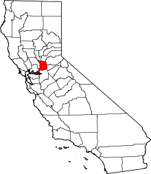 | |
| CDPs | ||
| Unincorporated communities | ||
| Ghost towns | ||