Grass Valley, California
| City of Grass Valley | |
|---|---|
| City | |
|
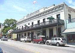
The historic Holbrooke Hotel and Restaurant | |
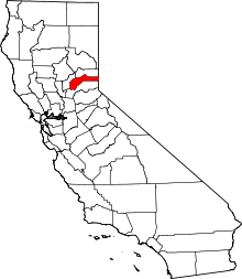
 Location in Nevada County and the state of California | |
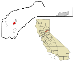
 City of Grass Valley Location in the United States | |
| Coordinates: 39°13′9″N 121°3′30″W / 39.21917°N 121.05833°WCoordinates: 39°13′9″N 121°3′30″W / 39.21917°N 121.05833°W | |
| Country | United States |
| State | California |
| County | Nevada |
| Incorporated | March 13, 1893[1] |
| Area[2] | |
| • Total | 4.743 sq mi (12.285 km2) |
| • Land | 4.743 sq mi (12.285 km2) |
| • Water | 0 sq mi (0 km2) 0% |
| Elevation[3] | 2,411 ft (735 m) |
| Population (2010) | |
| • Total | 12,860 |
| • Density | 2,700/sq mi (1,000/km2) |
| Time zone | Pacific (PST) (UTC-8) |
| • Summer (DST) | PDT (UTC-7) |
| ZIP codes | 95945, 95949 |
| Area code | 530 |
| FIPS code | 06-30798 |
| GNIS feature IDs | 277525, 2410651 |
| Website |
www |
The city of Grass Valley is the largest city in the western region of Nevada County, California, United States. Situated at roughly 2,500 feet (760 m) elevation in the western foothills of the Sierra Nevada mountain range, this historic northern Gold Country city is located 57 miles (92 km) by car from the state capitol in Sacramento, 64 miles (103 km) from Sacramento International Airport, 88 miles (142 km) west of Reno, Nevada, and 177 miles (285 km) northeast of San Jose, California. As of the 2010 United States Census, its population was 12,860.
History
Grass Valley, which was originally known as Boston Ravine and later officially named Centerville, dates from the California Gold Rush, as does nearby Nevada City. When a post office was established in 1851, it was renamed Grass Valley the following year for unknown reasons. The town incorporated in 1860.[4]
Grass Valley is the location of the Empire Mine and North Star Mine, two of the richest mines in California. George Starr, manager of the Empire Mine, and William Bowers Bourn II, the mine owner, donated mine property which became Memorial Park.[5]:42
Many of those who came to settle in Grass Valley were tin miners from Cornwall, England. They were attracted to the California gold fields because the same skills needed for deep tin mining were needed for hardrock (deep) gold mining. Many of them specialized in pumping the water out of very deep mining shafts. This followed the disastrous fall in tin prices as large alluvial deposits began to be exploited elsewhere.
Grass Valley still holds on to its Cornish heritage, with events such as its annual Cornish Christmas and St Piran's Day celebrations.[6] Pasties are a local favorite dish with a few restaurants in town specializing in recipes handed down from the original immigrant generation. Grass Valley is also twinned with the Cornish town of Bodmin, UK.
There was formerly a Roman Catholic diocese of Grass Valley.[7]
Geography
Grass Valley is located at 39°13′9″N 121°3′30″W / 39.21917°N 121.05833°W (39.219215, -121.058414).[8]
According to the United States Census Bureau, the city has a total area of 4.7 square miles (12 km2), all of it land.
A variety of igneous and metamorphic rock supports Grass Valley. Granitic rock such as quartz diorite underlies the downtown core and extends south along Highway 49. Metavolcanic rock and diabase underlie areas around the granitic zone. Neighborhoods around Nevada County Golf Course and Sierra Nevada Memorial Hospital are underlain by ultramafic rock[9] which supports infertile soils of the Dubakella series. Here the vegetation is not as luxuriant as one would expect from the high average annual precipitation, and forested areas are often dominated by several species of oaks and the crooked, thin-crowned gray pine.[10] Straight, dense ponderosa pine inhabitants the more fertile soils which include Musick series on granitic rock and Sites series on mafic or metamorphic rock.[11][12] [13]
Climate
Grass Valley has a hot-summer Mediterranean climate (Köppen Csa) with warm to hot, dry summers and wet, cool, rainy winters. Summer is very dry, but thunderstorms may occur. The winter rains contribute to a heavy fuel-loading of brush and grass, which dry out during the summer, posing a wildfire hazard. Snow occurs at times.
Over the course of a year, 34.7 days of 90 °F (32 °C) or hotter and 1.2 days of 100 °F (38 °C) or hotter occur, with 69.0 days of 32 °F (0 °C) or colder.[14]
| Climate data for Grass Valley, California (elevation 2,400ft) | |||||||||||||
|---|---|---|---|---|---|---|---|---|---|---|---|---|---|
| Month | Jan | Feb | Mar | Apr | May | Jun | Jul | Aug | Sep | Oct | Nov | Dec | Year |
| Record high °F (°C) | 77 (25) |
81 (27) |
81 (27) |
88 (31) |
99 (37) |
100 (38) |
108 (42) |
108 (42) |
104 (40) |
97 (36) |
87 (31) |
80 (27) |
108 (42) |
| Average high °F (°C) | 53.5 (11.9) |
55.2 (12.9) |
57.5 (14.2) |
62.1 (16.7) |
71.0 (21.7) |
79.5 (26.4) |
87.4 (30.8) |
87.1 (30.6) |
82.2 (27.9) |
72.1 (22.3) |
59.6 (15.3) |
53.1 (11.7) |
68.3 (20.2) |
| Average low °F (°C) | 32.0 (0) |
33.6 (0.9) |
36.0 (2.2) |
38.8 (3.8) |
45.4 (7.4) |
51.3 (10.7) |
56.2 (13.4) |
55.0 (12.8) |
50.5 (10.3) |
42.9 (6.1) |
36.2 (2.3) |
31.7 (−0.2) |
42.5 (5.8) |
| Record low °F (°C) | 15 (−9) |
9 (−13) |
19 (−7) |
26 (−3) |
27 (−3) |
36 (2) |
40 (4) |
41 (5) |
35 (2) |
27 (−3) |
19 (−7) |
3 (−16) |
3 (−16) |
| Average precipitation inches (mm) | 9.69 (246.1) |
8.56 (217.4) |
8.32 (211.3) |
4.02 (102.1) |
1.97 (50) |
0.68 (17.3) |
0.12 (3) |
0.21 (5.3) |
0.79 (20.1) |
2.70 (68.6) |
6.73 (170.9) |
9.46 (240.3) |
53.26 (1,352.8) |
| Average snowfall inches (cm) | 2.2 (5.6) |
2.5 (6.4) |
2.4 (6.1) |
0.8 (2) |
0 (0) |
0 (0) |
0 (0) |
0 (0) |
0 (0) |
0 (0) |
0.3 (0.8) |
1.9 (4.8) |
10.0 (25.4) |
| Average precipitation days (≥ 0.01 in) | 13.1 | 12.1 | 11.9 | 8.4 | 5.5 | 2.7 | 0.2 | 0.9 | 2.2 | 5.0 | 10.0 | 12.6 | 84.6 |
| Average snowy days (≥ 0.1 in) | 0.4 | 1.0 | 1.1 | 0.2 | 0 | 0 | 0 | 0 | 0 | 0 | 0.1 | 0.6 | 3.4 |
| Source #1: NOAA [15] | |||||||||||||
| Source #2: WRCC [16] | |||||||||||||
Demographics
| Historical population | |||
|---|---|---|---|
| Census | Pop. | %± | |
| 1900 | 4,719 | — | |
| 1910 | 4,520 | −4.2% | |
| 1920 | 4,006 | −11.4% | |
| 1930 | 3,817 | −4.7% | |
| 1940 | 5,701 | 49.4% | |
| 1950 | 5,283 | −7.3% | |
| 1960 | 4,876 | −7.7% | |
| 1970 | 5,149 | 5.6% | |
| 1980 | 6,697 | 30.1% | |
| 1990 | 9,048 | 35.1% | |
| 2000 | 10,922 | 20.7% | |
| 2010 | 12,860 | 17.7% | |
| Est. 2015 | 12,944 | [17] | 0.7% |

2010
The 2010 United States Census[19] reported that Grass Valley had a population of 12,860. The population density was 2,711.3 people per square mile (1,046.8/km²). The racial makeup of Grass Valley was 11,493 (89.4%) White, 208 (1.6%) Native American, 188 (1.5%) Asian, 46 (0.4%) African American, 9 (0.1%) Pacific Islander, 419 (3.3%) from other races, and 497 (3.9%) from two or more races. Hispanics or Latinos of any race were 1,341 persons (10.4%).
The census reported that 12,401 people (96.4% of the population) lived in households, 118 (0.9%) lived in noninstitutionalized group quarters, and 341 (2.7%) were institutionalized.
Of the 6,077 households, 1,544 (25.4%) had children under the age of 18 living in them, 1,665 (27.4%) were opposite-sex married couples living together, 980 (16.1%) had a female householder with no husband present, and 316 (5.2%) had a male householder with no wife present, 466 (7.7%) wereunmarried opposite-sex partnerships, and 33 (0.5%) were same-sex married couples or partnerships. About 2,605 households (42.9%) were made up of individuals and 1,415 (23.3%) had someone living alone who was 65 years of age or older. The average household size was 2.04. The 2,961 families (48.7% of all households) had an average family size of 2.78.
The population was distributed as 2,625 people (20.4%) under the age of 18, 1,146 people (8.9%) aged 18 to 24, 2,882 people (22.4%) aged 25 to 44, 3,183 people (24.8%) aged 45 to 64, and 3,024 people (23.5%) who were 65 years of age or older. The median age was 43.2 years. For every 100 females, there were 78.9 males. For every 100 females age 18 and over, there were 73.5 males.
The 6,637 housing units averaged 1,399.3 per square mile (540.3/km²), of which 2,391 (39.3%) were owner-occupied, and 3,686 (60.7%) were occupied by renters. The homeowner vacancy rate was 4.0%; the rental vacancy rate was 6.7%; 4,663 people (36.3% of the population) lived in owner-occupied housing units and 7,738 people (60.2%) lived in rental housing units.
2000
As of the census[20] of 2000, 10,922 people, 5,016 households, and 2,678 families resided in the city. The population density was 2,660.2 people per square mile (1,026.0/km²).
Of the 5,016 households, 26.5% had children under the age of 18 living with them, 32.4% were married couples living together, 16.3% had a female householder with no husband present, and 46.6% were not families. About 39.1% of all households were made up of individuals, and 20.3% had someone living alone who was 65 years of age or older. The average household size was 2.13 and the average family size was 2.80 people.
The median income for a household in the city was $28,182, and for a family was $33,220. Males had a median income of $32,568 versus $21,915 for females. The per capita income for the city was $16,877. About 12.9% of families and 14.9% of the population were below the poverty line, including 20.0% of those under age 18 and 6.3% of those age 65 or over.
Government
Grass Valley has been a charter city since it was incorporated in 1893. It uses a council-manager form of government.[21]
State and federal representation
In the California State Legislature, Grass Valley is in the 1st Senate District, represented by Republican Ted Gaines,[22] and the 1st Assembly District, represented by Republican Brian Dahle.[23]
In the United States House of Representatives, Grass Valley is in California's 1st congressional district, represented by Republican Doug LaMalfa.[24]
Economy
The combined communities of Grass Valley and Nevada City have a fairly diversified economy. The gold rush days left a historical legacy and today, tourism and the related services sector are considered to constitute the bulk of the local economy.[25] Many of those who do not commute to the Sacramento Valley, work locally in retail, wholesale, trade, engineering, manufacturing, construction, and other businesses, as well in various levels of local and state government. A significant number of high-tech electronics companies are in the area.
Another significant sector of the local economy is the agriculture industry, as the soil in Nevada County is considered to be quite fertile. Around the time the areas were being settled during the Gold Rush, farmers planted orchards, vegetables, and other produce as ranchers brought in cattle, sheep, and other livestock. While the percentage of land dedicated to agriculture has significantly decreased over the last few decades, agriculture continues to be an important aspect of the area’s economy including local produce and organic agricultural products. During the past decade, Nevada County has become known for its growing wine industry.[25]
Commercial employers in Grass Valley include Raley's, Safeway, K-Mart, Starbucks, GNC, Jamba Juice, JC Penney, and BriarPatch, as well as fast-food chain restaurants. Other major employers include Nevada Union High School, Nevada Irrigation District, Sierra Nevada Memorial Hospital, and other various faith-related entities.[26]
The Grass Valley Group is a research and development company founded in the city in 1958.[27]
Education
Higher education
- Nevada County Campus of Sierra College
Public primary and secondary schools
- Bitney College Prep Charter High School
- Grass Valley Charter School
- Lyman Gilmore Middle School
- Nevada Union High School
- Scotten Elementary School
- Union Hill Middle School
- William and Marian Ghidotti Early College High School
- Bear River High School
- Magnolia Intermediate School
- Cottage Hill Elementary School
- Pleasant Ridge Elementary School
- Sierra Academy of Expeditionary Learning
- Yuba River Charter School
Public libraries
Transportation
Grass Valley is at the intersection of State Route 49 and State Route 20. Public transportation is served by the Gold Country Stage and is limited to the urban areas.
Designated historical landmarks

- Empire Mine State Historic Park (CHL#298)
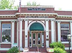
- Grass Valley Public Library (NRHP#92000267)
- Holbrooke Hotel (CHL#914)
- Home of Lola Montez (CHL#292)
- Home of Lotta Crabtree (CHL#293)
- Lyman Gilmore Middle School
- Mount Saint Mary's Convent and Academy (CHL#855)
- North Star Mine Powerhouse (CHL#843)
- Overland Emigrant Trail (CHL#799)
- Site of the First Discoveries of Quartz Gold in California (CHL#297)
Sister cities
Grass Valley has two sister cities:[28]
Notable people
- Gallant Bess, a horse rescued by a U.S. Navy sailor during World War II
- Hunter Burgan, musician
- John Cardiel, professional skateboarder
- Lotta Crabtree, 19th century actress
- Pete Daley, baseball player
- Jonathan Dayton, film director
- Alonzo Delano, first city treasurer
- Matt DiBenedetto, NASCAR driver
- Brodie Farber, professional fighter
- Lyman Gilmore, historically significant pilot
- Fred Hargesheimer, World War II pilot, philanthropist
- John Flint Kidder, builder, historically significant railroad owner
- Sarah Kidder, historically significant railroad owner
- Mark Meckler, political activist
- Lola Montez, 19th century dancer
- Hans Ostrom, writer and professor
- Jim Pagliaroni, professional baseball player[29][30]
- Mike Pinder, music artist
- Charles H. Prisk, newspaper editor-publisher
- William F. Prisk, State Senator, newspaper editor-publisher
- Chuck Ragan, American singer, songwriter, and guitarist
- Dennis Richmond, news anchor
- John Rollin Ridge, writer
- Clint Ritchie, actor
- Tim Rossovich, professional football player, actor
- Richard Roundtree, actor
- Josiah Royce, philosopher
- Gabe Ruediger, professional fighter
- Chris Senn, professional skateboarder
- Jeremy Sisto, actor
- Meadow Sisto, actress
- Wallace Stegner, author
- J. Christopher Stevens, assassinated U.S. ambassador to Libya, was born in Grass Valley[31]
- Clint Walker, actor
- William Watt, miner, State Senator, UC Regent
- Chuck Yeager, first pilot to break the sound barrier
See also
References
- ↑ "California Cities by Incorporation Date" (Word). California Association of Local Agency Formation Commissions. Retrieved August 25, 2014.
- ↑ "2010 Census U.S. Gazetteer Files – Places – California". United States Census Bureau.
- ↑ "Grass Valley". Geographic Names Information System. United States Geological Survey. Retrieved October 7, 2014.
- ↑ Durham, David L. (2000). California's Gold Country: Includes Mariposa, Tuolumne, Calaveras, Amador, El Dorado, Placer, Sierra & Nevada Counties. Clovis, Calif.: Quill Driver Books. p. 133. ISBN 1-884995-25-X.
- ↑ McQuiston, F.W., 1986, Gold: The Saga of the Empire Mine, 1850-1956, Grass Valley:Empire Mine Park Association, ISBN 9780931892073
- ↑ Moberly, Greg (2008-03-10). "Flight of the pasty". The Union. Retrieved 2008-03-12.
- ↑ Herbermann, Charles George (1913). The Catholic Encyclopedia. Universal Knowledge Foundation. p. 294. Retrieved 2008-08-01.
- ↑ "US Gazetteer files: 2010, 2000, and 1990". United States Census Bureau. 2011-02-12. Retrieved 2011-04-23.
- ↑ http://ngmdb.usgs.gov/Prodesc/proddesc_63087.htm
- ↑ https://www.google.ca/maps/@39.2258162,-121.0474607,3a,75y,291.18h,76.97t/data=!3m4!1e1!3m2!1sH_ppfDYbTkOzB_i11BCCzA!2e0!6m1!1e1 Google Street View showing gray pine-studded grassland on Dubakella soil.
- ↑ http://casoilresource.lawr.ucdavis.edu/gmap/
- ↑ https://www.google.ca/maps/place/Grass+Valley,+CA,+USA/@39.214774,-121.072447,3a,75y,57.91h,89.67t/data=!3m4!1e1!3m2!1sv44gtXC4_1h3ZL5ciV-FQQ!2e0!4m2!3m1!1s0x809b703f5e27f1a9:0x63ba323ef37bb379 Ponderosa pine in an area dominated by Sites soil as seen in Google Street View
- ↑ https://www.google.ca/maps/@39.210165,-121.056639,3a,75y,180h,90t/data=!3m4!1e1!3m2!1sn1uTqVOCuKwAXZUQ3gcG6w!2e0 Musick soil landscape at Grass Valley as seen in Google Street View
- ↑ http://www.nws.noaa.gov/climate/xmacis.php?wfo=sto
- ↑ "NowData - NOAA Online Weather Data". National Oceanic and Atmospheric Administration. Retrieved 2012-09-28.
- ↑ "Seasonal Temperature and Precipitation Information". Western Regional Climate Center. Retrieved May 3, 2013.
- ↑ "Annual Estimates of the Resident Population for Incorporated Places: April 1, 2010 to July 1, 2015". Retrieved July 2, 2016.
- ↑ "Census of Population and Housing". Census.gov. Retrieved June 4, 2015.
- ↑ "2010 Census Interactive Population Search: CA - Grass Valley city". U.S. Census Bureau. Retrieved July 12, 2014.
- ↑ "American FactFinder". United States Census Bureau. Retrieved 2008-01-31.
- ↑ "Town History". City of Grass Valley. Retrieved January 14, 2015.
- ↑ "Senators". State of California. Retrieved March 10, 2013.
- ↑ "Members Assembly". State of California. Retrieved March 2, 2013.
- ↑ "California's 1st Congressional District - Representatives & District Map". Civic Impulse, LLC. Retrieved March 2, 2013.
- 1 2 Business & Economic Development in Grass Valley and Nevada County CA
- ↑ Major Employers in California
- ↑ Grass Valley Group official site
- ↑ "Sister Cities". City of Grass Valley. Retrieved February 5, 2015.
- ↑ "Lives Lived: Jim Pagliaroni". theunion.com. Retrieved December 29, 2011.
- ↑ "Former major league catcher Jim Pagliaroni dies at 72". latimes.com. Retrieved December 29, 2011.
- ↑ "Stevens Remembered as a Man Who Cared Deeply for Libya". Salt Lake City Tribune. September 11, 2012.
External links
| Wikimedia Commons has media related to Grass Valley, California. |
 |
French Corral | Nevada City | Scotts Flat Reservoir | |
| Penn Valley | |
Cedar Ridge | ||
| ||||
| | ||||
| Beale Air Force Base | Alta Sierra | Foresthill |