Lincoln, California
| Lincoln, California | |
|---|---|
| General law city[1] | |
| City of Lincoln | |
|
"Welcome to Lincoln!" | |
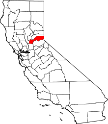
 Location in Placer County and the state of California | |
 Lincoln, California Location in the United States of America | |
| Coordinates: 38°53′14″N 121°17′46″W / 38.88722°N 121.29611°WCoordinates: 38°53′14″N 121°17′46″W / 38.88722°N 121.29611°W | |
| Country |
|
| State |
|
| County | Placer |
| Incorporated | August 7, 1890[2] |
| Government | |
| • Type | Council-manager[1] |
| • Mayor | Spencer Short[1] |
| • State senator | Ted Gaines (R)[3] |
| • Assemblymember | Kevin Kiley (R)[3] |
| • U. S. rep. | Tom McClintock (R)[4] |
| Area[5] | |
| • Total | 20.130 sq mi (52.137 km2) |
| • Land | 20.106 sq mi (52.075 km2) |
| • Water | 0.024 sq mi (0.062 km2) 0.12% |
| Elevation[6] | 167 ft (51 m) |
| Population (July 28th, 2015)[7] | |
| • Total | 45,837 |
| • Density | 2,300/sq mi (880/km2) |
| Time zone | Pacific (UTC-8) |
| • Summer (DST) | PDT (UTC-7) |
| ZIP code | 95648 |
| Area code | 916 |
| FIPS code | 06-41474 |
| GNIS feature ID | 277539 |
| Website |
ci |
Lincoln is a city in Placer County, California, United States, part of the Sacramento metropolitan area. Located in an area of rapid suburban development, it grew 282.1 percent between 2000 and 2010, making it the fastest growing city over 10,000 people in the U.S.[8] Its 2015 population was estimated to be 45,837.[7]
Lincoln is part of the Sacramento-Roseville Metropolitan Statistical Area.
History
The original townsite was surveyed and laid out in 1859 by Theodore Judah along the proposed line of the California Central Railroad. The name "Lincoln" was conferred in honor of Charles Lincoln Wilson, one of the organizers and directors of the California Central Railroad. The CCRR was planned as a rail link between the cities of Marysville and Sacramento via a connection to the Sacramento Valley Railroad in Folsom. Grading from Folsom to Marysville commenced in 1858 and was completed to Marysville by 1860. Track laying began that same year and the rails reached the site of Lincoln in early 1861. At this point, due to a lack of funds, further construction on the California Central was temporarily halted and Lincoln experienced a small-scale boom as the northern terminus of this new road. Within a few years, however, more investors were found and the line was extended to Wheatland, in Yuba County, bringing an end to this early stage of Lincoln's development.
When most of its population and business moved on with the railroad, the town settled into a lull until the early 1870s, when rich clay deposits of the Ione Formation were discovered nearby. This led to the establishment of Gladding, McBean & Co., the pottery for which Lincoln is famous, ushering in a new era of prosperity and growth.
Lincoln remained a sleepy town until the mid-1990s, when the suburbs of Sacramento started expanding out past nearby Roseville. The city is now experiencing a new period of growth. As of the 2010 census, the population was 42,819, for a growth rate of 282.1% since 2000, making Lincoln the fastest growing city in the United States over the last decade.[8]
In June 2004, Lincoln gained additional notoriety when it opened the first casino in the greater Sacramento Metropolitan Area, Thunder Valley Casino Resort.
In 2006, Lincoln was named an All-America City by the National Civic League. It was the only California city to be named an All-America City that year and only one of 10 cities to receive the prestigious award.
Geography
Lincoln is located at 38°53′14″N 121°17′46″W / 38.88722°N 121.29611°W (38.887121, -121.295973).[9]
According to the United States Census Bureau, the city has a total area of 20.1 square miles (52 km2), of which 0.02 square miles (0.052 km2), or 0.12%, is water.
Climate
Lincoln has a hot-summer Mediterranean climate (Köppen Csa) that is characterized by cool, wet winters and hot, dry summers. The "wet season" is generally October through April. Lincoln averages nearly 250 sunny days per year. During summer, days can become quite hot with an average high of 94 °F (34 °C) in July. Some days have even hit 104 °F (40 °C) and been known to last several weeks. Fortunately, the cooling effect of the delta breeze from the Bay Area helps bring night temperatures down to comfortable levels. Spring and fall months are quite short transitional periods with mild temperatures. During winter months, temperatures are quite chilly with an average low of 39 °F (4 °C) in January. Some nights(although uncommon) have reported below freezing temperatures. Lincoln receives a little over 20.45 inches of precipitation a year. Snowfall is extremely rare in Lincoln but it does happen from time to time.
| Climate data for Lincoln, California | |||||||||||||
|---|---|---|---|---|---|---|---|---|---|---|---|---|---|
| Month | Jan | Feb | Mar | Apr | May | Jun | Jul | Aug | Sep | Oct | Nov | Dec | Year |
| Record high °F (°C) | 75 (24) |
78 (26) |
86 (30) |
98 (37) |
107 (42) |
110 (43) |
115 (46) |
110 (43) |
111 (44) |
102 (39) |
87 (31) |
76 (24) |
115 (46) |
| Average high °F (°C) | 53 (12) |
60 (16) |
64 (18) |
71 (22) |
80 (27) |
88 (31) |
94 (34) |
92 (33) |
87 (31) |
77 (25) |
63 (17) |
54 (12) |
73.6 (23.2) |
| Daily mean °F (°C) | 46 (8) |
51 (11) |
54 (12) |
60 (16) |
66 (19) |
73 (23) |
78 (26) |
76 (24) |
73 (23) |
65 (18) |
54 (12) |
47 (8) |
61.9 (16.7) |
| Average low °F (°C) | 39 (4) |
42 (6) |
44 (7) |
48 (9) |
53 (12) |
58 (14) |
61 (16) |
61 (16) |
58 (14) |
52 (11) |
44 (7) |
39 (4) |
49.9 (10) |
| Record low °F (°C) | 21 (−6) |
23 (−5) |
27 (−3) |
33 (1) |
36 (2) |
43 (6) |
48 (9) |
46 (8) |
41 (5) |
31 (−1) |
27 (−3) |
16 (−9) |
16 (−9) |
| Average precipitation inches (mm) | 3.98 (101.1) |
3.46 (87.9) |
3.07 (78) |
1.58 (40.1) |
0.58 (14.7) |
0.12 (3) |
0.04 (1) |
0.06 (1.5) |
0.35 (8.9) |
1.08 (27.4) |
2.80 (71.1) |
3.33 (84.6) |
20.45 (519.3) |
| Average precipitation days | 9 | 8 | 9 | 5 | 3 | 1 | 1 | 1 | 1 | 3 | 7 | 9 | 57 |
| Source: http://www.myforecast.com/bin/climate.m?city=11897&zip_code=95648&metric=false | |||||||||||||
Demographics
| Historical population | |||
|---|---|---|---|
| Census | Pop. | %± | |
| 1880 | 275 | — | |
| 1890 | 961 | 249.5% | |
| 1900 | 1,061 | 10.4% | |
| 1910 | 1,402 | 32.1% | |
| 1920 | 1,325 | −5.5% | |
| 1930 | 2,094 | 58.0% | |
| 1940 | 2,044 | −2.4% | |
| 1950 | 2,410 | 17.9% | |
| 1960 | 3,197 | 32.7% | |
| 1970 | 3,176 | −0.7% | |
| 1980 | 4,132 | 30.1% | |
| 1990 | 7,248 | 75.4% | |
| 2000 | 11,205 | 54.6% | |
| 2010 | 42,819 | 282.1% | |
| Est. 2015 | 46,474 | [10] | 8.5% |
2010
The 2010 United States Census[12] reported that Lincoln had a population of 42,819. The population density was 2,127.1 people per square mile (821.3/km²). The racial makeup of Lincoln was 34,087 (79.6%) White, 629 (1.5%) African American, 399 (0.9%) Native American, 2,663 (6.2%) Asian, 115 (0.3%) Pacific Islander, 3,125 (7.3%) from other races, and 1,801 (4.2%) from two or more races. Hispanic or Latino of any race were 7,597 persons (17.7%).
The Census reported that 42,704 people (99.7% of the population) lived in households, 30 (0.1%) lived in non-institutionalized group quarters, and 85 (0.2%) were institutionalized.
There were 16,479 households, out of which 5,190 (31.5%) had children under the age of 18 living in them, 10,365 (62.9%) were opposite-sex married couples living together, 1,202 (7.3%) had a female householder with no husband present, 586 (3.6%) had a male householder with no wife present. There were 775 (4.7%) unmarried opposite-sex partnerships, and 110 (0.7%) same-sex married couples or partnerships. 3,518 households (21.3%) were made up of individuals and 2,128 (12.9%) had someone living alone who was 65 years of age or older. The average household size was 2.59. There were 12,153 families (73.7% of all households); the average family size was 3.01.
The population was spread out with 10,382 people (24.2%) under the age of 18, 2,360 people (5.5%) aged 18 to 24, 10,862 people (25.4%) aged 25 to 44, 9,166 people (21.4%) aged 45 to 64, and 10,049 people (23.5%) who were 65 years of age or older. The median age was 40.5 years. For every 100 females there were 92.5 males. For every 100 females age 18 and over, there were 89.6 males.
There were 17,457 housing units at an average density of 867.2 per square mile (334.8/km²), of which 13,115 (79.6%) were owner-occupied, and 3,364 (20.4%) were occupied by renters. The homeowner vacancy rate was 2.5%; the rental vacancy rate was 4.7%. 32,473 people (75.8% of the population) lived in owner-occupied housing units and 10,231 people (23.9%) lived in rental housing units.
2000
As of the census[13] of 2000, there were 11,205 people, 3,874 households, and 3,033 families residing in the city. The population density was 612.6 people per square mile (236.5/km²). There were 4,146 housing units at an average density of 226.7 per square mile (87.5/km²). The racial makeup of the city was 79.64% White, 0.44% African American, 1.26% Native American, 1.08% Asian, 0.14% Pacific Islander, 13.47% from other races, and 3.97% from two or more races. Hispanic or Latino of any race were 25.98% of the population.
There were 3,874 households out of which 40.5% had children under the age of 18 living with them, 59.5% were married couples living together, 13.3% had a female householder with no husband present, and 21.7% were non-families. Of all households 17.2% were made up of individuals and 6.8% had someone living alone who was 65 years of age or older. The average household size was 2.86 and the average family size was 3.20.
In the city the population was spread out with 30.0% under the age of 18, 8.9% from 18 to 24, 30.3% from 25 to 44, 19.6% from 45 to 64, and 11.3% who were 65 years of age or older. The median age was 32 years. For every 100 females there were 95.9 males. For every 100 females age 18 and over, there were 92.7 males.
The median income for a household in the city was $45,547, and the median income for a family was $51,166. Males had a median income of $38,460 versus $25,603 for females. The per capita income for the city was $19,447. About 10.3% of families and 12.4% of the population were below the poverty line, including 20.0% of those under age 18 and 4.7% of those age 65 or over.
References
- 1 2 3 "City Council". City of Lincoln, California. Retrieved May 23, 2015.
- ↑ "California Cities by Incorporation Date" (Word). California Association of Local Agency Formation Commissions. Retrieved August 25, 2014.
- 1 2 "Statewide Database". UC Regents. Retrieved December 3, 2014.
- ↑ "California's 4th Congressional District - Representatives & District Map". Civic Impulse, LLC. Retrieved March 3, 2013.
- ↑ "2010 Census U.S. Gazetteer Files – Places – California". United States Census Bureau.
- ↑ "Lincoln". Geographic Names Information System. United States Geological Survey. Retrieved October 19, 2014.
- 1 2 "Lincoln (city) QuickFacts". United States Census Bureau. Retrieved January 7, 2015.
- 1 2 "Population Distribution and Change: 2000 to 2010" (PDF). U.S. Census Bureau. March 2011. Retrieved June 13, 2011.
- ↑ "US Gazetteer files: 2010, 2000, and 1990". United States Census Bureau. 2011-02-12. Retrieved 2011-04-23.
- ↑ "Annual Estimates of the Resident Population for Incorporated Places: April 1, 2010 to July 1, 2015". Retrieved July 2, 2016.
- ↑ "Census of Population and Housing". Census.gov. Retrieved June 4, 2015.
- ↑ "2010 Census Interactive Population Search: CA - Lincoln city". U.S. Census Bureau. Retrieved July 12, 2014.
- ↑ "American FactFinder". United States Census Bureau. Retrieved 2008-01-31.
External links
- Official website
- Western Placer Unified School District
- Lincoln Crossing Community Association
- Lincoln Today - online yellow pages in Lincoln
- Lincoln News Messenger - newspaper
- Lincoln Public Library