Fort Loramie, Ohio
| Fort Loramie, Ohio | |
|---|---|
| Village | |
|
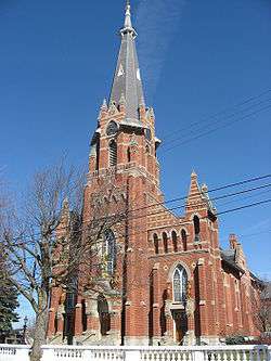
St. Michael's Catholic Church, a community landmark | |
 Location of Fort Loramie, Ohio | |
 Location of Fort Loramie in Shelby County | |
| Coordinates: 40°20′53″N 84°22′14″W / 40.34806°N 84.37056°WCoordinates: 40°20′53″N 84°22′14″W / 40.34806°N 84.37056°W | |
| Country | United States |
| State | Ohio |
| County | Shelby |
| Founded | 1837 |
| Government | |
| • Mayor | Randy Ahlers |
| Area[1] | |
| • Total | 0.96 sq mi (2.49 km2) |
| • Land | 0.96 sq mi (2.49 km2) |
| • Water | 0 sq mi (0 km2) |
| Elevation | 953 ft (289 m) |
| Population (2010)[2] | |
| • Total | 1,478 |
| • Estimate (2012[3]) | 1,492 |
| • Density | 1,539.6/sq mi (594.4/km2) |
| Time zone | EST (UTC-5) |
| • Summer (DST) | EDT (UTC-4) |
| ZIP code | 45845 |
| Area code(s) | 937 |
| FIPS code | 39-27832[4] |
| GNIS feature ID | 1064665[5] |
| Website | http://www.fortloramie.com/ |
Fort Loramie is a village in Shelby County, Ohio, United States, along Loramie Creek. The population was 1,478 at the 2010 census. The village was founded in 1837.
History
The first settlement at Fort Loramie was made after the War of 1812.[6] The village took its name from a pioneer trading post established by Peter Loramie.[7]
Geography
Fort Loramie is located at 40°20′53″N 84°22′14″W / 40.34806°N 84.37056°W (40.348043, -84.370600).[8]
According to the United States Census Bureau, the village has a total area of 0.96 square miles (2.49 km2), all land.[1] The village is at an elevation of 953 feet (290 m) above sea level.
Government
- Randy Ahlers - Mayor
- Tony Schmitmeyer
- Village Council
- Don Gusching
- Steve Barhorst
- Rick Meyer
- Matt Hoying
- Adam Schmeising
- Tim Boerger
- Dan Holland - Superintendent of Schools
Demographics
| Historical population | |||
|---|---|---|---|
| Census | Pop. | %± | |
| 1890 | 457 | — | |
| 1900 | 444 | −2.8% | |
| 1910 | 489 | 10.1% | |
| 1920 | 472 | −3.5% | |
| 1930 | 427 | −9.5% | |
| 1940 | 507 | 18.7% | |
| 1950 | 508 | 0.2% | |
| 1960 | 687 | 35.2% | |
| 1970 | 744 | 8.3% | |
| 1980 | 977 | 31.3% | |
| 1990 | 1,042 | 6.7% | |
| 2000 | 1,344 | 29.0% | |
| 2010 | 1,478 | 10.0% | |
| Est. 2015 | 1,491 | [9] | 0.9% |
2000 census
As of the census[4] of 2000, there were 1,344 people, 480 households, and 358 families residing in the village. The population density was 1,848.7 people per square mile (710.9/km²). There were 494 housing units at an average density of 679.5 per square mile (261.3/km²). The racial makeup of the village was 99.70% White, and 0.30% from two or more races. Hispanic or Latino of any race were 0.37% of the population.
There were 480 households out of which 40.4% had children under the age of 18 living with them, 68.3% were married couples living together, 4.0% had a female householder with no husband present, and 25.4% were non-families. 22.7% of all households were made up of individuals and 11.0% had someone living alone who was 65 years of age or older. The average household size was 2.80 and the average family size was 3.35.
In the village the population was spread out with 31.0% under the age of 18, 7.4% from 18 to 24, 31.2% from 25 to 44, 16.9% from 45 to 64, and 13.5% who were 65 years of age or older. The median age was 33 years. For every 100 females there were 95.1 males. For every 100 females age 18 and over, there were 97.4 males.
The median income for a household in the village was $54,750, and the median income for a family was $65,089. Males had a median income of $39,934 versus $27,039 for females. The per capita income for the village was $19,602. About 0.9% of families and 1.4% of the population were below the poverty line, including 0.2% of those under age 18 and 5.4% of those age 65 or over.
2010 census
As of the census[2] of 2010, there were 1,478 people, 530 households, and 396 families residing in the village. The population density was 1,539.6 inhabitants per square mile (594.4/km2). There were 564 housing units at an average density of 587.5 per square mile (226.8/km2). The racial makeup of the village was 99.7% White, 0.1% African American, 0.1% Asian, and 0.1% from two or more races. Hispanic or Latino of any race were 0.4% of the population.
There were 530 households of which 40.4% had children under the age of 18 living with them, 65.8% were married couples living together, 6.2% had a female householder with no husband present, 2.6% had a male householder with no wife present, and 25.3% were non-families. 22.6% of all households were made up of individuals and 11.9% had someone living alone who was 65 years of age or older. The average household size was 2.79 and the average family size was 3.32.
The median age in the village was 35 years. 31.1% of residents were under the age of 18; 6.5% were between the ages of 18 and 24; 26.1% were from 25 to 44; 21.7% were from 45 to 64; and 14.6% were 65 years of age or older. The gender makeup of the village was 49.0% male and 51.0% female.
Major events
Fort Loramie is known for its annual three-day-long festival in the summer, the Country Concert,[11] which attracts thousands of people from around the United States and Canada. Its singers include such popular country stars as Luke Bryan and Lady Antebellum. The yearly concert fest is located at Hickory Hill Lake located south of the village near the neighboring rural community of Newport.
Education
Fort Loramie has one public high school, Fort Loramie High School, and one public grade school, Fort Loramie Elementary.
The school also allows students to enroll into Upper Valley Career Center, a trade school in Piqua, Ohio.
Media
Fort Loramie is served by local daily newspaper, the Sidney Daily News, along with a few weekly newspapers.
References
- 1 2 "US Gazetteer files 2010". United States Census Bureau. Retrieved 2013-01-06.
- 1 2 "American FactFinder". United States Census Bureau. Retrieved 2013-01-06.
- ↑ "Population Estimates". United States Census Bureau. Retrieved 2013-06-17.
- 1 2 "American FactFinder". United States Census Bureau. Retrieved 2008-01-31.
- ↑ "US Board on Geographic Names". United States Geological Survey. 2007-10-25. Retrieved 2008-01-31.
- ↑ "History of Fort Loramie". Fort Loramie Chamber of Commerce. Retrieved 30 January 2013.
- ↑ Overman, William Daniel (1958). Ohio Town Names. Akron, OH: Atlantic Press. p. 46.
- ↑ "US Gazetteer files: 2010, 2000, and 1990". United States Census Bureau. 2011-02-12. Retrieved 2011-04-23.
- ↑ "Annual Estimates of the Resident Population for Incorporated Places: April 1, 2010 to July 1, 2015". Retrieved July 2, 2016.
- ↑ "Census of Population and Housing". Census.gov. Retrieved June 4, 2015.
- ↑ http://www.countryconcert.com/
External links
Municipalities and communities of Shelby County, Ohio, United States | ||
|---|---|---|
| City |  | |
| Villages | ||
| Townships | ||
| CDP | ||
| Unincorporated communities | ||