Freeman Township, Clay County, Iowa
| Freeman Township | |
|---|---|
| Township | |
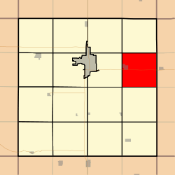 Location in Clay County | |
| Coordinates: 43°07′34″N 094°58′37″W / 43.12611°N 94.97694°WCoordinates: 43°07′34″N 094°58′37″W / 43.12611°N 94.97694°W | |
| Country |
|
| State |
|
| County | Clay |
| Area | |
| • Total | 35.67 sq mi (92.39 km2) |
| • Land | 35.09 sq mi (90.88 km2) |
| • Water | 0.59 sq mi (1.52 km2) 1.65% |
| Elevation | 1,339 ft (408 m) |
| Population (2000) | |
| • Total | 444 |
| • Density | 12.7/sq mi (4.9/km2) |
| GNIS feature ID | 0467871 |
Freeman Township is a township in Clay County, Iowa, USA. As of the 2000 census, its population was 444.
History
Freeman Township was created in 1882.[1]
Geography
Freeman Township covers an area of 35.67 square miles (92.4 km2) and contains one incorporated settlement, Dickens. According to the USGS, it contains one cemetery, Dickens.
The stream of Pickerel Run runs through this township. Also located in the township is Barringer Slough.
Notes
- ↑ Gillespie, Samuel (1909). History of Clay County, Iowa: From Its Earliest Settlement to 1909. S. J. Clarke Publishing Company. p. 60.
References
External links
Municipalities and communities of Clay County, Iowa, United States | ||
|---|---|---|
| Cities | ||
| Townships | ||
This article is issued from Wikipedia - version of the 11/2/2016. The text is available under the Creative Commons Attribution/Share Alike but additional terms may apply for the media files.