Fort Garland, Colorado
| Fort Garland, Colorado | |
|---|---|
| Census-designated place | |
|
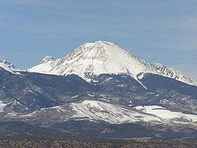
Entering from the south | |
 Location in Costilla County and the state of Colorado | |
| Coordinates: 37°25′46″N 105°26′7″W / 37.42944°N 105.43528°WCoordinates: 37°25′46″N 105°26′7″W / 37.42944°N 105.43528°W | |
| Country |
|
| State |
|
| County | Costilla[1] |
| Area | |
| • Total | 0.37 sq mi (0.97 km2) |
| • Land | 0.37 sq mi (0.97 km2) |
| • Water | 0 sq mi (0 km2) |
| Elevation[1] | 7,936 ft (2,419 m) |
| Population (2010) | |
| • Total | 433 |
| • Density | 1,153/sq mi (445.1/km2) |
| Time zone | MST (UTC-7) |
| • Summer (DST) | MDT (UTC-6) |
| ZIP code[2] | 81133 |
| Area code(s) | 719 |
| FIPS code | 08-27535 |
| GNIS feature ID | 0192831 |

Fort Garland is a census-designated place (CDP) in Costilla County, Colorado, United States. The population was 433 at the 2010 census.[3][4] The Fort Garland Post Office has the ZIP code 81133.[2]
General information
Fort Garland is referred to as the "Gateway to the San Luis Valley", as it is the first town one encounters when traveling west having crossed over La Veta Pass in the Sangre de Cristo Range. Fort Garland is home to many artists, painters, crafters and internationally known musicians.
Fort Garland has a business district with two motels, several restaurants, the Old Fort Market grocery store, the Fort Garland Museum, two gas stations, a car wash, hair salon, campgrounds, hardware store, liquor store, and multiple shops featuring collectibles and antiquities as well as a Wild West show.
The Annual Fort Garland Band Jam Music Festival features local and regional musicians, as well as nationally and internationally recognized musical talent. This summer event, usually held in mid-July, includes an open-air market, local food vendors offering up traditional and regional cuisine, a beer garden, and children's activities. The music offered covers numerous styles, from traditional Spanish guitar to R&B to rock and roll.
The Blanca/Fort Garland Community Center is open to residents and the public on daily, monthly or annual fees.
The Entrada Visitor's Center offers information on local and regional points of interest, such as the Great Sand Dunes, the Colorado 'Gator farm, UFO Watchtower and other activities located within the San Luis Valley.
Fort Garland is at the crossroads of U.S. Route 160 and Colorado State Highway 159, which leads south towards Taos and Santa Fe, New Mexico.
History
Fort Garland was established in 1858 to protect settlers in the San Luis Valley, then part of the New Mexico Territory. The fort was abandoned in 1883, following the confinement of the Utes to reservations. The Fort Garland Museum preserves some of the historic buildings from the fort.[5]
Geography
Fort Garland is located in northern Costilla County at 37°25′46″N 105°26′07″W / 37.429477°N 105.435280°W.[6] The town of Blanca is 4 miles (6.4 km) west on U.S. Route 160. Walsenburg is 47 miles (76 km) to the east, across the Sangre de Cristo Range.
According to the United States Census Bureau, the Fort Garland CDP has a total area of 0.37 square miles (0.97 km2), all of it land.[7]
Demographics
As of the census[4] of 2000, there were 432 people, 152 households, and 120 families residing in the CDP. The population density was 1,514.5 people per square mile (575.2/km²). There were 164 housing units at an average density of 574.9 per square mile (218.3/km²). The racial makeup of the CDP was 53.01% White, 0.69% African American, 2.31% Native American, 1.16% Asian, 0.93% Pacific Islander, 36.81% from other races, and 5.09% from two or more races. Hispanic or Latino of any race were 72.22% of the population.
There were 152 households out of which 42.8% had children under the age of 18 living with them, 56.6% were married couples living together, 18.4% had a female householder with no husband present, and 20.4% were non-families. 18.4% of all households were made up of individuals and 8.6% had someone living alone who was 65 years of age or older. The average household size was 2.84 and the average family size was 3.19.
In the CDP the population was spread out with 29.9% under the age of 18, 9.7% from 18 to 24, 27.3% from 25 to 44, 21.5% from 45 to 64, and 11.6% who were 65 years of age or older. The median age was 34 years. For every 100 females there were 85.4 males. For every 100 females age 18 and over, there were 80.4 males.
The median income for a household in the CDP was $18,929, and the median income for a family was $25,833. Males had a median income of $25,625 versus $18,750 for females. The per capita income for the CDP was $9,470. About 23.4% of families and 31.2% of the population were below the poverty line, including 35.3% of those under age 18 and 28.9% of those age 65 or over.
See also
- Outline of Colorado
- State of Colorado
- Fort Garland
- Old Spanish Trail (trade route)
- Spanish Fort (Colorado)
References
- 1 2 "US Board on Geographic Names". United States Geological Survey. 2007-10-25. Retrieved 2008-01-31.
- 1 2 "ZIP Code Lookup" (JavaScript/HTML). United States Postal Service. December 14, 2006. Retrieved December 14, 2006.
- ↑ Colorado Trend Report 2: State and Complete Places (Sub-state 2010 Census Data). Missouri Census Data Center. Accessed 2011-02-25.
- 1 2 "American FactFinder". United States Census Bureau. Retrieved 2008-01-31.
- ↑ Fort Garland
- ↑ "US Gazetteer files: 2010, 2000, and 1990". United States Census Bureau. 2011-02-12. Retrieved 2011-04-23.
- ↑ "Geographic Identifiers: 2010 Demographic Profile Data (G001): Fort Garland CDP, Colorado". U.S. Census Bureau, American Factfinder. Retrieved June 24, 2014.
External links
- Fort Garland at Sangres.com
- Fort Garland Museum at Colorado Historical Society
- Trinchera Peak at SummitPost
- Fort Garland visitors' website
- Fort Garland Music Festival
Municipalities and communities of Costilla County, Colorado, United States | ||
|---|---|---|
| Towns | 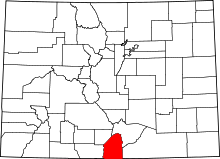 | |
| CDPs | ||
| Unincorporated communities | ||