Gabilan, California
| Gabilan | |
|---|---|
| Former settlement | |
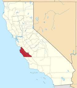
 Gabilan Location in California | |
| Coordinates: 36°32′48″N 121°29′39″W / 36.54667°N 121.49417°WCoordinates: 36°32′48″N 121°29′39″W / 36.54667°N 121.49417°W | |
| Country | United States |
| State | California |
| County | Monterey County |
| Elevation[1] | 112 ft (34 m) |
Gabilan was a former settlement in Monterey County, California.[1] It was located on the Southern Pacific Railroad 4 miles (6.4 km) northwest of Gonzales,[2] at an elevation of 112 feet (34 m),[1] and was situated in the foothills of the Gabilan Range. In Spanish, gavilan (gabilan is an older alternate rendering) means "sparrow hawk".[3][4] Hawks, especially the red-tailed hawk, are common in the area.
A post office operated at Gabilan (having been transferred from Alisal) from 1869 to 1883, and from 1898 to 1900.[5]
References
- 1 2 3 U.S. Geological Survey Geographic Names Information System: Gabilan, California
- ↑ Durham, David L. (1998). California's Geographic Names: A Gazetteer of Historic and Modern Names of the State. Clovis, Calif.: Word Dancer Press. p. 899. ISBN 1-884995-14-4.
- ↑ Gannett, Henry (1905). The Origin of Certain Place Names in the United States. Govt. Print. Off. p. 133.
- ↑ Gudde, Edwin G. (2004). California place names: The origin and etymology of current geographical names. Berkeley and Los Angeles, California: University of California Press. p. 140. ISBN 0-520-24217-3.
- ↑ Durham, David L. (1998). California's Geographic Names: A Gazetteer of Historic and Modern Names of the State. Clovis, Calif.: Word Dancer Press. p. 862. ISBN 1-884995-14-4.
This article is issued from Wikipedia - version of the 10/15/2016. The text is available under the Creative Commons Attribution/Share Alike but additional terms may apply for the media files.