Gaeland Township, Gove County, Kansas
| Gaeland Township | |
|---|---|
| Township | |
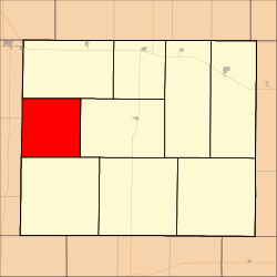 Location in Gove County | |
| Coordinates: 38°56′21″N 100°43′55″W / 38.93917°N 100.73194°WCoordinates: 38°56′21″N 100°43′55″W / 38.93917°N 100.73194°W | |
| Country | United States |
| State | Kansas |
| County | Gove |
| Area | |
| • Total | 80.37 sq mi (208.15 km2) |
| • Land | 80.37 sq mi (208.15 km2) |
| • Water | 0 sq mi (0 km2) 0% |
| Elevation | 2,943 ft (897 m) |
| Population (2000) | |
| • Total | 46 |
| • Density | 0.6/sq mi (0.2/km2) |
| GNIS feature ID | 0471376 |
Gaeland Township is a township in Gove County, Kansas, USA. As of the 2000 census, its population was 46.
Geography
Gaeland Township covers an area of 80.37 square miles (208.2 km2) and contains no incorporated settlements.
Transportation
Gaeland Township contains two airports or landing strips: Evans Airport and Stevenson Airport.
References
External links
Municipalities and communities of Gove County, Kansas, United States | ||
|---|---|---|
| Cities | 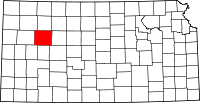 | |
| Townships | ||
| Footnotes | ‡This populated place also has portions in an adjacent county or counties | |
This article is issued from Wikipedia - version of the 11/11/2013. The text is available under the Creative Commons Attribution/Share Alike but additional terms may apply for the media files.