Glencoe, California
Coordinates: 38°21′15″N 120°35′06″W / 38.35417°N 120.58500°W
| Glencoe | |
|---|---|
| Unincorporated community | |
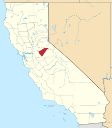
 Glencoe  Glencoe Location in California | |
| Coordinates: 38°21′15″N 120°35′06″W / 38.35417°N 120.58500°W | |
| Country | United States |
| State | California |
| County | Calaveras County |
| Elevation[1] | 2,749 ft (838 m) |
| Reference no. | 280 |
Glencoe (formerly, Mosquito and Mosquito Gulch) is an unincorporated community in Calaveras County, California. It lies at an elevation of 2749 feet (838 m) and is located at 38°21′15″N 120°35′06″W / 38.35417°N 120.58500°W. The community is in ZIP code 95232 and area code 209.
Glencoe was formerly called Mosquito Gulch. The business portion of the town was on the north side of Mosquito Gulch, but not one of the old buildings remains. The mines were first worked by Mexicans in the early 1850s. Quartz mining predominated but there was some placer mining as well.
The town today is registered as California Historical Landmark #280.[2]
The first post office was opened at Mosquito in 1858 but closed in 1869; it was re-established as Mosquito Gulch in 1873. The name was changed to Glencoe in 1912; the post office closed again in 1916, but was re-established in 1947.[3]
Politics
In the state legislature, Glencoe is in the 8th Senate District, represented by Republican Tom Berryhill,[4] and the 5th Assembly District, represented by Republican Frank Bigelow.[5] Federally, Glencoe is in California's 4th congressional district, represented by Republican Tom McClintock.[6]
References
- ↑ U.S. Geological Survey Geographic Names Information System: Glencoe, California
- ↑ "Glencoe". Office of Historic Preservation, California State Parks. Retrieved 2012-10-06.
- ↑ Durham, David L. (1998). California's Geographic Names: A Gazetteer of Historic and Modern Names of the State. Clovis, Calif.: Word Dancer Press. p. 777. ISBN 1-884995-14-4.
- ↑ "Senators". State of California. Retrieved March 21, 2013.
- ↑ "Members Assembly". State of California. Retrieved March 21, 2013.
- ↑ "California's 4th Congressional District - Representatives & District Map". Civic Impulse, LLC. Retrieved March 1, 2013.