Gohad
| Gohad गोहद Gohud | |
|---|---|
| city | |
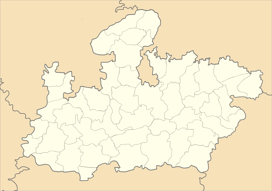 Gohad Location in Madhya Pradesh, India | |
| Coordinates: 26°26′N 78°26′E / 26.43°N 78.44°ECoordinates: 26°26′N 78°26′E / 26.43°N 78.44°E | |
| Country |
|
| State | Madhya Pradesh |
| District | Bhind |
| Elevation | 159 m (522 ft) |
| Population (2001) | |
| • Total | 45,194 |
| Languages | |
| • Official | Hindi |
| Time zone | IST (UTC+5:30) |
Gohad is a city and a municipality in Bhind district in the Indian state of Madhya Pradesh. A town of historical importance it is situated close to the city of Gwalior.
History
According to Alexander Cunningham and William Crooke, people of the rajasthan move to village Bamrauli (near Agra) settled the town of Gohad in 1505 and constructed the Gohad Fort.[1][2]
The historically important rulers among the above were Bhim Singh (1707–1756) and Chhatar Singh (1757–1785). They occupied the Gwalior fort twice; Bhim Singh from 1740 to 1756 and Chhatra Singh from 1780 to 1783. During this period, they constructed several monuments within Gwalior fort, including the Cenotaph of Bhim Singh.[3] In 1783 Gwalior Fort was captured by Marathas under Mahadji Shinde
Gohad was handed over to Marathas under a revised treaty dated 22 November 1805 between Marathas and Britishers. Under this treaty Gohad ruler Rana Kirat Singh was given Dhaulpur, Badi and Rajakheda in exchange with Gohad. Rana Kirat Singh moved to Dhaulpur in December 1805.[4] Sindhias could take over Gohad on 27 February 1806 with the help of Britishers. Thus the Rana Jat rulers of Bamraulia gotra ruled Gohad for 300 years from 1505-1805.[5]
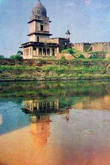
Gohad Fort
Rana Singhandev II had founded Gohad fort but Maharaja Bhim Singh Rana, Maharaja Chhatra Singh and Maharaja Kirat Singh did the major construction works.[6] The site of Gohad fort was selected strategically on the Vaisli River where it takes a circular turn. The river was dug and flow of river was extended up to the fort to take a semi circular shape.[6] The fort has 7 gates named after the villages to which they face and the way they lead to. These are Itayli (in south), Barthara (in west), Gohadi (in northwest), Birkhari (in northeast), Kathwan (in east), Kharaua (in southeast) and Saraswati. The fort was protected with four lines of defence.[7]
The Jat rulers of Gohad constructed several other monuments including forts, palaces, temples, wells and gardens which are of archaeological and historical importance. These include the Gohad Fort, Itayali Darwaja, Chhatra Mahal, Shish Mahal, Satbhanwar, Laxman-tal, Rani-guru temple, Laxman temple and Modi-ki-Haveli to mention a few.[8] [5]
Historical places around Gohad
Behat
Behat (बेहट) is a village in Gwalior district at a distance of 50 km from Gwalior, in east direction, near the border of Bhind district. It was the summer capital of Maharaja Chhatra Singh Rana who had also constructed a palace, called Chhatrapur, on the hill top at Behat village which was used as a summer capital. It is a marvelous site surrounded by deep forests.[9]
Maharaja Chhatra Singh Rana was a great warrior, protector of his public, great lover of art and culture. There is a deep and big Bawdi for regular supply of water in the palace. Diwann-e-Khas is constructed below the palace. The palace is a good example of the architectural skills of Rana rulers. The site is now a protected monument by Archaeological Survey of India.[10]
Behat is believed to be the birthplace of famous singer Tansen. Tan Sen(Ram Rattan 1520-1589), was born in Behat near Gwalior in a Brahmin family, but them, converse to Islam when he knows the Saint Sufi and singer Mohammad Ghaus of Gwalior and go to live with him, he was his first Master.
Karwas
Karwas (करवास) is a village in Bhind district in Madhya Pradesh. It was the site of an important fort of Gohad Rana rulers. The ancestor of Bamraulis Jagdeo Singh had come from Agra and stayed at Bhind which was ruled by Aniruddh Singh Bhadauria. There was war between Bamraulias and Bhadauria rulers at place called Pach'hara in which Bhadauria was defeated. The Ranas kept their capital at Pach'hara for some time and later shifted the capital to Gohad. The brother of Gohad ruler Jagdeo Singh constructed a fort here in samvat 1680 (1623 AD).[11] Umara-i-Uzzam Maharaja Mahendra GOPAL SINGH, a Bhadauria Rajput Maharaja of Bhadawar 1707/1730, was appointed governor of Narwar in 1707. In 1708 he captured the Jat fort of Gohad and in 1712 stormed the fort of Rampura.
This place had played an important role in the defeat of Rana rulers of Gohad at Gwalior fort. The chieftain of Karwas fort along with Motumal aligned with Sindia and planned a conspiracy to kill Maharaja Bhim Singh Rana. The Karwas chieftain had demanded a separate free state for him which was refused by Maharaja Bhim Singh Rana. The Gohad ruler got angry over his demand and reduced his status. The Karwas chieftain conspired and signed a secret treaty with Sindia. As an award of which he was made the commander of Maratha army during Panipat war for one day. The Marathas were victorious that day. It was here a strategy was made that Marathas armies would attack Maharaja Bhim Singh Rana from three sides at regular intervals . They first occupied Bilhati fort and the secondly attacked Gwalior fort. The gates were opened from inside and Maharaja was killed by conspiracy of Karwas chieftain.[12]
At present there are only the ruins of the fort at Karwas. The descendants at present living in Karwas include 8 families of Bamraulia Rana rulers and 5 families of Descendants of Jagdeo Singh. The genealogy of Bamraulia descendants in this village is as under: Aman Singh, his son Acharaj Singh, his son Thakur Das, his son, Tamir Singh, his son Jaswant Singh, His son Ganesh Singh, His son Govind Singh.[12]
Guhisar
Guhisar (IAST:Guhīsar, Hindi: गुहीसर) is a village in Bhind district in Madhya Pradesh. Guhisar is located at a distance of 30 km from Gwalior city in east direction on Bilara Road. Guhīsar is geographically located at Latitude and Longitude 26° 14' 28" North, 78° 32' 43" East.
There is a small fort in Guhisar known as 'Guhisar ki Garhi'. The fort was constructed by Gohad ruler Maharaja Chhatar Singh. The fort is situated on a hillock and surrounded by deep ditch to protect it. One can enter it through a small entrance and can reach the palace. The palace is surrounded by four double storied burj. There is a secret tunnel believed to connect this fort with Gohad and Karwas forts. The defence strategy of the fort is exemplary. The fort could be conquered only in case of an internal conspiracy or the chieftain himself surrenders.[13]
Utila
Utila (IAST: Utīlā, Hindi: उटीला) is a village and a fort in Gwalior district in Madhya Pradesh. Utila is located at a distance of 20 km from Gwalior city in east direction on Gwalior –Hastinapur-Behat Road.
There is a small fort in Utila known as ‘Ranaon ki Garhi’. The fort was constructed by Gohad ruler Maharaja Bhim Singh Rana around 1740. The fort is situated on a hillock and surrounded by deep ditch to protect it. The Jat rulers of Gohad had constructed this fort for the central defence of Gohad Fort. The soldiers posted at this fort used to send light signals to Singpur fort from where these were transmitted to Gohad and Behat forts. The jat rulers were in regular warfare with Sindhias so these forts were of immense importance to them. The palace is surrounded by four high burj. The defence strategy of the fort is example of architectural skills of the Gohad Jat rulers.[14]
Bilheti
Bilheti (Hindi: बिल्हेटी) is a village in Gwalior district in Madhya Pradesh. Bilheti is located at a distance of 20 km from Gwalior city in east direction on Gwalior-Chitaura Road.[15]
There is a small fort in Bilheti known as ‘Rana Ranjit Singh ki Garhi’. The fort was constructed by Gohad ruler Maharaja Bhim Singh Rana. The fort is situated on a hillock and surrounded by deep ditch to protect it. The fort has three tyre defence system. One can enter it through a small but very illusive entrance. As one enters after passage of a gallery there is a big gate which leads to the underground building which was probably used for defence in emergencies. Inside compound there is the palace. The palace is surrounded by a ditch.[15]
There is a Shiva temple inside the palace which shows that the Gohad Rana Rulers were the followers of Shiva.[15]
The defence strategy of the fort is exemplary. The fort could be conquered only in case of an internal conspiracy or the chieftain himself surrenders.[15]
Makhori
Makhori (मखोरी) is a village in Bhind district in Madhya Pradesh. Makhori is located at a distance of 2 km from Guhisar in east direction on Gwalior-Baragaon-Bilara Road.[16]
There is a small fort in Makhori known as ‘Ranaon ki Garhi’. The fort was constructed by Gohad ruler Maharaja Chhatar Singh. The fort is situated on a hillock and surrounded by deep ditch to protect it. One can enter it through a small entrance gate. The fort is made of stones rich in iron content which protects it from cannon attacks. There is a secret tunnel believed to connect this fort with other forts. The defence strategy of the fort is exemplary. At one time this fort was owned by Jagjit Singh Rana. At present there is no Jat family in Makhori. The chieftain of this fort moved to Dhaulpur along with the Gohad ruler.[16]
Bandholi
Bandholi (बन्धोली) is a village in Gwalior district situated at a distance of 6 km from Murar on Gwalior-Behat road.
There is a small fort in Bandholi known as ‘Jat Raja ki Garhi’. The fort was constructed by Gohad rulers. The fort is situated on a hillock. The Jat rulers of Gohad had constructed this fort for the defence of Gohad Fort. As per bards[17] This fort belonged to Rana Raj Singh who was Bilokhara gotra Jat. This fort was a regional centre of Gohad Jat rulers. There was collection of taxes from 22 villages. This fort fell in the war between Sindhias and Ranas of Gohad.[18]
The Jat rulers constructed a Shiva temple at the fort. There is organized an annual fair on this temple on krishna chaturdasiof Hindi month magh every year. This religious festival was started by the Jat rulers.[18]
Geography
Gohad is located at 26°26′N 78°26′E / 26.43°N 78.44°E It has an average elevation of 159 metres (521 feet).
coor title dm|26|26|N| 78|27|E|region:IN_type:city
Demographics
As of 2001 India census,[19] Gohad had a population of 45,194. Males constitute 55% of the population and females 45%. Gohad has an average literacy rate of 57%, lower than the national average of 59.5%: male literacy is 68%, and female literacy is 44%. In Gohad, 17% of the population is under 6 years of age.
See also
- Gohad Fort
- Chhatar Singh
- Girdhar Pratap Singh
- Kirat Singh
- Bamraulia
- Karwas
- Guhisar
- Utila Fort
- Endori
References
- ↑ Dr. Ajay Kumar Agnihotri (1985) : (Hindi), p.14-15
- ↑ Upendra Nath Sharma:Jaton ka Navin Itihas, p.46
- ↑ Dr Natthan Singh (2004) : "Jat Itihas",p.358-60
- ↑ Dr. Ajay Kumar Agnihotri (1985) : "Gohad ke jaton ka Itihas" (Hindi), p.71
- 1 2 Dr. Ajay Kumar Agnihotri (1985) : "Gohad ke jaton ka Itihas" (Hindi)
- 1 2 Jatvir smarika, 1992
- ↑ Jatvir smarika, 2005
- ↑ Dr. Natthan Singh (2004) : "Jat Itihas"
- ↑ Dr. Ajay Kumar Agnihotri (1985) : "Gohad ke jaton ka Itihas" (Hindi), p.103
- ↑ Tempal Singh Sirohi: “Behat ka Kila evam Chhatra Durg, Jat-Veer Smarika, Gwalior. 1992, p. 44
- ↑ Bachchoo Singh Nauhwar: “Karwas Ki Garhi (Bhind), Jat-Veer Smarika, Gwalior. 1992, p. 48
- 1 2 Bachchoo Singh Nauhwar: “Karwas Ki Garhi (Bhind), Jat-Veer Smarika, Gwalior. 1992, p. 49
- ↑ Gajendra Singh Chahar:, “Guhisar ki Garhi”, Jat-Veer Smarika, Gwalior, 1992, p. 50
- ↑ Ranvir Singh:, “Utila Garhi”, Jat-Veer Smarika, Gwalior, 1992, p. 45
- 1 2 3 4 Albel Singh Rana :, “Garhi Bilheti”, Jat-Veer Smarika, Gwalior, 1992, p. 46
- 1 2 Surendra singh Chahar:, “Makhori ki Garhi”, Jat-Veer Smarika, Gwalior, 1992, p. 51
- ↑ Jaga-Jagannath Hanselia, Tonk, Rajastha
- 1 2 Raghuvir Singh:, “bandholi ki Garhi”, Jat-Veer Smarika, Gwalior, 1992, p. 55
- ↑ "Census of India 2001: Data from the 2001 Census, including cities, villages and towns (Provisional)". Census Commission of India. Archived from the original on 2004-06-16. Retrieved 2008-11-01.
Further reading
- Dr. Ajay Kumar Agnihotri (1985) : "Gohad ke jaton ka Itihas" (Hindi)
- Dr. Natthan Singh (2004) : "Jat Itihas"
- Jat Samaj, Agra: October–November 2004
- Dr. Natthan Singh (2005): Sujas Prabandh (Gohad ke Shasakon ki Veer gatha – by Poet Nathan), Jat Veer Prakashan Gwalior