Gosnold, Massachusetts
| Gosnold, Massachusetts | ||
|---|---|---|
| Town | ||
|
Gosnold Town Hall in the village of Cuttyhunk | ||
| ||
 Location in Dukes County in Massachusetts | ||
| Coordinates: 41°28′54″N 70°45′25″W / 41.48167°N 70.75694°WCoordinates: 41°28′54″N 70°45′25″W / 41.48167°N 70.75694°W | ||
| Country | United States | |
| State | Massachusetts | |
| County | Dukes | |
| Settled | 1641 | |
| Incorporated | 1864 | |
| Government | ||
| • Type | Open town meeting | |
| Area | ||
| • Total | 140.2 sq mi (363.0 km2) | |
| • Land | 13.2 sq mi (34.2 km2) | |
| • Water | 127.0 sq mi (328.9 km2) | |
| Elevation | 85 ft (26 m) | |
| Population (2010) | ||
| • Total | 75[1] | |
| • Density | 6/sq mi (2.2/km2) | |
| Time zone | Eastern (UTC-5) | |
| • Summer (DST) | Eastern (UTC-4) | |
| ZIP code | 02713 | |
| Area code(s) | 508 / 774 | |
| FIPS code | 25-26325 | |
| GNIS feature ID | 0618290 | |


Gosnold is a town that encompasses the Elizabeth Islands in Dukes County, Massachusetts, United States. At the 2010 census, the town population was 75,[1] making it the least populous town in Massachusetts. Most of the residents live in the village of Cuttyhunk, while most of the land in the town is owned by the Forbes family.
History
The earliest settlers of the Elizabeth Islands were the Wampanoag Native Americans. The tribe did not settle permanently on the Elizabeth Islands, but used them in summer for hunting, fishing, and gardening. Occasionally, arrowheads or stone tools are discovered on the islands. The islands' names come from the Wampanoag language.
Bartholomew Gosnold was among the first Europeans to become aware of the Elizabeth Islands, including Cuttyhunk, in 1602. He and his crew attempted to establish a trading post on Cuttyhunk so that they could trade with the natives, the first attempt by Europeans to do so. The trading post was abandoned after only a few weeks, and Gosnold decided to return home. Upon his return to England, the British Crown claimed jurisdiction of the island chain.
Gosnold was first settled in 1641, the year of purchase of the islands by Thomas Mayhew, Sr. The islands were claimed by the Wampanoag until 1658, when the Wampanoag sachem transferred the deed of ownership to Mayhew. Constituting Dukes County, New York since 1683, the Elizabeth Islands, Martha's Vineyard, and Nantucket, were transferred to the newly created Province of Massachusetts Bay in 1691. Gosnold was separately incorporated as a municipality in 1864; previously it was a part of the town of Chilmark.[2]
Geography
According to the United States Census Bureau, the town has a total area of 140.2 square miles (363.0 km2), of which 13.2 square miles (34.2 km2) is land and 127.0 square miles (328.9 km2), or 90.59%, is water.[1] Gosnold ranks 272nd out of the 351 communities in the Commonwealth in terms of land area; however, it has the longest distance between points within municipal limits of any town in the Commonwealth. It consists of the Elizabeth Islands, including Nonamesset Island, Uncatena Island, Naushon Island, Pasque Island, Nashawena Island, Penikese Island, Cuttyhunk Island, and several smaller islands. The string of islands extend roughly southwest of the southwestern tip of Falmouth, with the closest island, Nonamesset, being less than one-third of a mile away at its closest point. More than half the population lives on Cuttyhunk, with the majority of the rest living on Naushon.
Demographics
| Historical population | ||
|---|---|---|
| Year | Pop. | ±% |
| 1870 | 99 | — |
| 1880 | 152 | +53.5% |
| 1890 | 135 | −11.2% |
| 1900 | 164 | +21.5% |
| 1910 | 152 | −7.3% |
| 1920 | 181 | +19.1% |
| 1930 | 120 | −33.7% |
| 1940 | 136 | +13.3% |
| 1950 | 56 | −58.8% |
| 1960 | 66 | +17.9% |
| 1970 | 83 | +25.8% |
| 1980 | 63 | −24.1% |
| 1990 | 98 | +55.6% |
| 2000 | 86 | −12.2% |
| 2010 | 75 | −12.8% |
| * = population estimate. Source: United States Census records and Population Estimates Program data.[1][3][4][5][6][7][8] | ||
As of the census[9] of 2000, there were 86 people, 46 households, and 21 families residing in the town. The population density was 6.4 people per square mile (2.5/km²). There were 215 housing units at an average density of 16.1 per square mile (6.2/km²). The racial makeup of the town was 95.35% White, with no African Americans, Native Americans, Asians, or Pacific Islanders, and 4.65% from two or more races. None of the population is Hispanic or Latino of any race.
There were 46 households out of which 17.4% had children under the age of 18 living with them, 34.8% were married couples living together, 8.7% had a female householder with no husband present, and 54.3% were non-families. 45.7% of all households were made up of individuals and 6.5% had someone living alone who was 65 years of age or older. The average household size was 1.87 and the average family size was 2.71.
In the town the population was spread out with 17.4% under the age of 18, 5.8% from 18 to 24, 32.6% from 25 to 44, 31.4% from 45 to 64, and 12.8% who were 65 years of age or older. The median age was 42 years. For every 100 females there were 138.9 males. For every 100 females age 18 and over, there were 144.8 males.
The median income for a household in the town was $22,344, and the median income for a family was $27,500. Males had a median income of $21,875 versus $30,625 for females. The per capita income for the town was $15,265. There were 25.0% of families and 23.5% of the population living below the poverty line, including 40.0% of under eighteens and 22.2% of those over 64.
Thanks to the population drop reflected in the 2010 Census, Gosnold now has the lowest population density of any town in the Commonwealth. The title was previously held by Mount Washington at the southwest corner of Massachusetts.
Gosnold was first in a 2008 ranking of all Massachusetts communities in terms of total value of real estate per resident.[10]
Government
On the national level, Gosnold is a part of Massachusetts's 9th congressional district, and is currently represented by Democrat Bill Keating. Massachusetts is currently represented in the United States Senate by senior Senator (Democrat) Elizabeth Warren and junior Senator (Democrat) Ed Markey.
On the state level, Gosnold is represented in the Massachusetts House of Representatives as a part of the Barnstable, Dukes and Nantucket district, which includes all of Martha's Vineyard and Nantucket, as well as a portion of Falmouth. The town is represented in the Massachusetts Senate as a portion of the Cape and Islands district, which includes all of Martha's Vineyard, Nantucket and most of Barnstable County (with the exception of Bourne, Sandwich, and Falmouth).[11] All of Dukes County is patrolled by the Fifth (Oak Bluffs) Barracks of Troop D of the Massachusetts State Police.[12]
Gosnold is governed on the local level by the open town meeting form of government, and is led by a board of selectmen. Due to its geographic isolation and small population, the town has at times asked for a waiver from the Commonwealth from anti-nepotism laws.[13]
Education
The town currently has four students (as of the 2009-10 school year) attending school in Cuttyhunk, with others attending schools on the mainland. Penikese Island is also home to The Penikese School, a private school for troubled boys.
References
- 1 2 3 4 "Geographic Identifiers: 2010 Demographic Profile Data (G001): Gosnold town, Dukes County, Massachusetts". U.S. Census Bureau, American Factfinder. Retrieved October 29, 2015.
- ↑ Rev. Elias Nason, M.A.; revised and enlarged by George J. Varney (1890). "Gosnold, Massachusetts 1890". A Gazetteer of the State of Massachusetts with Numerous Illustrations. Publisher: B.B. Russell. pp. 334–336.
- ↑ "1990 Census of Population, General Population Characteristics: Massachusetts" (PDF). US Census Bureau. December 1990. Table 76: General Characteristics of Persons, Households, and Families: 1990. 1990 CP-1-23. Retrieved July 12, 2011.
- ↑ "1980 Census of the Population, Number of Inhabitants: Massachusetts" (PDF). US Census Bureau. December 1981. Table 4. Populations of County Subdivisions: 1960 to 1980. PC80-1-A23. Retrieved July 12, 2011.
- ↑ "1950 Census of Population" (PDF). 1: Number of Inhabitants. Bureau of the Census. 1952. Section 6, Pages 21-10 and 21-11, Massachusetts Table 6. Population of Counties by Minor Civil Divisions: 1930 to 1950. Retrieved July 12, 2011.
- ↑ "1920 Census of Population" (PDF). Bureau of the Census. Number of Inhabitants, by Counties and Minor Civil Divisions. Pages 21-5 through 21-7. Massachusetts Table 2. Population of Counties by Minor Civil Divisions: 1920, 1910, and 1920. Retrieved July 12, 2011.
- ↑ "1890 Census of the Population" (PDF). Department of the Interior, Census Office. Pages 179 through 182. Massachusetts Table 5. Population of States and Territories by Minor Civil Divisions: 1880 and 1890. Retrieved July 12, 2011.
- ↑ "1870 Census of the Population" (PDF). Department of the Interior, Census Office. 1872. Pages 217 through 220. Table IX. Population of Minor Civil Divisions, &c. Massachusetts. Retrieved July 12, 2011.
- ↑ "American FactFinder". United States Census Bureau. Retrieved 2008-01-31.
- ↑ "Massachusetts total residential values per resident, 2008". The Boston Globe. January 21, 2010.
- ↑ Index of Legislative Representatives by City and Town
- ↑ Station D-5, SP Oak Bluffs
- ↑ https://news.google.com/newspapers?id=2bUSAAAAIBAJ&sjid=mvkDAAAAIBAJ&pg=5791,310318&dq=gosnold+nepotism&hl=en
External links
| Wikimedia Commons has media related to Gosnold, Massachusetts. |
| Wikivoyage has a travel guide for Gosnold. |
- Images of Cuttyhunk Island
- Images of Hadley's Harbor
- Cuttyhunk Historical Society; The Museum of the Elizabeth Islands
Further reading
- The Cuttyhunk Historical Society. (2002). Images of America: Cuttyhunk and the Elizabeth Islands. Charleston, SC: Arcadia Publishing. ISBN 0-7385-0980-9.
Municipalities and communities of Dukes County, Massachusetts, United States | ||
|---|---|---|
| Towns | 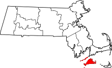 | |
| CDPs | ||
| Other villages | ||