Physical geodesy
| Geodesy | ||||||||||||||||
|---|---|---|---|---|---|---|---|---|---|---|---|---|---|---|---|---|
 | ||||||||||||||||
| Fundamentals | ||||||||||||||||
| Concepts | ||||||||||||||||
| Technologies | ||||||||||||||||
| Standards | ||||||||||||||||
|
||||||||||||||||
| History | ||||||||||||||||
Physical geodesy is the study of the physical properties of the gravity field of the Earth, the geopotential, with a view to their application in geodesy.
Measurement procedure
Traditional geodetic instruments such as theodolites rely on the gravity field for orienting their vertical axis along the local plumb line or local vertical direction with the aid of a spirit level. After that, vertical angles (zenith angles or, alternatively, elevation angles) are obtained with respect to this local vertical, and horizontal angles in the plane of the local horizon, perpendicular to the vertical.
Levelling instruments again are used to obtain geopotential differences between points on the Earth's surface. These can then be expressed as "height" differences by conversion to metric units.
The geopotential
The Earth's gravity field can be described by a potential as follows:

which expresses the gravitational acceleration vector as the gradient of , the potential of gravity. The vector triad is the orthonormal set of base vectors in space, pointing along the coordinate axes.


Note that both gravity and its potential contain a contribution from the centrifugal pseudo-force due to the Earth's rotation. We can write

where is the potential of the gravitational field, that of the gravity field, and that of the centrifugal force field.


The centrifugal force is given by

where

is the vector pointing to the point considered straight from the Earth's rotational axis. It can be shown that this pseudo-force field, in a reference frame co-rotating with the Earth, has a potential associated with it that looks like this:

This can be verified by taking the gradient () operator of this expression.

Here, , and are geocentric coordinates.


Units of gravity and geopotential
Gravity is commonly measured in units of m·s−2 (metres per second squared). This also can be expressed (multiplying by the gravitational constant G in order to change units) as newtons per kilogram of attracted mass.
Potential is expressed as gravity times distance, m2·s−2. Travelling one metre in the direction of a gravity vector of strength 1 m·s−2 will increase your potential by 1 m2·s−2. Again employing G as a multipier, the units can be changed to joules per kilogram of attracted mass.
A more convenient unit is the GPU, or geopotential unit: it equals 10 m2·s−2. This means that travelling one metre in the vertical direction, i.e., the direction of the 9.8 m·s−2 ambient gravity, will approximately change your potential by 1 GPU. Which again means that the difference in geopotential, in GPU, of a point with that of sea level can be used as a rough measure of height "above sea level" in metres.
The normal potential
To a rough approximation, the Earth is a sphere, or to a much better approximation, an ellipsoid. We can similarly approximate the gravity field of the Earth by a spherically symmetric field:

of which the equipotential surfaces—the surfaces of constant potential value—are concentric spheres.
It is more accurate to approximate the geopotential by a field that has the Earth reference ellipsoid as one of its equipotential surfaces, however. The most recent Earth reference ellipsoid is GRS80, or Geodetic Reference System 1980, which the Global Positioning system uses as its reference. Its geometric parameters are: semi-major axis a = 6378137.0 m, and flattening f = 1/298.257222101.
A geopotential field is constructed, being the sum of a gravitational potential and the known centrifugal potential , that has the GRS80 reference ellipsoid as one of its equipotential surfaces. If we also require that the enclosed mass is equal to the known mass of the Earth (including atmosphere) GM = 3986005 × 108 m3·s−2, we obtain for the potential at the reference ellipsoid:


Obviously, this value depends on the assumption that the potential goes asymptotically to zero at infinity (), as is common in physics. For practical purposes it makes more sense to choose the zero point of normal gravity to be that of the reference ellipsoid, and refer the potentials of other points to this.

Disturbing potential and geoid
Once a clean, smooth geopotential field has been constructed matching the known GRS80 reference ellipsoid with an equipotential surface (we call such a field a normal potential) we can subtract it from the true (measured) potential of the real Earth. The result is defined as T, the disturbing potential:

The disturbing potential T is numerically a great deal smaller than U or W, and captures the detailed, complex variations of the true gravity field of the actually existing Earth from point-to-point, as distinguished from the overall global trend captured by the smooth mathematical ellipsoid of the normal potential.
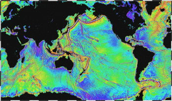
Due to the irregularity of the Earth's true gravity field, the equilibrium figure of sea water, or the geoid, will also be of irregular form. In some places, like west of Ireland, the geoid—mathematical mean sea level—sticks out as much as 100 m above the regular, rotationally symmetric reference ellipsoid of GRS80; in other places, like close to Ceylon, it dives under the ellipsoid by nearly the same amount. The separation between these two surfaces is called the undulation of the geoid, symbol , and is closely related to the disturbing potential.

According to the famous Bruns formula, we have

where is the force of gravity computed from the normal field potential .

In 1849, the mathematician George Gabriel Stokes published the following formula named after him:

In this formula, stands for gravity anomalies, differences between true and normal (reference) gravity, and S is the Stokes function, a kernel function derived by Stokes in closed analytical form. (Note that determining anywhere on Earth by this formula requires to be known everywhere on Earth. Welcome to the role of international co-operation in physical geodesy.)

The geoid, or mathematical mean sea surface, is defined not only on the seas, but also under land; it is the equilibrium water surface that would result, would sea water be allowed to move freely (e.g., through tunnels) under the land. Technically, an equipotential surface of the true geopotential, chosen to coincide (on average) with mean sea level.
As mean sea level is physically realized by tide gauge bench marks on the coasts of different countries and continents, a number of slightly incompatible "near-geoids" will result, with differences of several decimetres to over one metre between them, due to the dynamic sea surface topography. These are referred to as vertical or height datums.
For every point on Earth, the local direction of gravity or vertical direction, materialized with the plumb line, is perpendicular to the geoid. On this is based a method, astrogeodetic levelling, for deriving the local figure of the geoid by measuring deflections of the vertical by astronomical means over an area.
Gravity anomalies
Above we already made use of gravity anomalies . These are computed as the differences between true (observed) gravity , and calculated (normal) gravity . (This is an oversimplification; in practice the location in space at which γ is evaluated will differ slightly from that where g has been measured.) We thus get


These anomalies are called free-air anomalies, and are the ones to be used in the above Stokes equation.
In geophysics, these anomalies are often further reduced by removing from them the attraction of the topography, which for a flat, horizontal plate (Bouguer plate) of thickness H is given by

The Bouguer reduction to be applied as follows:

so-called Bouguer anomalies. Here, is our earlier , the free-air anomaly.

In case the terrain is not a flat plate (the usual case!) we use for H the local terrain height value but apply a further correction called the terrain correction (TC).
See also
References
- B. Hofmann-Wellenhof and H. Moritz, Physical Geodesy, Springer-Verlag Wien, 2005. (This text is an updated edition of the 1967 classic by W.A. Heiskanen and H. Moritz).