Great Falls (Potomac River)
| Great Falls | |
|---|---|
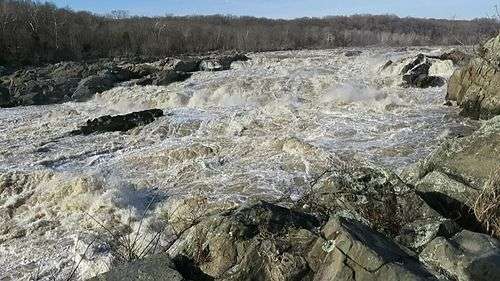
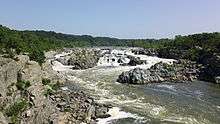 View of the Great Falls from Virginia | |
| Location | Montgomery County, Maryland and Fairfax County, Virginia |
| Type | Cascade |
| Total height | 76 ft |
| Watercourse | Potomac River |
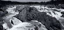
Great Falls is a series of rapids and waterfalls on the Potomac River, 14 miles (23 km) upstream from Washington, D.C., on the border of Montgomery County, Maryland and Fairfax County, Virginia. Great Falls Park, operated by the National Park Service, is located on the southern banks in Virginia, while Chesapeake and Ohio Canal parkland is located along the northern banks of the river in Maryland. The Potomac and the falls themselves are legally entirely within Maryland, with the state and county boundaries following the south bank of the river.
Scenic views are offered on both the Maryland side and the Virginia side. The Billy Goat Trail on Bear Island, accessible from Maryland, offers scenic views of the Great Falls, as do vantage points on Olmsted Island (also accessible from Maryland). There are overlook points on the Virginia side.
The Great Falls area is popular for outdoor activities such as kayaking, whitewater rafting, rock climbing, and hiking.
Great Falls and Little Falls (about 5 miles downstream) are named in contradistinction to one another.
History
Roughly 35,000 years ago, the Potomac River began carving out the Great Falls of the Potomac. The river cascades over a series of 20-foot (6.1 m) falls, falling a total of 76 feet (23 m) in elevation over a distance of less than 1 mile (1.6 km).[1]
The Potomac narrows significantly as it passes over the falls and through Mather Gorge. Heavy rain or snow in the watershed upstream causes white-water floods which entirely submerge the rocks and even threaten the adjacent park visitor center (built on stilts for this reason). A pillar at the Virginia overlook, well above the river, marks the level of the 1936 Potomac Flood.
The rocks which form the falls and river gorge are a strongly metamorphized schist.
Multimedia
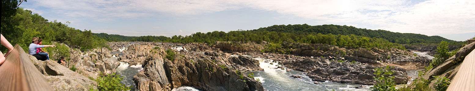 Great Falls panorama from Virginia
.jpg) Great Falls panorama from Maryland
Great Falls panorama from Maryland
Canals
_at_approx_14.12_mi_for_Chesapeake_and_Ohio_Canal.jpg)
Various attempts to build canals around Great Falls were undertaken. The remains of the Patowmack Canal on the Virginia side, were an early attempt to skirt the falls, using 5 locks. That canal was started by George Washington. Later the Chesapeake and Ohio Canal was built on the Maryland side of the falls, and ultimately connected the Potomac tidewater with Cumberland, Maryland. The Chesapeake and Ohio also used the Great Falls as a feeder (now abandoned) to supply water for its own use.
See also
| Wikimedia Commons has media related to Great Falls of the Potomac River. |
Notes
- ↑ "Great Falls of the Potomac : Image of the Day". NASA. July 29, 2004. Retrieved August 17, 2010.
References
- "Great Falls of the Potomac". NASA Earth Observatory. Retrieved 2006-05-24.
External links
- Great Falls Visitor Center official site
- Great Falls Park official site
- Satellite imagery of Great Falls on Google Maps
Coordinates: 38°59′51″N 77°15′09″W / 38.99750°N 77.25250°W