Greenwood County Airport
| Greenwood County Airport Coronaca Army Airfield | |||||||||||
|---|---|---|---|---|---|---|---|---|---|---|---|
|
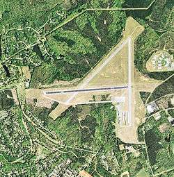
Orthophoto from USGS | |||||||||||
| IATA: GRD – ICAO: KGRD – FAA LID: GRD | |||||||||||
| Summary | |||||||||||
| Airport type | Public | ||||||||||
| Owner | Greenwood County | ||||||||||
| Serves | Greenwood, South Carolina | ||||||||||
| Elevation AMSL | 631 ft / 192 m | ||||||||||
| Coordinates | 34°14′55″N 082°09′33″W / 34.24861°N 82.15917°WCoordinates: 34°14′55″N 082°09′33″W / 34.24861°N 82.15917°W | ||||||||||
| Map | |||||||||||
 GRD Location of airport in South Carolina | |||||||||||
| Runways | |||||||||||
| |||||||||||
| Statistics (2011) | |||||||||||
| |||||||||||
Greenwood County Airport (IATA: GRD, ICAO: KGRD, FAA LID: GRD) is a county owned, public use airport located three nautical miles (6 km) north of the central business district of Greenwood, a city in Greenwood County, South Carolina, United States.[1] It is included in the National Plan of Integrated Airport Systems for 2011–2015, which categorized it as a general aviation facility.[2] The airport does not have scheduled commercial airline service.
History
Greenwood County Airport opened in November 1943 as a United States Army Air Force military airfield called Coronaca Army Airfield. It was a sub-base of Greenville Army Air Base, supporting B-25 Mitchell medium bomber training for Third Air Force. Training was accomplished by the 50th Station Compliment Squadron.
The military use of the airport ended on December 31, 1945 and the airfield was turned over to civil authorities and converted into a civil airport in 1947. It replaced the smaller Chinquapin Airport which was subsequently closed.
Facilities and aircraft
Greenwood County Airport covers an area of 1,380 acres (558 ha) at an elevation of 631 feet (192 m) above mean sea level. It has one runway designated 9/27 with an asphalt surface measuring 5,003 by 100 feet (1,525 x 30 m).[1]
For the 12-month period ending April 1, 2011, the airport had 40,000 aircraft operations, an average of 109 per day: 97% general aviation, 3% air taxi, and <1% military. At that time there were 53 aircraft based at this airport: 77% single-engine, 21% multi-engine, and 2% helicopter.[1]
See also
References
- 1 2 3 4 FAA Airport Master Record for GRD (Form 5010 PDF). Federal Aviation Administration. Effective April 5, 2012.
- ↑ "2011–2015 NPIAS Report, Appendix A" (PDF, 2.03 MB). National Plan of Integrated Airport Systems. Federal Aviation Administration. October 4, 2010. External link in
|work=(help)
-
 This article incorporates public domain material from the Air Force Historical Research Agency website http://www.afhra.af.mil/.
 - Manning, Thomas A. (2005), History of Air Education and Training Command, 1942-2002. Office of History and Research, Headquarters, AETC, Randolph AFB, Texas ASIN: B000NYX3PC
External links
- Aerial image as of March 1999 from USGS The National Map
- FAA Terminal Procedures for GRD, effective November 10, 2016
- Resources for this airport:
- FAA airport information for GRD
- AirNav airport information for KGRD
- ASN accident history for GRD
- FlightAware airport information and live flight tracker
- NOAA/NWS latest weather observations
- SkyVector aeronautical chart, Terminal Procedures
.jpg)
| Airfields |
| .svg.png) | |||||||||||||||||||||||||||||||
|---|---|---|---|---|---|---|---|---|---|---|---|---|---|---|---|---|---|---|---|---|---|---|---|---|---|---|---|---|---|---|---|---|---|
| Units |
| ||||||||||||||||||||||||||||||||